Church Locations in Iceland
10 curated GPS coordinates
Plan an Iceland church photography route with GPS coordinates for turf churches, Budakirkja, Hallgrimskirkja, colorful village churches, coastal chapels, and striking modern architecture set against mountains, lava fields, and black sand. The church map is useful for photographers who want cultural stops between larger landscape locations. Each waypoint includes access details, season notes, road context, and distance from Reykjavik for building a flexible Ring Road or Snaefellsnes route.
The catalog covers black timber churches like Budakirkja on Snaefellsnes, the turf-roofed Hofskirkja in Vatnajokull National Park, and standout coastal chapels such as Reyniskirkja above Vik and Strandarkirkja on the south Reykjanes coast — each tagged with the best seasons and the kind of road that gets you there.
Pair church stops with the surrounding photo locations using the GPS layer in Google My Maps or Gaia: most churches sit within a 15 to 30 minute detour from a major landscape or waterfall waypoint, so they slot cleanly into a Ring Road or peninsula loop without rebuilding the day.
For winter trips the church catalog stays photogenic when waterfall flow lines freeze flat and aurora foregrounds need a strong dark silhouette — turf roofs against snow, lit village steeples against blue hour, and isolated chapels above black sand all hold up when the weather collapses on bigger landscape stops.
Secure checkout by Stripe · refund & terms
Popular church locations in this map
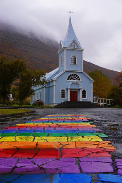
Seyðisfjarðarkirkja became famous on Instagram mostly due to the rainbow road leading up to the church. The church is located in Eastern Region of Iceland.
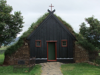
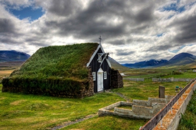
Víðimýrarkirkja church is one of Iceland's very few turf churches to have been preserved
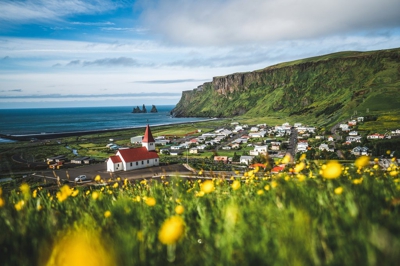
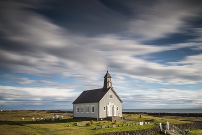
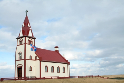
A church in the village of Vik. The Reyniskirkja Church, built in 1929, is located very close to Vik.
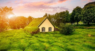
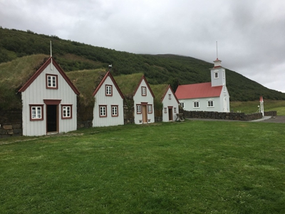
This fairytale-like building is the last turf church ever built in Iceland. Hofskirkja was originally constructed in 1884.
Strandarkirkja is a Lutheran parish church in Selvogur, on the southern coast of Iceland
A church on Flat (Flatey) Iceland north of Iceland
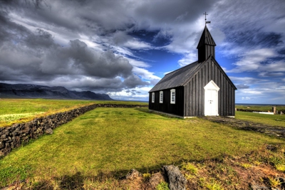
This black church sits alone among a field of lava rock.
An old farmhouse in northern Iceland. Laufás turf house now belongs to the National Museum of Iceland and is run by the Akureyri Museum.
Raufarhöfnarkirkja is in the Raufarhöfnar priesthood in Thingeyjar Prophecy. The church was built in 1928.
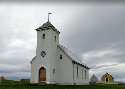
Saurbæjarkirkja is a church in the Eyjafjörður region of Iceland. It is located about 26 kilometres south of Akureyri.
Before you buy
- Yes — everything from turf-roof churches and Viking-era sites to Hallgrímskirkja and the contemporary designs. Architecture photographers will find plenty.
- Yes. Many churches work as quick cultural photo stops between waterfalls, coastlines, and landscape viewpoints, especially when the weather is better for architecture than wide landscapes.
- Every map ships in all three formats so you don't have to choose. Use GPX for Gaia GPS, Garmin, or most outdoor apps. Use KML for Google Maps and Google Earth. Use GeoJSON for custom tooling or web maps.
- Yes. Once you import the file into an app like Google Maps (My Maps), Gaia GPS, or Maps.me, the waypoints are stored on your device and work without cell service — which matters, because Iceland's coverage is patchy outside the Ring Road.
- We have step-by-step guides for Google Maps, Google Earth, and Gaia GPS. Most imports take under two minutes.
- Yes — pay once and download the files immediately. There's no subscription. If we add new locations to the category later, existing buyers can reach out for the updated file.
- Yes. The files are yours to load onto your phone, a second phone, a tablet, a handheld GPS, or your laptop. Personal-use license.