Waterfall Locations in Iceland
43 curated GPS coordinates
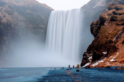
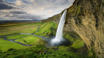
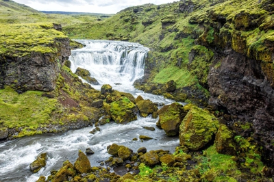
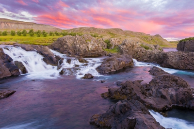
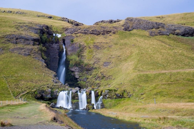
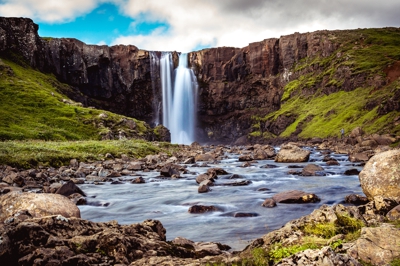
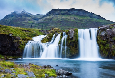
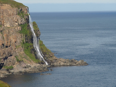
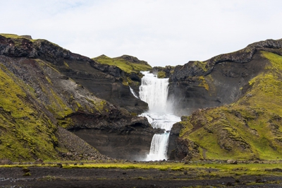
This Iceland waterfalls map gives photographers 43 curated GPS waypoints for Skogafoss, Seljalandsfoss, Dettifoss, Godafoss, Gullfoss, Glymur, Dynjandi, and smaller cascades that are easy to miss while driving. Download KML, GPX, and GeoJSON files, then compare access, seasonality, vehicle needs, and distance from Reykjavik before choosing sunrise, sunset, or bad-weather backup locations.
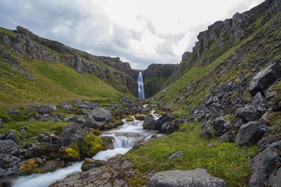
Use the map as a route planner, not just a checklist: group South Coast waterfalls near Vik and Hella, add Golden Circle stops like Gullfoss and Glymur, or build longer North Iceland and Westfjords days around Dettifoss, Godafoss, Aldeyjarfoss, Hengifoss, and Dynjandi.
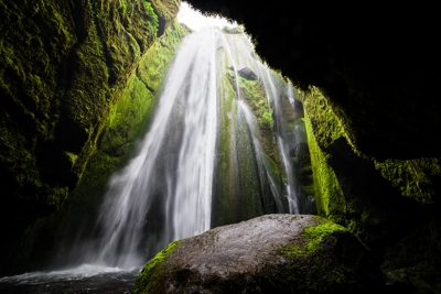
Unlike a generic list of famous falls, the GPS layer is built around field decisions: where to park, which stops pair naturally in one day, which viewpoints need a hike, and which cascades work as bad-weather backups when spray, wind, or crowds compromise the headline locations.
Secure checkout by Stripe · refund & terms
Every location, at its real position
43waterfall locations
Loads an interactive map · about 250 KB
Popular waterfall locations in this map
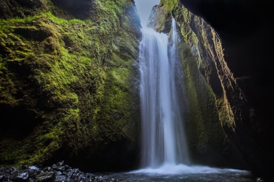
Photographer field notes
- Start around 1/4-2 seconds for visible motion while retaining texture, then adjust for the water volume and the look you want.
- Use an ND filter when daylight prevents a slow enough shutter speed, and a polarizer when glare on wet rock overwhelms detail.
- Carry at least two lens cloths and keep one dry. Spray from larger falls reaches farther than it appears from the car park.
- For rainbow photographs, put the sun behind you and move laterally rather than crowding the main viewpoint.
The Aldeyjarfoss waterfall is situated in the Highlands of Iceland at the northern part of the Sprengisandur Highland Road
Barnafoss is also known as Bjarnafoss, which was its previous name. The waterfall is located in Western Region of Iceland.
Þjófafoss, a waterfall on the Þjórsá in the Merkurhraun lava field west of Route 26, below the 480 m Búrfell. Búrfellsskógur, the birch wood the entry is named for, lies south of the mountain.
A waterfall on the Gönguleið um Fimmvörðuháls trail
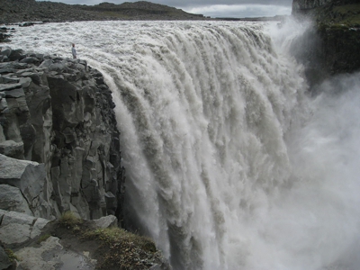
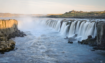
Dettifoss is a waterfall in Vatnajökull National Park in Northeast Iceland, and is reputed to be the second most powerful waterfall in Europe after the Rhine Falls.
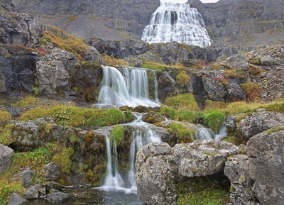
A tiered waterfall in a remote, scenic corner of the Westfjords, with multiple falls, rugged hiking, and overlooks.

Fagrifoss is waterfall situated in Southeast Iceland near the Lakagígar region. It is located along the 4x4 road F206 approximately 24 km from Kirkjubæjarklaustur and 40 km from Laki.
The Faxi waterfall is located on the Golden Circle, a popular tourist trail east of Reykjavik. The waterfall is located on the Tungufljót river.
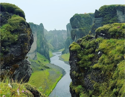
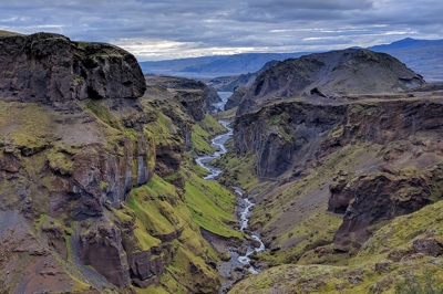
Fjaðrárgljúfur is a canyon in southeast Iceland. The Fjaðrá river flows through it.
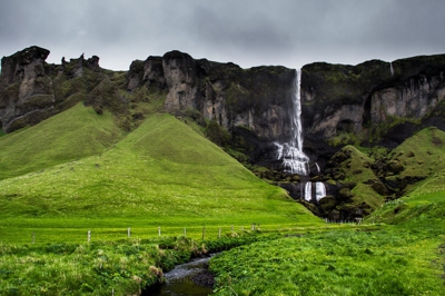
A small waterfall in the southern part of Iceland. Foss á Síðu is a waterfall in the South of Iceland and belongs to the most beautiful and most famous waterfalls in Iceland.
Like the Háifoss, the small valley Gjáin with its small waterfalls
Reached by a hiking trail, this waterfall sits near an ancient lava field & has a viewing platform.
Gljúfrafoss or Gljúfrabúi is a small waterfall north of the larger falls of Seljalandsfoss in Iceland
Gljúfursárfoss is a striking waterfall with a single drop of roughly 45 metres, easy to reach, not far from Vopnafjörður in the east of Iceland.
Gluggafoss is a waterfall in southern Iceland, specifically in the Fljótshlíð area
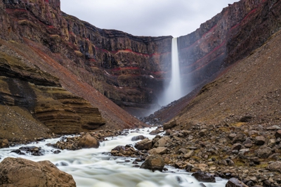
Glymur is the second-highest waterfall in Iceland, with a cascade of 198 m
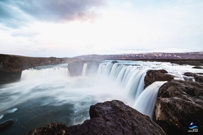
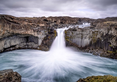
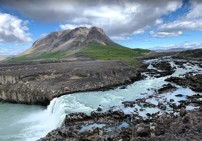
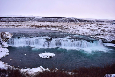
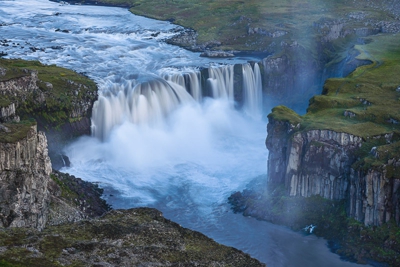
Goðafoss is a waterfall in northern Iceland. It is located along the country's main ring road at the junction with the Sprengisandur highland road.
Gufufoss looked to us like the largest and most striking waterfall in the Seyðisfjörður area. The falls plunged with a rectangular shape and power that made it difficult to even get close to its misty base.
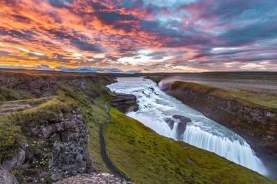
Gullfoss is a waterfall located in the canyon of the Hvítá river in southwest Iceland
Hafragilsfoss is a waterfall in Iceland. The waterfall flows downstream from Dettifoss within the depths of the Jökulságljúfur canyon.
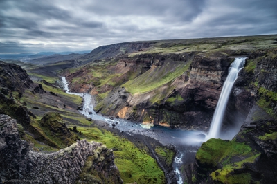
The waterfall Háifoss is situated near the volcano Hekla in southern Iceland
Hengifoss is the third highest waterfall in Iceland, 128 meters. It is located in Hengifossá in Fljótsdalshreppur, East Iceland.
A waterfall on the Gönguleið um Fimmvörðuháls trail
A waterfall on the Gönguleið um Fimmvörðuháls trail
Hjalparfoss is a beautiful, two stepped waterfall near the confluence of Rivers Thjorsa and Fossa in the Thjorsa Valley.
Hundafoss is a waterfall in Skaftafell in Vatnajökull National Park in Iceland, and is one of the most popular sights in the park
A beautiful waterfall in Snaefellsnes Peninsula
Kirkjufoss is a waterfall in the river Jökulsá á Fljótsdal and is about 40 meters high. Kirkjufoss is located in the east of Iceland near mount Snæfell.
A canyon with waterfalls west of Laugarbakki in Northwestern Region of Iceland
Langárfoss is a small roadside waterfall
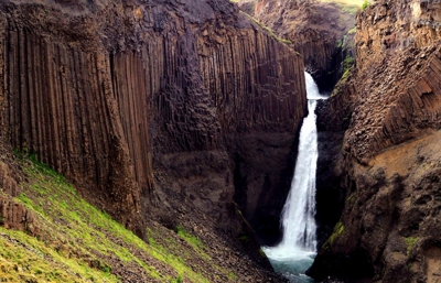
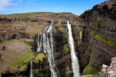
Towering waterfall framed by massive, hexagonal basalt columns, reached by an uphill hiking path. Located in Eastern Region of Iceland.
A waterfall north of Dalvik in the Northeastern Region of Iceland.
Nauthúsagil is a hidden waterfall in southern Iceland, specifically in the Fljótshlíð area
.jpg)
Sveinstekksfoss is a modest waterfall along the stream Fossá just northeast of the town of Djúpivogur. The waterfall is located in the Eastern Region of Iceland.
Ófærufoss is a waterfall situated in the Eldgjá chasm in central Iceland
Selfoss is a waterfall on the river Jökulsá á Fjöllum in the Northeastern Region of Iceland
Before you buy
- 43 curated waterfall waypoints across Iceland, from the famous ones (Skógafoss, Seljalandsfoss, Dettifoss, Goðafoss, Gullfoss, Dynjandi) to smaller cascades and route anchors that are easy to miss while driving.
- Coordinates drop you at the photographer's vantage point, and every waypoint says whether you drive in, walk in, or both. Written parking notes — the pull-off and the walk from it — exist for the falls I have shot myself, not yet for all 43.
- Yes. Use the GPS points, distance from Reykjavik, season notes, and access fields to group nearby waterfalls into practical Ring Road, South Coast, North Iceland, or Westfjords shooting days.
- Every map ships in all three formats so you don't have to choose. Use GPX for Gaia GPS, Garmin, or most outdoor apps. Use KML for Google Maps and Google Earth. Use GeoJSON for custom tooling or web maps.
- Yes. Once you import the file into an app like Google Maps (My Maps), Gaia GPS, or Maps.me, the waypoints are stored on your device and work without cell service — which matters, because Iceland's coverage is patchy outside the Ring Road.
- We have step-by-step guides for Google Maps, Google Earth, and Gaia GPS. Most imports take under two minutes.
- Yes — pay once and download the files immediately. There's no subscription. If we add new locations to the category later, existing buyers can reach out for the updated file.
- Yes. The files are yours to load onto your phone, a second phone, a tablet, a handheld GPS, or your laptop. Personal-use license.