Lighthouse Locations in Iceland
13 curated GPS coordinates
This Iceland lighthouse map gives photographers 13 coastal GPS waypoints for classic stops near Reykjavik like Grotta, Akranes, and Gardur, plus remote towers on Reykjanes, Snaefellsnes, the southeast coast, and longer Westfjords detours. Download KML, GPX, and GeoJSON files with gravel-road access notes, season timing, route-planning context, and offline navigation support.
The lighthouse map focuses on field decisions: which towers are quick roadside stops, which require gravel roads or short walks, which pair naturally with coastal landscape locations, and which remote Westfjords routes are better left for summer or stable weather.
Use it to connect lighthouse stops with coastal viewpoints, blue-hour timing, aurora foregrounds, and backup locations when wind, tides, road closures, or storms make exposed shorelines difficult.
The map covers harbor lights like Sugandiseyjarviti in Stykkisholmur and the old Akranes lighthouse as well as exposed cape stations on Ondverdarnes, Svortuloft, and Hraunhafnartangi near the Arctic Circle. Each waypoint pairs with distance-from-Reykjavik notes so you can sequence a realistic single-day or multi-day coastal loop.
If you are planning a dedicated lighthouse trip, the inaugural Lighthouse Challenge invites photographers to capture ten towers from this map on a single trip — use the free itinerary builder to draft a route, then download the GPS map to navigate offline.
Companion reading on the Iceland Photo Map blog covers when a dedicated photo map beats free travel apps, how workshops and tours compare with self-drive planning, how to navigate between photo spots, what to pack for exposed coastal weather, and how North Iceland bases like Myvatn can connect to longer lighthouse routes.
Secure checkout by Stripe · refund & terms
Popular lighthouse locations in this map

Skarðsviti Lighthouse is located along the western side of Vatnsnes peninsula in Iceland, 7 km north of Hvammstangi
A lighthouse south east of Keflavik
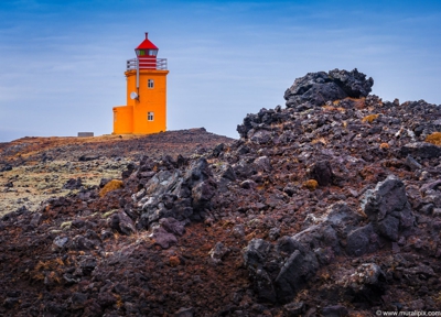
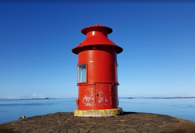
The lighthouse is about 3 kilometers past Skarsdvik beach
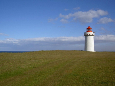
Grótta is a nature reserve on the tip of the Seltjarnarnes Peninsula, in the north-westernmost part of the Greater Reykjavík Area
The lighthouse is about 3 kilometers past Skarsdvik beach
Súgandisey Island Lighthouse was installed there in 1948 as a sealing lighthouse to Stykkisholm harbor
This is a modern lighthouse in the northwestern part of Skagi Peninsula.
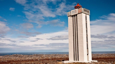
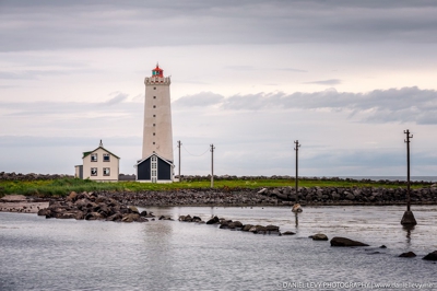
Hraunhafnartangi Lighthouse is the northernmost lighthouse in Iceland. It is located about 800 meters south of the Arctic Circle.
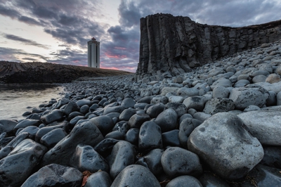
The Hvalnes Lighthouse is in the eastern region of Iceland along Route 1 (the Ring Road) between the cities of Höfn and Djúpivogur.
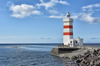
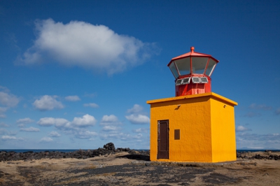
The old Garðskagi Lighthouse was built in 1897
A lighthouse north of Iceland north of Þórshöfn in Northeastern Region Iceland

Akranes is a port town on the west coast of Iceland about 45 km north of Reykjavík. This spot is also good for Aurora photography.
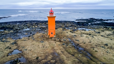
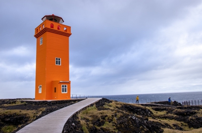
Stafnesviti stands in between the towns Sandgerði and Hafnir at Stafnes and was built in 1925
Before you buy
- The map includes access notes for each site. Many lighthouses sit at the end of gravel roads or short hikes; the notes flag anything that needs a 4x4 or a modest walk.
- Most are. A handful of the more remote Westfjords lighthouses are effectively summer-only due to road closures — the seasonal notes tell you which.
- Yes. The map helps you compare nearby coastal stops, gravel-road detours, and remote peninsula locations so you can build a realistic route around weather and daylight.
- Every map ships in all three formats so you don't have to choose. Use GPX for Gaia GPS, Garmin, or most outdoor apps. Use KML for Google Maps and Google Earth. Use GeoJSON for custom tooling or web maps.
- Yes. Once you import the file into an app like Google Maps (My Maps), Gaia GPS, or Maps.me, the waypoints are stored on your device and work without cell service — which matters, because Iceland's coverage is patchy outside the Ring Road.
- We have step-by-step guides for Google Maps, Google Earth, and Gaia GPS. Most imports take under two minutes.
- Yes — pay once and download the files immediately. There's no subscription. If we add new locations to the category later, existing buyers can reach out for the updated file.
- Yes. The files are yours to load onto your phone, a second phone, a tablet, a handheld GPS, or your laptop. Personal-use license.