Import Your Maps
To import an Iceland photography GPS map, download the KML, GPX, or GeoJSON file from any map page and open it in your mapping app. Google My Maps loads a KML in seven steps from a desktop browser; Gaia GPS uploads KML or GPX directly to your account in four. Both cache the waypoints for offline use on your phone, so you can navigate the Ring Road or the highlands without cellular service.
Follow these steps to load your Iceland photography waypoints into your preferred mapping app — ready for offline navigation in minutes.
Google My Maps: step-by-step
Open Google My Maps
In your browser, navigate to google.com/maps/d and sign in with your Google account.
Create a New Map
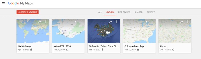
Click the + Create New Map button. Once the map is created, double-click on it to open the editor.
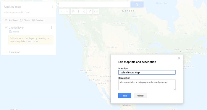
Name Your Map
In the Map title field, type a friendly name for your map, then click Save.
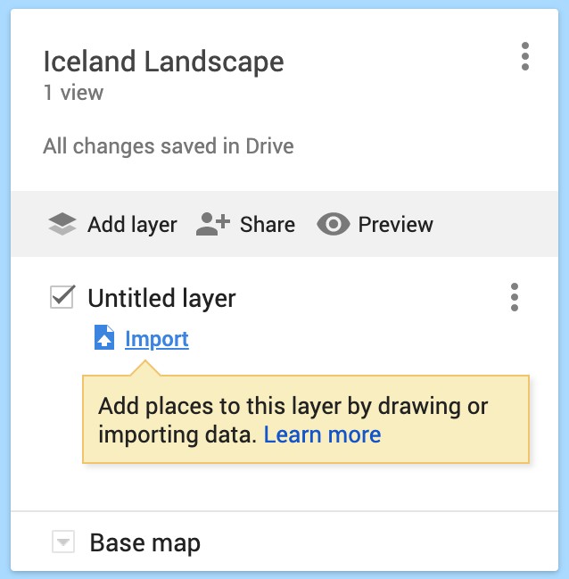
Import the KML or GPX File
Click the Import link to open the file-upload dialog.
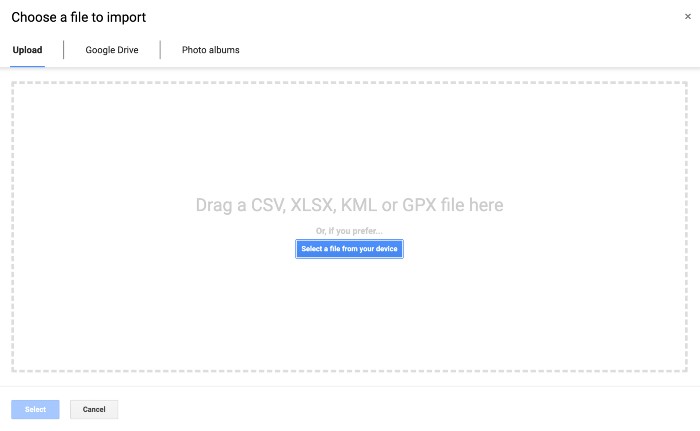
Upload the Map File
Click Select a file from your device, then choose the KML or GPX file you downloaded.
Waypoints Imported
Your waypoints are now visible on the map. Click any pin to see detailed information about that photography location.
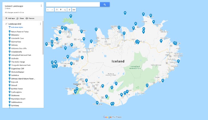
Explore Waypoint Details
Click any waypoint to view its name, coordinates, description, and photography tips. You're all set to explore Iceland.
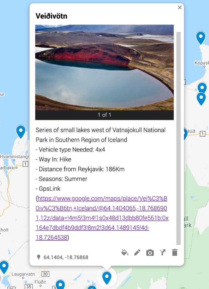
Using a different app, a phone, or a Garmin?
Each guide says which of the three files to take, whether the result survives losing signal, and what tends to go wrong — checked against the app maker's own documentation.
Plan the shoot after your map is imported
Once your KML or GPX file is loaded, pair the waypoint map with location-specific field notes for timing, access, and conditions.
Use these steps with Iceland GPS maps
Common import questions
Quick fixes for the issues photographers hit most often when loading a KML or GPX file.
- Google My Maps allows up to 10,000 features per layer and 10 layers per map. If you imported a large map and the points didn't show, split the file across layers or use a different category map. Also confirm you uploaded the .kml file (not a zipped .kmz) into the import dialog.
- Email or AirDrop the .gpx file to your phone, then tap it and choose "Open in" your GPS app (Gaia GPS, Organic Maps, OsmAnd, AllTrails, Locus). Most apps register .gpx as a supported file type after install. This does not work for Google Maps: My Maps has no iPhone app, so that one has to be imported from a desktop browser.
- Yes, using the GPX file — Garmin handhelds do not read KML. Connect the unit over USB and copy the .gpx into the device's NewFiles folder, or use Garmin BaseCamp or the Garmin Explore app to import and sync. Check your model's waypoint limit first; some are lower than you would expect. The per-app import guides linked above cover this in full.
- No — every map ships in all three formats. The coordinates and names are identical across files; only styling and metadata vary slightly between formats. Pick the one your app prefers.
- Yes. Once in Google My Maps, Gaia GPS, or Locus, the waypoints are yours to rename, recolor, regroup, or delete. We recommend duplicating the file first so you keep a clean copy of the original.
- The map gives you the destination coordinates. Your app of choice (Google Maps, Apple Maps, Waze, your Garmin's routing engine) generates the driving route. This is intentional — Iceland's road conditions change daily, so live routing beats baked-in directions.