Landscape Photography
Landscape Locations in Iceland
62 curated GPS coordinates
This Iceland landscape photography map gives photographers 62 GPS viewpoints for glacier lagoons, black sand beaches, volcanic terrain, mountain roads, coastal cliffs, and aurora foregrounds. Download KML, GPX, and GeoJSON files, then use seasonal guidance, access notes, and distance context to move beyond a generic Ring Road checklist and prioritize the best light.
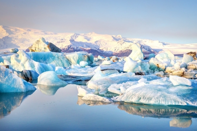
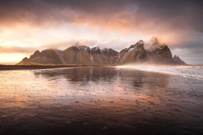
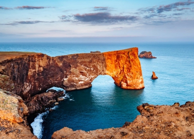
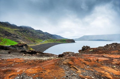
The landscape map is strongest for Ring Road and South Coast planning: Jökulsárlón, Stokksnes, Dyrhólaey, Reynisfjara, Snæfellsnes, and highland viewpoints all sit in one route-ready file.
✓ Precise GPS coordinates
✓ Detailed descriptions
✓ Distance from Reykjavik
✓ Google Maps integration
✓ High-quality photos
✓ Best season to visit
✓ Required vehicle type
✓ Access instructions
$20 USDone-time · instant download
Secure checkout by Stripe · refund & terms
Route anchors
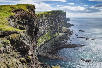
Popular landscape locations in this map
Questions & answers
Before you buy
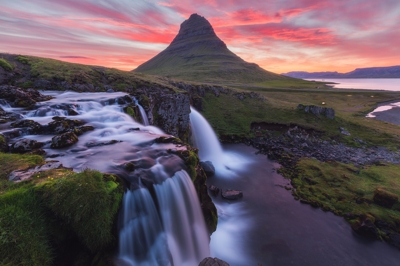
- Yes — the landscape map includes well-known aurora foreground locations (Kirkjufell, Stokksnes, Þingvellir) along with mountain, canyon, and black-sand-beach viewpoints.
- Yes. Each location includes a recommended season. Many are year-round; some highland spots are summer-only and flagged accordingly.
- Yes. Locations are chosen as photography viewpoints rather than broad regions, with GPS coordinates for where to start shooting or navigate from.
- Every map ships in all three formats so you don't have to choose. Use GPX for Gaia GPS, Garmin, or most outdoor apps. Use KML for Google Maps and Google Earth. Use GeoJSON for custom tooling or web maps.
- Yes. Once you import the file into an app like Google Maps (My Maps), Gaia GPS, or Maps.me, the waypoints are stored on your device and work without cell service — which matters, because Iceland's coverage is patchy outside the Ring Road.
- We have step-by-step guides for Google Maps, Google Earth, and Gaia GPS. Most imports take under two minutes.
- Yes — pay once and download the files immediately. There's no subscription. If we add new locations to the category later, existing buyers can reach out for the updated file.
- Yes. The files are yours to load onto your phone, a second phone, a tablet, a handheld GPS, or your laptop. Personal-use license.