What is the best month for Iceland landscape photography?
June for endless daylight and accessible highlands; September for aurora season starting alongside autumn color; February for blue ice caves and snow-covered black-sand beaches.
Iceland’s landscape photography ranges from glacier lagoons (Jökulsárlón, Fjallsárlón) and black-sand beaches (Reynisfjara) to lava fields, geothermal vents, and the highland deserts of the interior. This page lists every curated landscape viewpoint in our GPS map with seasonal notes, access details, and distance from Reykjavik so you can plan around weather, daylight, and road conditions.
Dramatic volcanic landscapes, glacier lagoons, black sand beaches, and highland deserts. Discover the most photogenic landscape viewpoints across Iceland.
June for endless daylight and accessible highlands; September for aurora season starting alongside autumn color; February for blue ice caves and snow-covered black-sand beaches.
Seven to ten days lets you cover the South Coast, Snæfellsnes, and Jökulsárlón at a sustainable pace. Two weeks adds the Westfjords or the East. Anything under five days forces hard cuts.
Not for the Ring Road or Golden Circle. Hire a guide for the highlands, ice caves, and any winter glacier work — those routes change with weather and require local judgment about safety and access.
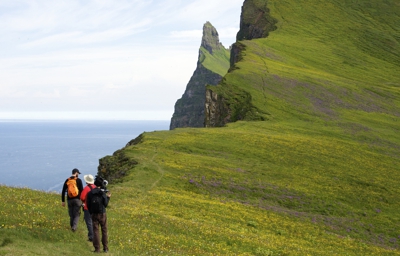
Hornstrandir Nature Reserve Westfjords Region
Kleifarvatn is the largest lake on the Reykjanes Peninsula in Iceland, situated in the southern part of the peninsula.
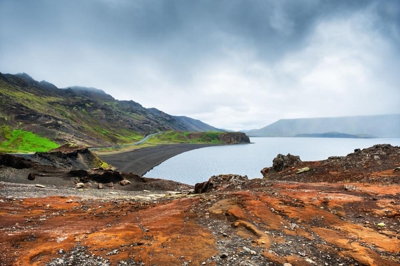
The geothermal area Krýsuvík is situated on the Reykjanes peninsula in Iceland
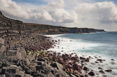
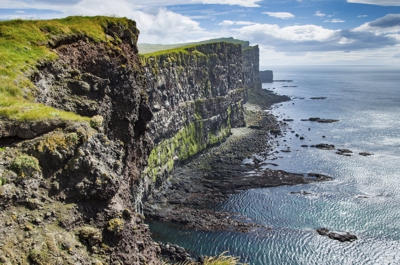
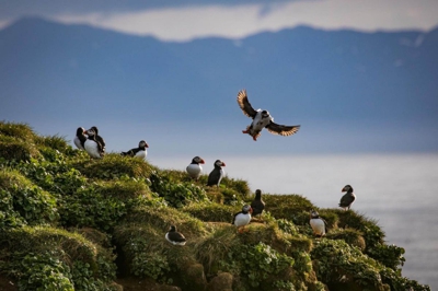
The great stretch of cliffs at Krýsuvíkurbjarg are amongst the best bird-watching sites in Iceland.
Þingvellir (Thingvellir) is a historic site and national park in Iceland, east of Reykjavík. It's known for the Alþing (Althing), the site of Iceland's parliament from the 10th to 18th centuries.
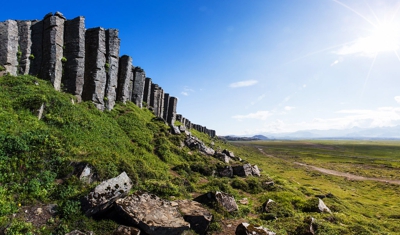
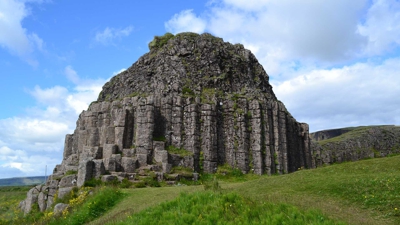
Gerðuberg is a cliff of dolerite, a coarse-grained basalt rock, located on western peninsula Snæfellsnes.
A waterfall area west of Route 26 located in the Búrfell forest (Búrfellsskógur).
Eiriksstadir - Viking Longhouse. Sit with us by the fire and listen to the historians tell ancient fiction stories of the Vikings. You can try out authentic Viking tools and learn about the know-how, architecture and clothing of the Vikings, all crafted using original tools and methods.
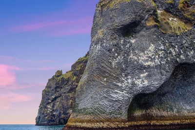
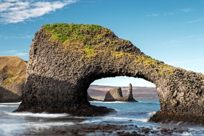
Halldórsskora. Elephant Rock. 'Elephant Rock' is a natural rock formation in Heimaey, part of the Westman Islands or Vestmannaeyjar. The islands are a visitor attraction in their own right, but Elephant Rock is the main draw.
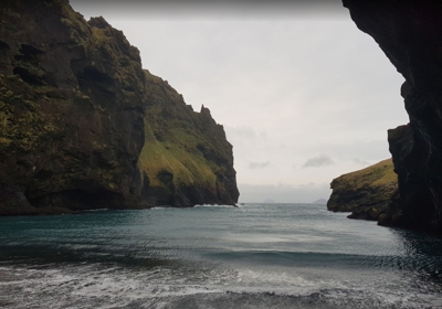
A scenic spot in Heimaey island in the southern part of Iceland. The ferry is available from Landeyjahöfn.
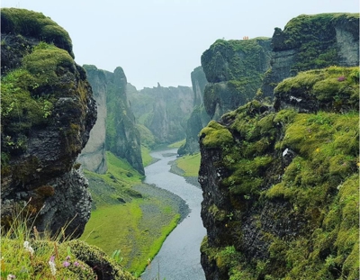
A canyon in Fimmvörðuháls Iceland. A lovely hike into the mysterious Stakkholtsgjá Canyon in southern Iceland.
Scenic Cliff. A walk up Súgandisey cliff for unbeatable views of the harbor and the North Atlantic.
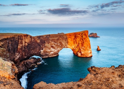
Dyrhólaey, formerly known by seamen as Cape Portland, is a small promontory located on the southern coast of Iceland.
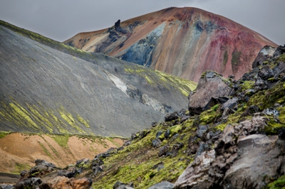
Fjallabak Nature Reserve ("Friðland að Fjallabaki") is an area in the Icelandic Highlands.
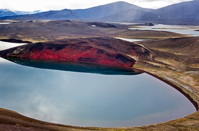
Series of small lakes west of Vatnajokull National Park in the Southern Region of Iceland.
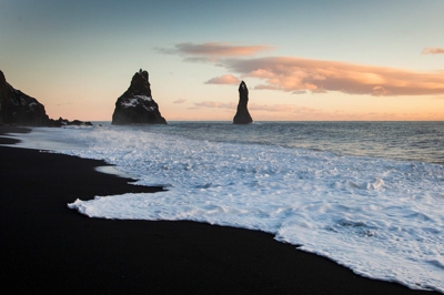
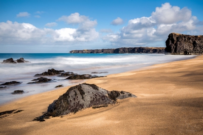
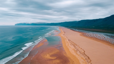
A black sand beach near Vik. Reynisfjara Beach is one of the most well-known black-sanded beaches in the whole world.
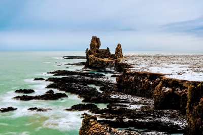
A beautiful viewpoint in Arnarstapi village.
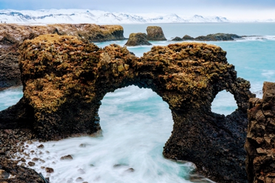
A beautiful viewpoint in Arnarstapi village.
A beautiful viewpoint in Arnarstapi village.
Ólafsvík is a small town in Iceland on the northern side of the Snæfellsnes Peninsula.
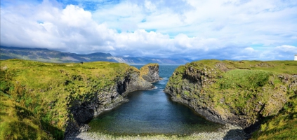
An awesome viewpoint south of Snaefellsnes Peninsula.
The Lóndrangar are a pair of rock pinnacles in Iceland. They are volcanic plugs of basalt that have been hewn out from surrounding softer rock by erosion.
Tour guides lead visitors down a subterranean, spiral staircase to explore this ancient lava tube.
Djúpalónssandur or the Black Lava Pearl Beach.
Flatey is the largest of the Western Islands on the Breidafjordur Bay and a popular spot for tourists.
Skarðsvík, on the Snæfellsnes Peninsula, is an exceptional, golden sand beach in Iceland.
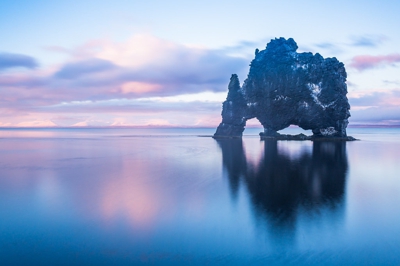
Hvítserkur is a 15 meter high basalt stack along the eastern shore of the Vatnsnes peninsula.
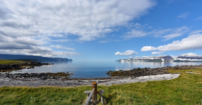
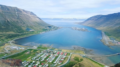
A scenic vista overlook in the southern part of Westfjords.
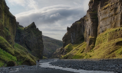
Fjaðrárgljúfur is a canyon in southeast Iceland. The Fjaðrá river flows through it.
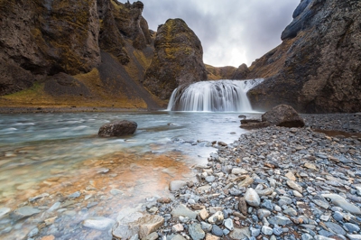
A small waterfall in the southern part of Iceland. Stjórnarfoss waterfall is one of the hidden and seldom visited falls. However, it is a beautiful place and located not far from the main road.
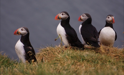
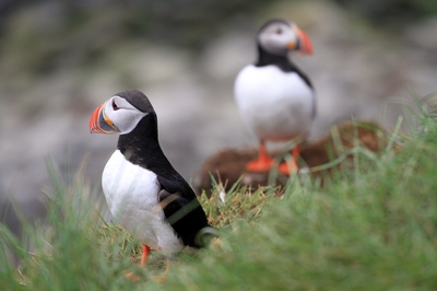
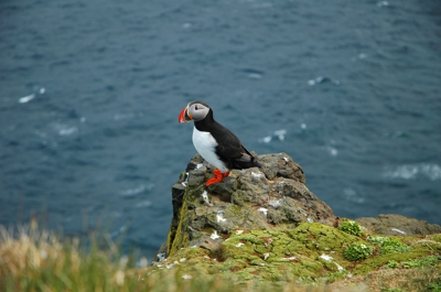
Grímsey is the northernmost point of Iceland situated on the Arctic Circle. It is home to one hundred people, one million seabirds and one of the biggest Puffin colonies in Iceland.
Dverghamrar (Dwarf Rocks), just east of Foss, are peculiar and beautiful formations of columnar basalt located in the southern region of Iceland.
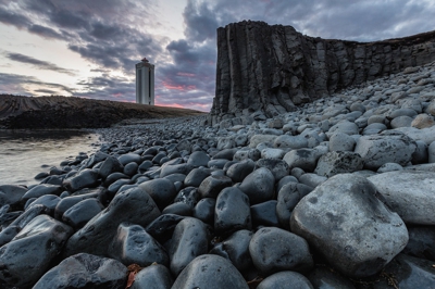
This is a modern lighthouse in the northwestern part of Skagi Peninsula.
Djúpavík's old herring factory, Djúpavík, Iceland.
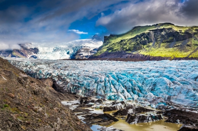
Vatnajökull National Park is a protected wilderness area in south Iceland centered around Vatnajökull glacier.
Bíldudalur is a village situated on the coast of Arnarfjörður, part of the Westfjords Region in Iceland.
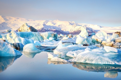
In southeastern Iceland, you'll find a glacier lagoon filled with icebergs. This ice lagoon has become one of Iceland's most popular attractions due to its stunning beauty. The lagoon is called Jökulsárlón, or 'Glacier's-River-Lagoon'.
Patreksfjörður is an Icelandic village in Westfjords with 687 inhabitants.
Rauðisandur (Red Beach) is a 10 kilometer stretch of a beach on the southern coast of the Westfjords (Vestfirðir) in Iceland. And, yes, the sand is red, at least in certain conditions.
Sandafell is a small mountain, 362 meters, a little south of Þingeyri.
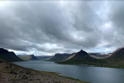
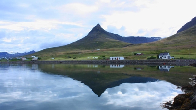
A beautiful overlook of the Fjords.
A scenic lookout in the northeastern part of Iceland, west of Súðavík.
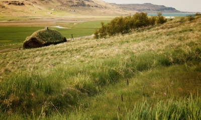
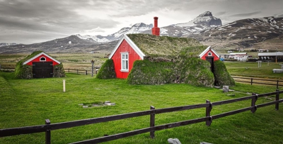
An old farmhouse in northern Iceland. Laufás turf house now belongs to the National Museum of Iceland and is run by the Akureyri Museum.
A waterfall north of Dalvik in the Northeastern Region of Iceland.
Látrabjarg is a promontory and the western most point in Iceland. The cliffs are home to millions of birds, including puffins, northern gannets, guillemots and razorbills.
A small fishing village in the Westfjords Peninsula.
A small village in the Westfjords Peninsula. Ferry to Hornstrandir Nature Reserve.
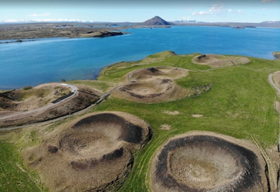
The Skútustaðagígar Craters are found in the Lake Mývatn area, which is very volcanic and near to the Krafla volcano system.
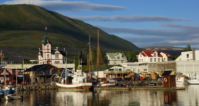
A port in a fishing village in the Northeastern Region of Iceland with a population of about 2,000.
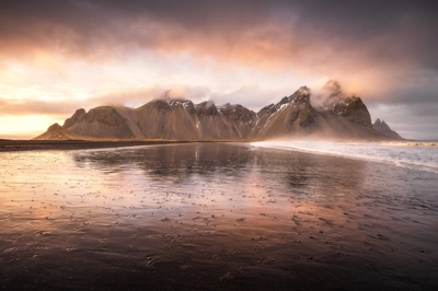
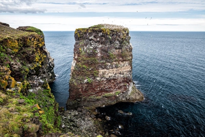
Stokksnes is a headland on the southeastern Icelandic coast, near Hofn and Hornafjördur. In the Eastern Region of Iceland.
Kálfaströnd, a farm on a peninsula of the same name which provides some of the prettiest and most varied scenery on the Lake Mývatn shore. The whole area has multiple photography opportunities for beautiful landscapes.
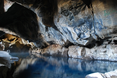
Grjótagjá is a small lava cave near lake Mývatn in the Northeastern Region of Iceland.
An Island north of Iceland. Take the ferry from Dalvik. Grimsey Island is far away in the north: Home of one hundred people and one million seabirds.
A bird viewpoint in Tjörneshreppur Iceland. "Voladalstorfa" is about 12 kilometers (8 miles) from Husavik.

Karl og Kerling ('Old Man' and 'Old Woman'), two rock pillars, believed to be petrified trolls.
A cape in the northern part of Iceland north of Kópasker. Good for bird watching.
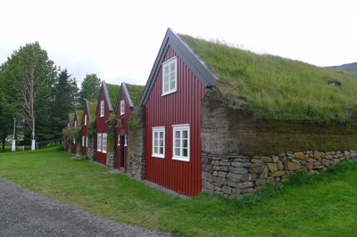
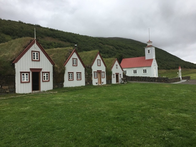
In the beautiful valley, Hofsárdalur stands the old family center of Bustarfell. This turf town, with its buildings with red rods and grassy rooftops, is one of the oldest and best-preserved farms of its kind in the country.
Rauðanes means Point Red and it is one of the pearls in Icelandic nature.
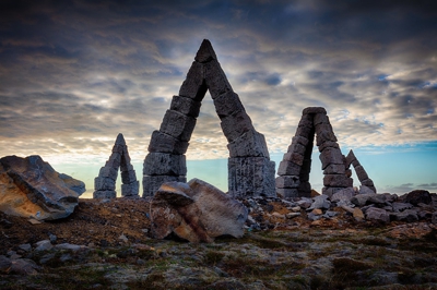
The Arctic Henge in Raufarhöfn, Iceland: This modern monument to pagan beliefs looks like it was transported straight from ancient times.
One of East Iceland's most illustrious spots is the Stórurð ("The Giant Boulders"), located to the east of the road leading to Borgarfjörður Eystri.
The Vattarnes fjord peninsula has a fabulous coastline in the Eastfjords of Iceland. The area is divided between Reyðarfjörður and Fáskrúðsfjörður.
It is one of only a handful of turf houses in Iceland which is still inhabited. Lindarbakki Turf House in Borgarfjörður-Eystri in eastern Iceland.