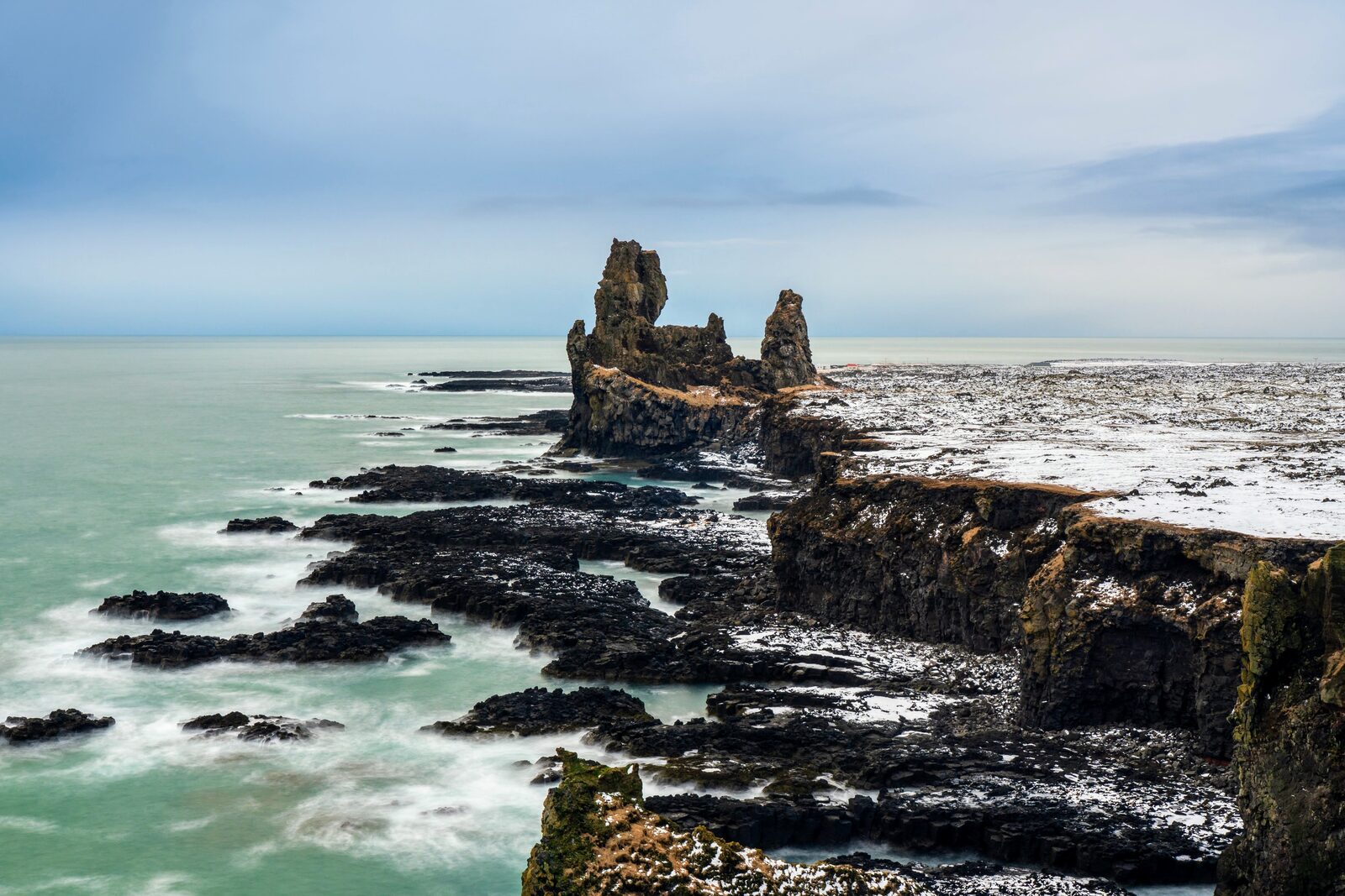
Londrangar
Two basalt pinnacles rising out of the North Atlantic — the Snæfellsnes peninsula's natural skyline. Lóndrangar is a pair of volcanic plugs standing 75 and 61 metres tall on the southern shore of the Snæfellsnes peninsula. Icelandic folklore calls them the troll-church and troll-library. For photographers, they're a rare west-coast silhouette that works in almost any weather — cloud, sun, snow, or storm all flatter the dark basalt against the sea.
What you'll shoot
The two pinnacles at midday — winter light picks out the green moss terraces between the basalt columns.
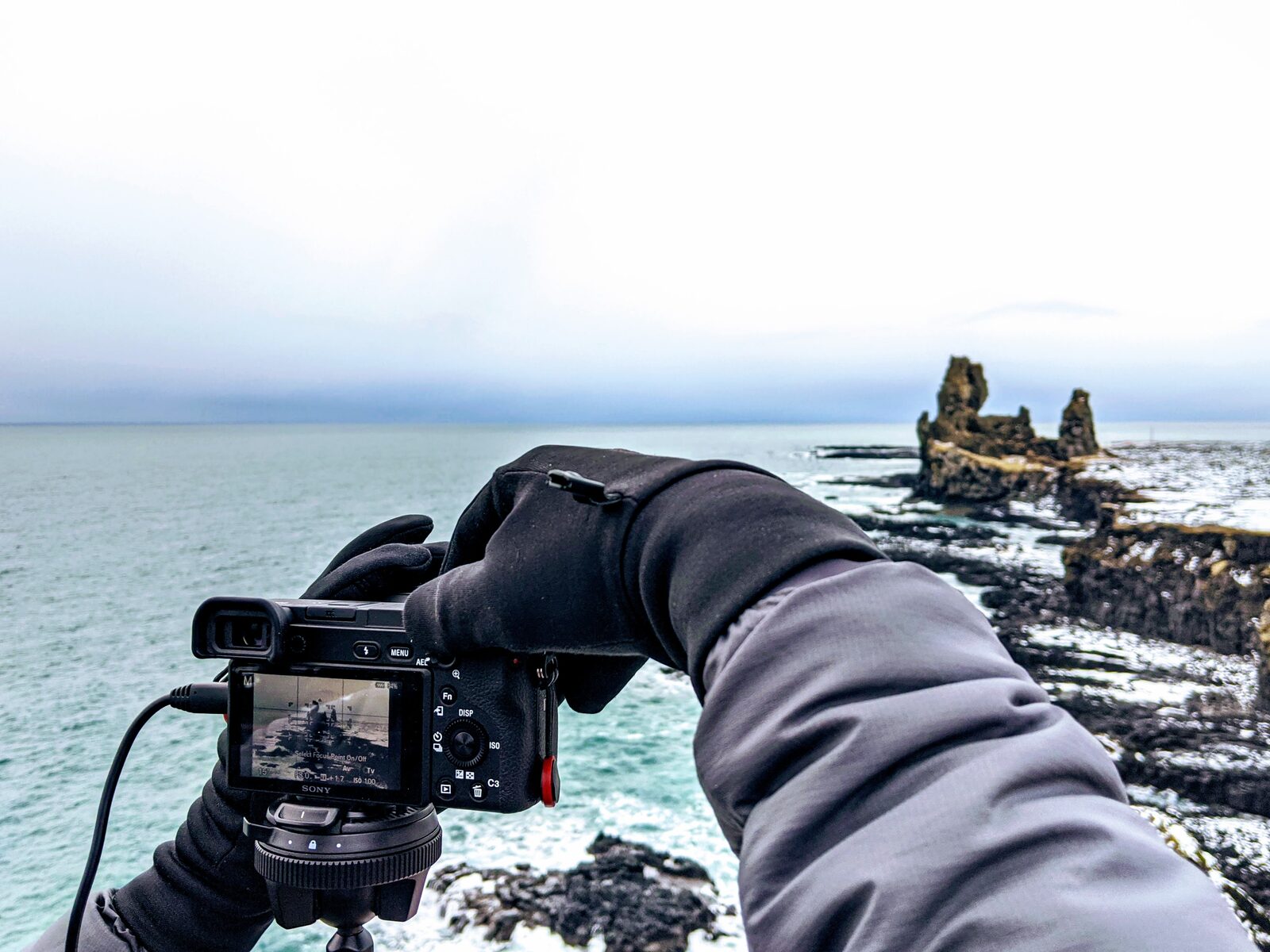
Working the frame — mirrorless, gloved hands, horizontal composition with the pinnacles camera-right.
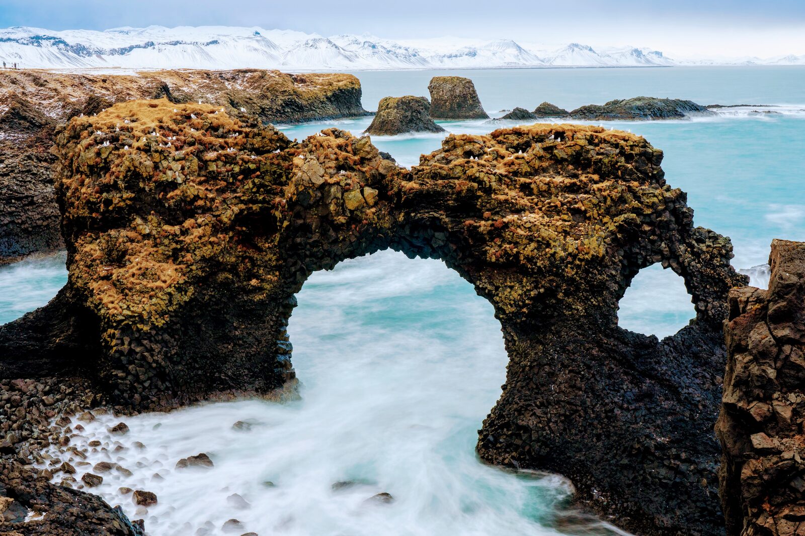
Gatklettur sea arch — 5-minute drive east. A natural arch framed by turquoise surf.
Port Arnarstapi — 8 minutes from Lóndrangar, same coastline, different mood. Plan both in one outing.
Overview
The Lóndrangar are a pair of rock pinnacles in Iceland. They are volcanic plugs of basalt that have been hewn out from surrounding softer rock by erosion.
Two basalt pinnacles rising out of the North Atlantic — the Snæfellsnes peninsula's natural skyline.
Lóndrangar is a pair of volcanic plugs standing 75 and 61 metres tall on the southern shore of the Snæfellsnes peninsula. Icelandic folklore calls them the troll-church and troll-library. For photographers, they're a rare west-coast silhouette that works in almost any weather — cloud, sun, snow, or storm all flatter the dark basalt against the sea.
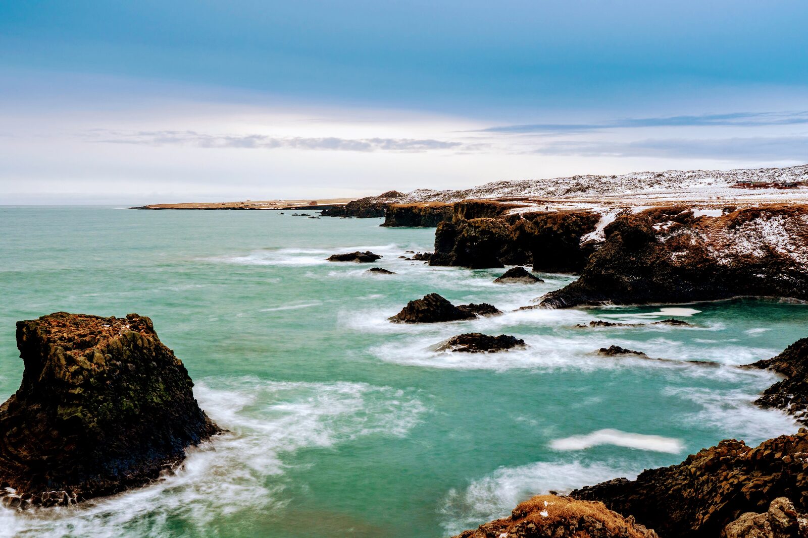
The site is wilder and less visited than anywhere on the South Coast. The wind does the work: it smooths the sea to silver between gusts and shreds clouds over the pinnacles in patterns that change minute-to-minute.
Best time to shoot
Late afternoon in winter; anytime golden hour in summer. Overcast counts as great light here.
- Winter afternoons (14:00–15:30): the sun sits low on the western horizon and throws a warm rake across the pinnacles.
- Summer: golden hour extends for hours here; shoot the full sequence from 20:00 to midnight on long days.
- Storm light: the Snæfellsnes weather turns fast. If you see a squall approaching from the sea, set up and wait — the 5-minute window between walls of rain produces the best frames.
- Don't skip cloudy days. The pinnacles photograph better against a textured grey sky than against blue.
Gear
- Lens
- 24–70 mm covers 90% of compositions; 70–200 mm for tight isolations of the pinnacles against surf
- Tripod
- Bring one — the wind is real. A heavier tripod earns its weight here
- Filter
- Polarizer to cut glare on the sea; ND for long exposures on the surf below
- Protection
- Rain cover and a lens cloth — sea spray carries up the cliff on strong days
Difficulty
Very easy — clifftop viewpoint with a platform
Flat, short walk from parking. Stay behind the safety ropes; the cliff edge is genuinely dangerous.
Parking & access
Free gravel lot at the clifftop viewpoint, directly off Route 574. Under 5 min walk to the viewing platform.
- Route 574 is a gravel-quality highway — fine for 2WD in summer, chains recommended in winter.
- No services on site; the nearest café is in Arnarstapi, 10 min east.
Don't leave after the obvious wide shot. Walk 200m east along the clifftop for an alternative angle that reveals the smaller pinnacle — most photographers only capture the tall one.
Questions & answers
If you're already on a Snæfellsnes loop, absolutely. It's 15 minutes from the peninsula tip and pairs naturally with Arnarstapi and Kirkjufell. As a standalone day-trip from Reykjavík, it's a 2.5-hour drive each way — commit or skip.
Not safely. The base is reachable only via a scramble down the cliff which is illegal and genuinely dangerous. Shoot from the clifftop platform.
Gatklettur sea arch (5 min east), Arnarstapi port (8 min), Djúpalónssandur black-pebble beach (10 min west), and Kirkjufell mountain (40 min northeast). An entire day's shoot fits inside 40 km here.