All Locations in Iceland
121 curated GPS coordinates
The All Maps bundle is the fastest way to plan an Iceland photography trip from one GPS layer. It combines 120+ curated waypoints for waterfalls, landscape viewpoints, lighthouses, churches, and bird colonies into KML, GPX, and GeoJSON files built for offline route planning in Google My Maps, Gaia GPS, Garmin, and phone navigation apps.
Each waypoint includes coordinates, descriptions, season notes, access details, and distance from Reykjavik so you can compare stops quickly before sunrise, sunset, or a long driving day.
Secure checkout by Stripe · refund & terms
Every location, at its real position
121locations
Loads an interactive map · about 250 KB
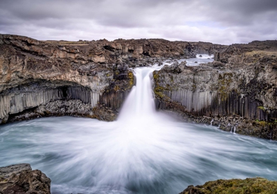
The Aldeyjarfoss waterfall is situated in the Highlands of Iceland at the northern part of the Sprengisandur Highland Road
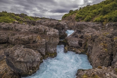
Barnafoss is also known as Bjarnafoss, which was its previous name. The waterfall is located in Western Region of Iceland.
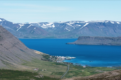
Bíldudalur is a village situated on the coast of Arnarfjörður, part of the Westfjords Region in Iceland.
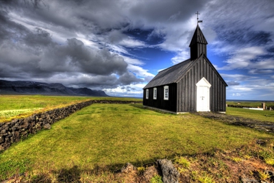
This black church sits alone among a field of lava rock.
Þjófafoss, a waterfall on the Þjórsá in the Merkurhraun lava field west of Route 26, below the 480 m Búrfell. Búrfellsskógur, the birch wood the entry is named for, lies south of the mountain.
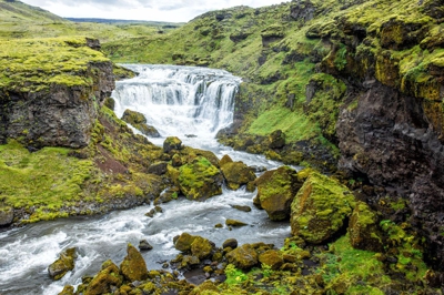
A waterfall on the Gönguleið um Fimmvörðuháls trail
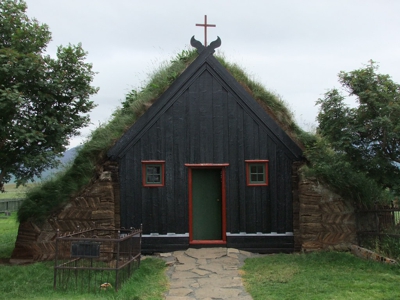
Víðimýrarkirkja church is one of Iceland's very few turf churches to have been preserved
A beautiful viewpoint in Arnarstapi village.
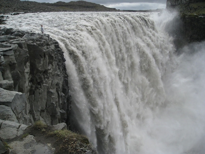
Dettifoss is a waterfall in Vatnajökull National Park in Northeast Iceland, and is reputed to be the second most powerful waterfall in Europe after the Rhine Falls.
Djúpavík's old herring factory, Djúpavík, Iceland.
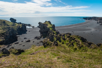
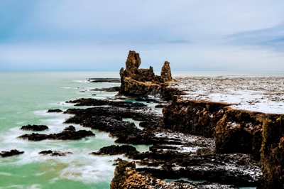
Djúpalónssandur or the Black Lava Pearl Beach.
Dverghamrar (Dwarf Rocks), just east of Foss, are peculiar and beautiful formations of columnar basalt located in the southern region of Iceland.
A tiered waterfall in a remote, scenic corner of the Westfjords, with multiple falls, rugged hiking, and overlooks.
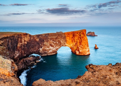
Dyrhólaey, formerly known by seamen as Cape Portland, is a small promontory located on the southern coast of Iceland.
Eiriksstadir - Viking Longhouse. Sit with us by the fire and listen to the historians tell ancient fiction stories of the Vikings. You can try out authentic Viking tools and learn about the know-how, architecture and clothing of the Vikings, all crafted using original tools and methods.

Fagrifoss is waterfall situated in Southeast Iceland near the Lakagígar region. It is located along the 4x4 road F206 approximately 24 km from Kirkjubæjarklaustur and 40 km from Laki.
The Faxi waterfall is located on the Golden Circle, a popular tourist trail east of Reykjavik. The waterfall is located on the Tungufljót river.
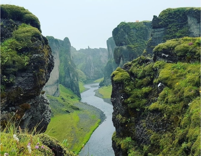
Fjaðrárgljúfur is a canyon in southeast Iceland. The Fjaðrá river flows through it.
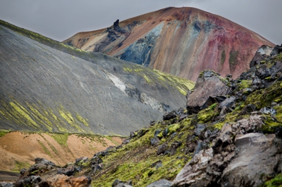
Fjallabak Nature Reserve ("Friðland að Fjallabaki") is an area in the Icelandic Highlands.
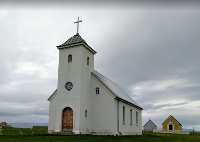
A church on Flat (Flatey) Iceland north of Iceland
A lighthouse north of Iceland north of Þórshöfn in Northeastern Region Iceland
A small waterfall in the southern part of Iceland. Foss á Síðu is a waterfall in the South of Iceland and belongs to the most beautiful and most famous waterfalls in Iceland.
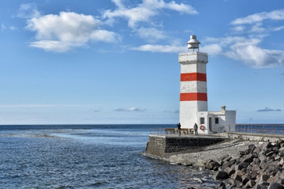
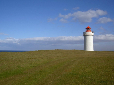
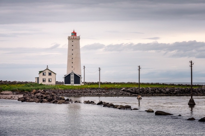
The old Garðskagi Lighthouse was built in 1897
A beautiful viewpoint in Arnarstapi village.
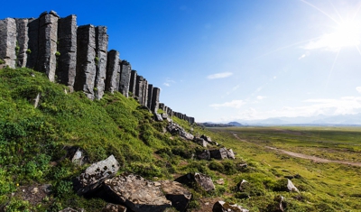
Gerðuberg is a cliff of dolerite, a coarse-grained basalt rock, located on western peninsula Snæfellsnes.
Like the Háifoss, the small valley Gjáin with its small waterfalls
Reached by a hiking trail, this waterfall sits near an ancient lava field & has a viewing platform.
Gljúfrafoss or Gljúfrabúi is a small waterfall north of the larger falls of Seljalandsfoss in Iceland
Gljúfursárfoss is a striking waterfall with a single drop of roughly 45 metres, easy to reach, not far from Vopnafjörður in the east of Iceland.
Gluggafoss is a waterfall in southern Iceland, specifically in the Fljótshlíð area
Glymur is the second-highest waterfall in Iceland, with a cascade of 198 m
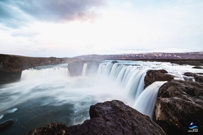
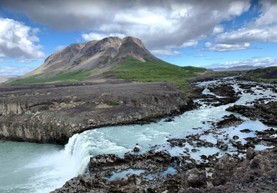
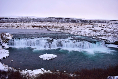
Goðafoss is a waterfall in northern Iceland. It is located along the country's main ring road at the junction with the Sprengisandur highland road.
An Island north of Iceland. Take the ferry from Dalvik. Grimsey Island is far away in the north: Home of one hundred people and one million seabirds.
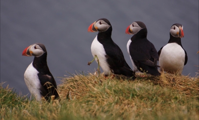
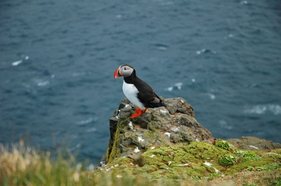
A 49-hectare island in the mouth of Steingrímsfjörður, less than 2 km off Drangsnes in the Westfjords, holding one of the larger puffin colonies in Iceland. Reached by a short boat trip from the village.
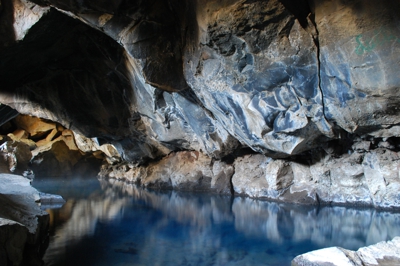
Grjótagjá is a small lava cave near lake Mývatn in the Northeastern Region of Iceland.
Grótta is a nature reserve on the tip of the Seltjarnarnes Peninsula, in the north-westernmost part of the Greater Reykjavík Area
Before you buy
- Every category in the library — waterfalls, landscape viewpoints, lighthouses, churches, and puffin/bird colonies — in one download. It's the full library, priced below the sum of the individual maps.
- Photographers doing a multi-category trip (e.g. Ring Road, 7+ day itinerary, photo workshop) where you'd otherwise buy two or more individual maps. If you're only shooting one subject, the category map is fine.
- Every map ships in all three formats so you don't have to choose. Use GPX for Gaia GPS, Garmin, or most outdoor apps. Use KML for Google Maps and Google Earth. Use GeoJSON for custom tooling or web maps.
- Yes. Once you import the file into an app like Google Maps (My Maps), Gaia GPS, or Maps.me, the waypoints are stored on your device and work without cell service — which matters, because Iceland's coverage is patchy outside the Ring Road.
- We have step-by-step guides for Google Maps, Google Earth, and Gaia GPS. Most imports take under two minutes.
- Yes — pay once and download the files immediately. There's no subscription. If we add new locations to the category later, existing buyers can reach out for the updated file.
- Yes. The files are yours to load onto your phone, a second phone, a tablet, a handheld GPS, or your laptop. Personal-use license.