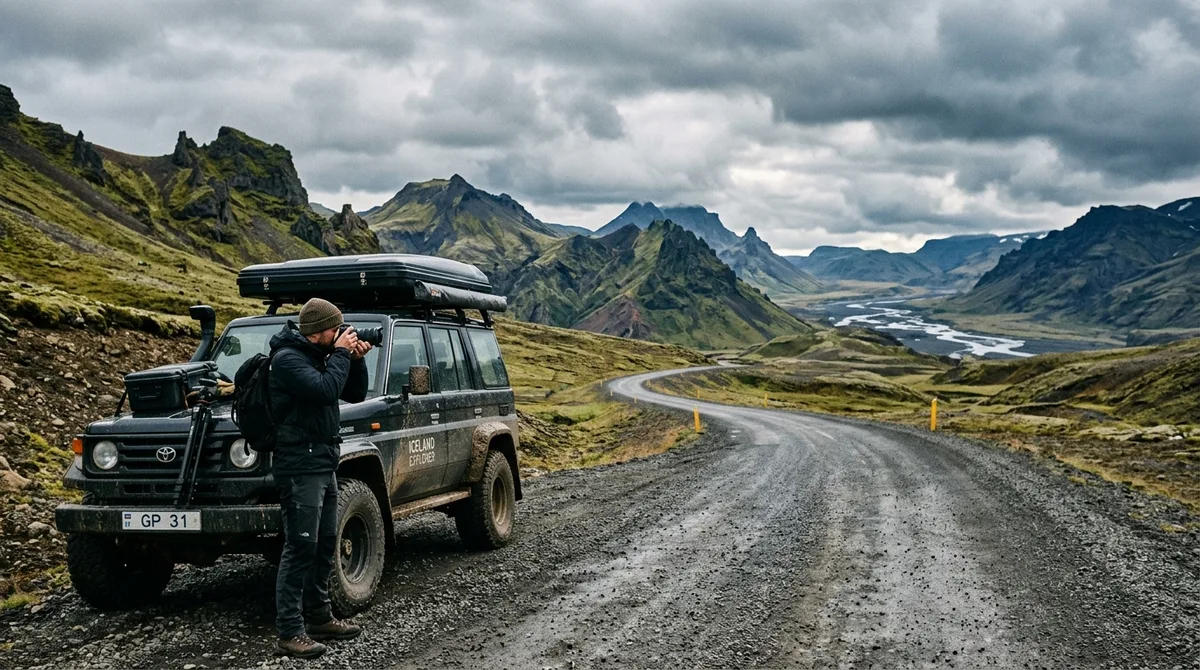
Planning a Realistic 7-Day Iceland Photography Road Trip Itinerary
When planning an Iceland photography road trip itinerary 7 days in duration, the primary mistake photographers make is attempting to drive the entire 1,332-kilometer (828-mile) Ring Road (Route 1). While circling the island in a week is technically feasible from a pure driving standpoint, it leaves almost no buffer for setup, weather delays, or extended golden hour sessions. A focused 7-day plan targeting the South Coast and Snæfellsnes Peninsula yields significantly higher image yields and far less time spent behind the wheel.
In Iceland, driving times are rarely linear. Weather shifts, gravel road transitions, single-lane bridges, and frequent roadside composition opportunities routinely double estimated travel durations. Balancing your daily drive time against available daylight is essential. For example, during the shoulder months of May or September, you can expect roughly 12 to 15 hours of usable light, offering extended golden hours and soft directional side-lighting. In contrast, midsummer brings 24-hour light with persistent low-angle illumination, while deep winter compresses your shooting window into 4 to 5 hours of low-arc sun.
To structure your 7-day Iceland photography itinerary effectively, split your geography into two main focal zones:
- Zone 1: The South & Southeast Coast (Days 1–5): High concentration of dramatic waterfalls, sea stacks, black sand beaches, glacial rivers, and tidal ice fields.
- Zone 2: Golden Circle & Snæfellsnes Peninsula (Days 6–7): Diverse volcanic geology, dramatic coastal cliffs, isolated churches, and iconic mountain peaks like Kirkjufell.
Understanding environmental shifts requires reliable monitoring. Static mapping files provide static seasonal notes and exact coordinates, but live conditions require active checks. Always consult the Icelandic Meteorological Office (veður.is) for live weather warnings, wind speeds, and cloud cover updates prior to heading out each morning.
Day 1 to 3: The South Coast Golden Hour and Waterfall Route
The southern corridor along Route 1 contains some of North Europe's most accessible yet visually striking landforms. Managing moisture, crowds, and changing light across these first three days establishes a productive rhythm for the rest of your shoot.
Day 1: Arrival, Seljalandsfoss, and Gljúfrabúi
After picking up your rental vehicle at Keflavík International Airport (KEF), bypass Reykjavík and head directly east along Route 1 toward Hvolsvöllur (approx. 150 km / 2 hours). Your afternoon and evening target centers on the waterfall complex near Hamragarðar.
Seljalandsfoss: This 60-meter waterfall faces directly west, making it an exceptional late-afternoon and golden hour location. The wide cavern behind the cascade allows you to shoot out toward the coastal plain through the veil of water.
- Focal Lengths: 14mm to 24mm ultra-wide lenses are required to capture both the curving cavern ceiling and the full vertical drop.
- Technique: Use a circular polarizer to manage wet rock reflections. Keep a dedicated microfiber cloth in hand; the continuous fine spray will cover front elements within seconds. Bracket exposures (+1, 0, -1 EV) to preserve detail in the bright western sky and the shadowy interior cave walls.
Gljúfrabúi: Located just 500 meters north of Seljalandsfoss, this hidden waterfall sits tucked inside a narrow vertical canyon. Wading through the shallow stream into the slot canyon opens up a dramatic framing opportunity looking straight up at the drop. Bring waterproof boots or chest waders, and gear up with a rain cover for your camera body.
Day 2: Skógafoss, Kvernufoss, and Dyrhólaey
Start your second day early to beat tour buses at Skógafoss, located 28 kilometers east of Seljalandsfoss along the South Coast photography route.
Skógafoss: Facing south, Skógafoss produces intense moisture plumes. On sunny mornings, mid-morning sunlight creates vibrant single or double rainbows across the mist.
- Composition Strategy: Position a human element (wearing bright outerwear like red or yellow) near the base of the water to emphasize the massive 60-meter tall, 25-meter wide scale.
- Filters: A 3-stop or 6-stop Neutral Density (ND) filter allows shutter speeds around 1/4s to 1s to smooth out the water texture without losing all motion structure.
Kvernufoss: Situated in a gorge just behind the Skógar Museum, Kvernufoss is often far less crowded than Skógafoss. Like Seljalandsfoss, you can walk behind its 30-meter drop. The mossy canyon walls provide leading lines, ideal for focal lengths between 24mm and 70mm.
Dyrhólaey Promontory: In the late afternoon, drive east to Dyrhólaey. The upper viewpoint offers expansive panoramas of the endless black sand coastline extending toward Vík, framed by towering sea arches and sea stacks. Check seasonal access rules if shooting during early summer, as nesting puffins may close certain upper tracks.
Day 3: Reynisfjara Black Sand Beach and Vík Coastline
Begin early morning shooting at Reynisfjara. The geometric basalt columns (Garðar) and Reynisdrangar sea stacks offer rich textural foregrounds. Position your tripod carefully on the black pebbles to catch backlighting as sun breaks over the ocean horizon.
Safety Critical: Reynisfjara is prone to dangerous sneaker waves—unpredictable swells that wash significantly higher up the shore without warning. Never turn your back on the ocean, keep a minimum 30-meter buffer from the water line, and keep tripod legs un-ballasted so you can pick up gear rapidly. Cross-reference real-time marine and safety alerts on SafeTravel Iceland before setting up long exposure shots near the surf zone.
Finish Day 3 driving through the Eldhraun lava field toward Kirkjubæjarklaustur. Eldhraun covers 565 square kilometers in thick, fragile Woolly Fringe-moss (Racomitrium lanuginosum). Shoot strictly from paved pullouts or marked walking trails; stepping onto the moss leaves scars that take decades to heal.
Day 4 to 5: Glacial Lagoons and Black Sand Beaches of the Southeast
Moving into the realm of Vatnajökull National Park, Days 4 and 5 focus on dynamic ice structures, reflections, and jagged mountain massifs. Managing dynamic contrast between pale glacial ice and dark basalt sand requires strict shutter control and metering precision.
Day 4: Jökulsárlón and Diamond Beach
Drive 190 kilometers east from Vík along Route 1 to reach the famous Jökulsárlón glacier lagoon and its adjacent coastline at Breiðamerkursandur (Diamond Beach).
Diamond Beach (Sunrise & Morning Light): Calved icebergs float through the lagoon outlet into the North Atlantic ocean, washing back ashore onto jet-black volcanic sand.
- Lighting: Low sunrise light illuminates the polished ice from behind, causing individual blocks to glow blue, cyan, and deep gold.
- Shutter Speed Selection: Use shutter speeds between 0.5 seconds and 2 seconds to capture the motion of receding ocean foam pulling around crystalline ice blocks. A 70-200mm telephoto zoom works exceptionally well here to isolate single ice structures, compressing them against breaking offshore waves.
Jökulsárlón Lagoon (Afternoon): As atmospheric conditions shift, track floating icebergs moving across the calm lagoon surface. On overcast days, the lack of harsh highlights brings out intense deep blues within packed glacial ice. Position shots using the distant ice cap of Breiðamerkurjökull as a background frame.
Fjallsárlón: Located 10 kilometers west of Jökulsárlón, this smaller glacier lagoon sees fewer visitors. Because the glacier snout sits directly against the water without a ocean outlet stream, the water remains calm, creating ideal conditions for mirror reflections of the ice face.
Day 5: Vestrahorn, Stokksnes, and Eystrahorn
Drive east past the town of Höfn to the Stokksnes peninsula, dominated by the 454-meter sharp peak of Vestrahorn.
Stokksnes Tidal Dunes: Pay the small access fee at the Viking Village cafe to access the private headland.
- Foreground Strategy: Walk past the radio station to find black sand dunes anchored by golden-green tufts of marram grass. Use ultra-wide lenses (16-35mm) positioned low (30-50 cm off the ground) to emphasize dune textures while framing the jagged spine of Vestrahorn across the midground.
- Reflections: When the tide recedes, a shallow sheet of water settles over the flat sand flats, creating a clean mirror reflection of the entire mountain range. Check local tide charts to arrive right at low-to-incoming tide when the sand is submerged under just 1-2 centimeters of water.
Day 6: Golden Circle and Highlands Fringes Photo Route
On Day 6, begin making your way back west along Route 1 toward the Golden Circle region. This transit day mixes geothermal activity with powerful inland river drops.
Brúarfoss, Gullfoss, and Geysir
Brúarfoss: Situated along Road 37, Brúarfoss is famous for its bright glacial-blue water feeding into a volcanic trench. The access path and footbridge put you directly over the river channel.
- Composition: Shoot upstream from the central footbridge using a 24-70mm lens. The turquoise waters contrast sharply with the dark surrounding basalt rock.
- Filters: A circular polarizer is critical to cut through river surface glare and reveal bright submerged rock structures.
Gullfoss: This massive two-tiered waterfall drops 32 meters into the Hvítá river canyon.
- Lighting & Timing: Gullfoss faces south-southwest. Late afternoon sun illuminates the massive mist cloud rising from the lower tier. Use a fast shutter speed (1/500s or faster) if you want to freeze the violent water spray, or a 6-stop ND filter to turn the river flow into smooth silky bands.
Highlands Fringes (Háifoss & Granni): If driving a capable 4x4 during summer or early autumn months, take Road 32 into the Fossárdalur valley to photograph Háifoss (Iceland’s fourth tallest waterfall at 122 meters) plunging into a deep canyon alongside its sister drop, Granni. The non-paved access road (Road 332) requires elevated ground clearance and careful speed management over severe washboard surfaces.
Day 7: Snæfellsnes Peninsula Loop to Complete Your 7 Day Iceland Photo Route
The final full day of your 7 day iceland photo route covers the Snæfellsnes Peninsula—often referred to as "Iceland in Miniature" due to its concentrated volcanoes, lava fields, sea cliffs, and iconic architecture.
Kirkjufell Mountain and Kirkjufellsfoss
Located on the northern coast near Grundarfjörður, Kirkjufell (463 meters) is one of the most photographed peaks in Iceland. Successful shooting here requires smart foreground placement to avoid unoriginal compositions.
Composition Setup: Walk up to the multi-tiered Kirkjufellsfoss waterfalls located across Road 54.
- Wide Angle Alignment: Mount a 14-24mm wide-angle lens on a sturdy tripod. Align the upper fall into the lower left corner of your frame, allowing the rushing water to lead the viewer's eye up toward the arrowhead peak of Kirkjufell rising in the right background.
- Seasonal Variation: In late spring and summer, late evening sunlight swings around to illuminate the north face of Kirkjufell in warm golden light.
Coastal Geology: Arnarstapi, Lóndrangar, and Búðakirkja
Loop around the tip of the peninsula via Road 574 to shoot dramatic coastal geology along the southern shore.
Lóndrangar Basalt Plugs: These two volcanic plugs (75m and 61m tall) rise directly out of ocean cliffs. Shoot from the eastern viewpoint near Svalþúfa hill to include sea-carved basalt formations and crashing Atlantic waves in your frame.
Arnarstapi Coastline: Walk the coastal cliff trail between Arnarstapi and Hellnar. Key landmarks include Gatklettur (an eroded stone arch framed against sea surf) and stone basalt bridges. A telephoto lens (100-400mm) lets you isolate nesting seabirds and dramatic ocean spray breaking against dark lava arches.
Búðakirkja: End your shooting day at the isolated black wooden church at Búðir (Búðakirkja photo location details). Set against the backdrop of yellow grass dunes and the Snæfellsjökull glacier, the black church offers strong minimalist compositions. Position your camera low along the flagstone path leading to the front door, using asymmetrical framing to highlight the structure against surrounding mountains.
After completing the Snæfellsnes loop, return south via Road 54 and Route 1 back to Reykjavík or Keflavík for your departure flight.
To help visualize how these days compare across key parameters, review this 7-day photographic breakdown:
| Day & Region | Primary Locations | Driving Dist. | Ideal Light Window | Primary Gear Recommended |
|---|---|---|---|---|
| Day 1: South Coast (West) | Seljalandsfoss, Gljúfrabúi | ~150 km | Late Afternoon / Golden Hour | Ultra-Wide (14-24mm), Rain Cover, Lens Cloths |
| Day 2: South Coast (Central) | Skógafoss, Kvernufoss, Dyrhólaey | ~90 km | Morning / Mid-Day | Standard Zoom (24-70mm), 3/6-Stop ND Filters |
| Day 3: South Coast (East) | Reynisfjara, Eldhraun Moss Fields | ~140 km | Sunrise / Late Evening | Telephoto (70-200mm), Sturdy Tripod |
| Day 4: Southeast Lagoons | Jökulsárlón, Diamond Beach, Fjallsárlón | ~190 km | Sunrise to Mid-Morning | Telephoto Zoom, Fast Shutter Control |
| Day 5: Southeast Peaks | Stokksnes, Vestrahorn, Höfn | ~100 km | Low Tide / Sunrise or Sunset | Ultra-Wide Angle, Polarizer, Waders |
| Day 6: Golden Circle | Brúarfoss, Gullfoss, Geysir | ~280 km | Mid-Day to Late Afternoon | Polarizer Filter, 6-Stop ND Filter |
| Day 7: Snæfellsnes Peninsula | Kirkjufell, Lóndrangar, Búðakirkja | ~350 km | Golden Hour / Blue Hour | 14-24mm Ultra-Wide, Graduated ND Filters |
Essential Mapping Logistics for a One Week Iceland Photography Plan
Executing an efficient one week iceland photography plan demands reliable offline navigation tools. Cellular coverage along rural coastal cliffs, mountain gaps, and glacial river valleys is frequently inconsistent or unavailable. Relying on live web searches or streaming map services in the field leads to missed golden hour light windows and drain on camera battery levels.
Working with Offline Waypoints and Navigation Engines
When preparing for your trip, separate your navigation setup into two distinct layers: structured offline location waypoints and base mapping engines. You can easily streamline this process by importing KML files into Gaia GPS, OsmAnd, Organic Maps, or dedicated Garmin handheld devices before landing in Iceland.
Understanding how waypoint files operate on your mobile device or GPS terminal is critical:
- Offline Waypoints vs Base Maps: Structured KML, GPX, and GeoJSON files live natively on your local device storage, so all precise location pins, coordinates, parking marks, and season notes work with zero cellular signal. However, downloading the background topographical map tiles for offline rendering is a separate step inside your chosen mapping app.
- Routing and Navigation: Navigation app integration relies on your primary mapping app to calculate driving routes. The downloadable files act as precise waypoints; your preferred navigation software handles the turn-by-turn routing and vector recalculations.
For Android users looking for an integrated field reference, Iceland Co-Pilot is live on Google Play, Android only, and included free with any Iceland Photo Map purchase — it is not sold separately and there is no separate Co-Pilot tier. The location catalog, field notes, parking and access notes, and arrival detection work today; full offline map tiles, light windows, road and weather status, and day routing are still in development.
If you prefer using existing third-party applications, you can read our transparent guide comparison page to see how different digital waypoint platforms stack up across features, device compatibility, and offline functionality.
Data Integrity and Curation Transparency
When selecting mapping resources for field use, understanding file contents and product scope prevents confusion during your shoot:
- Location Data Scope: Within the Iceland Photo Map location database, 112 of the 121 locations carry a researched brief compiled from published sources, each listing its sources. These are distinct from the 9 locations with written field notes. Every single location carries precise GPS coordinates, category tags, and seasonal access recommendations.
- Open Dataset Architecture: The underlying raw coordinates are published as an open CC-BY dataset. What is sold is the structural curation, standardized file formats (GPX, KML, GeoJSON), and structured season and access notes—not underlying location secrecy.
- Digital File Delivery: Iceland Photo Map sells downloadable files directly. Nothing is printed or posted, and buying does not create an account; files are delivered via direct download email links. If a file fails to load on your device, emailing support within 30 days guarantees we either get it working or refund you.
- Reviews and Ratings: Iceland Photo Map does not publish customer reviews, testimonials or star ratings, and no rating markup appears on the site.
Final Scouting Tips for Your Iceland Photography Road Trip Itinerary 7 Days
Maximizing image quality while executing an Iceland photography road trip itinerary 7 days long requires disciplined on-the-ground execution and strict environmental ethics.
Building Operational Buffer Time
rarely lock your schedule into rigid hour-by-hour targets. Iceland’s weather system—driven by the interaction of warm Atlantic moisture and cold Arctic air masses—can transform clear skies into severe gale-force winds or dense fog within minutes. Build 2 to 3 hours of unallocated buffer time into every single daily itinerary segment. If weather shuts down photography at one coastal headland, use your waypoint app to locate alternative sheltered interior waterfalls or low-elevation lava caves nearby.
Respecting Environmental Rules and Property Boundaries
With tourism increasing across Iceland, environmental protection agencies strictly enforce land access rules.
- Fragile Vegetation: rarely walk off designated wooden boardwalks or soil paths around thermal areas and moss beds. Trampled moss layers require upwards of 50 years to regenerate.
- Drone Regulations: Drones are banned in all Icelandic national parks (Vatnajökull, Þingvellir, Snæfellsjökull) and major nature reserves without special commercial permits. Always inspect posted boundary signs and refer to the Environment Agency of Iceland (Umhverfisstofnun) for updated drone flight restrictions.
- Parking Compliance: Pay all parking fees at popular sites (such as Seljalandsfoss, Skógafoss, Skaftafell, Kirkjufell, and Þingvellir) via official payment terminals or the Parka.is app. Unpaid automated camera parking scans carry high penalty surcharges from rental car agencies.
Frequently Asked Questions
Is 7 days enough time to photograph the entire Ring Road in Iceland?
No. Attempting the full 1,332-kilometer Ring Road in 7 days requires driving over 4 to 5 hours daily, leaving insufficient time for setup, scouting, or resting between light windows. A far better strategy for a 7-day trip is to focus strictly on the South Coast and Snæfellsnes Peninsula, minimizing driving and maximizing time spent behind the camera.
What is the best time of year for a 7-day Iceland photography road trip?
September and May are ideal shoulder months. They offer 12 to 15 hours of daylight with long golden hours, manageable weather, and open roads across coastal regions. September also brings the chance of early northern lights (aurora borealis) alongside dark night skies, while June and July offer 24-hour midnight sun light windows.
How do offline waypoint files work with mapping apps like Gaia GPS or Organic Maps?
The downloaded KML, GPX, or GeoJSON files store precise location coordinates, descriptions, and seasonal tags directly on your device storage. Once imported into apps like Gaia GPS, OsmAnd, or Organic Maps, your saved pins remain visible and searchable even without cellular service. However, you must download the offline base map tiles inside your mapping app separately to render underlying topography and roads without signal.
Do I need a 4x4 vehicle for a 7-day South Coast and Snæfellsnes photo route?
From late spring through early autumn (May to October), a standard 2WD vehicle is sufficient for driving paved routes like Route 1, the Golden Circle, and the main Snæfellsnes Peninsula roads. However, if you plan to travel between November and April, or intend to access highland fringe gravel tracks (F-roads like those leading to Háifoss), renting a four-wheel-drive (4x4) vehicle with proper ground clearance is strictly required by law and safety standards.
Download curated KML and GPX waypoints from Iceland Photo Map to load your 7-day photo itinerary straight into Gaia GPS, OsmAnd, or your Garmin device.