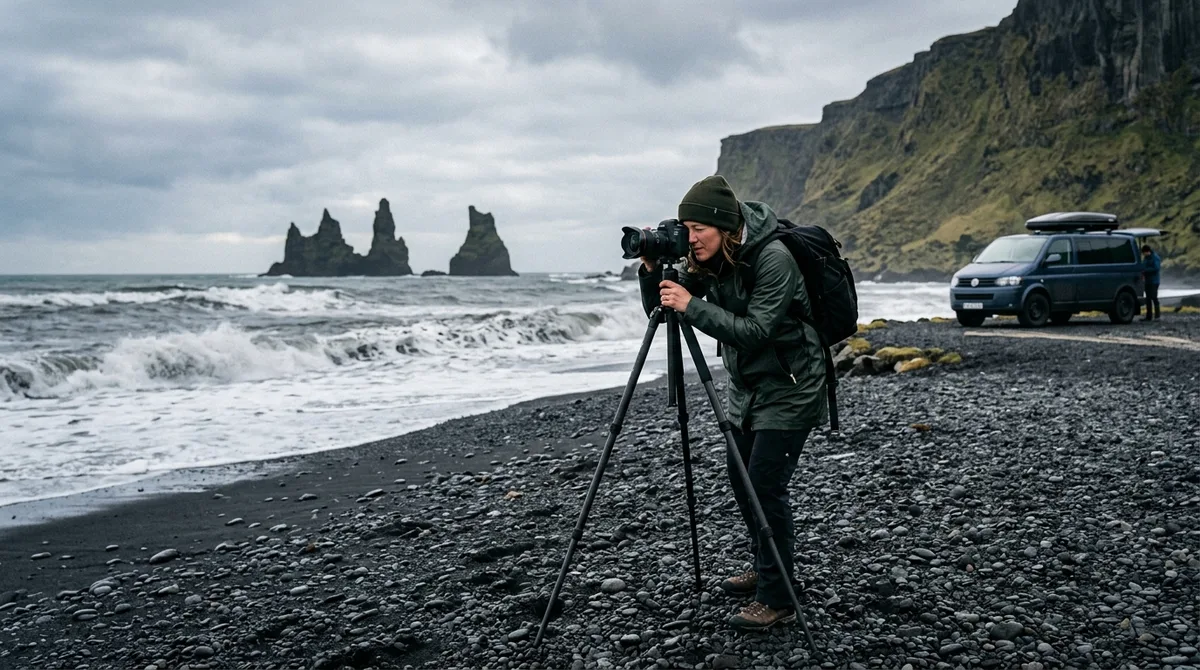
A well-planned Iceland photography road trip itinerary for 14 days gives you the exact window needed to circumnavigate the entire Ring Road (Route 1) while absorbing multi-day weather disruptions and dedicating focused golden-hour shoots to the Snæfellsnes Peninsula. Covering roughly 2,000 to 2,500 kilometers of driving, a two week Iceland photography route prevents rushed transitions, allowing you to wait out cloud cover at high-priority landmarks and capture both iconic vistas and secluded backcountry textures.
Executing an extended Iceland photo tour independently requires a disciplined balance between drive times, tidal schedules, light angles, and seasonal road conditions. This 14-day master itinerary provides an exhaustive, field-tested day-by-day roadmap tailored for dedicated landscape and travel photographers aiming to build a world-class portfolio across Iceland's diverse geological terrains.
Strategic Overview: Structuring a Two Week Iceland Photography Route
Fourteen days is the optimal threshold for an Iceland photography expedition. A standard 7-day or 10-day trip forces compromises—either skipping entire regions like the Eastfjords and North Iceland or turning every photo stop into a 20-minute roadside snapshot. With a full two-week window, you can dedicate 36 to 48 hours to complex regions like the Jökulsárlón/Vestrahorn corridor and the Snæfellsnes Peninsula, giving you multiple sunrise and sunset cycles to nail challenging compositions.
For additional route variations and segment planning, explore our dedicated 14-day Iceland photography itinerary resource alongside our shorter regional breakdowns.
Directional Strategy: Counter-Clockwise vs. Clockwise
For most photographers embarking on an Iceland photography road trip itinerary for 14 days, running counter-clockwise (South Coast first, then Eastfjords, North, and West) is the superior tactical choice for three reasons:
- Progressive Landscape Scale: You tackle the visually intense waterfalls and sea stacks of the South Coast early when energy levels are highest, before settling into the expansive, meditative coastal fjords of the East.
- Solar Angles in Shoulder Seasons: In spring and autumn, counter-clockwise travel aligns south-facing coastal bluffs and north-facing mountain amphitheaters favorably with the low southern sun arcs.
- Weather Flexibility: The South Coast has fewer alternative detour roads; knocking out this linear stretch first leaves North and West Iceland—where interconnected road loops make rerouting easier if storms hit—for the second week.
Midnight Sun vs. Shoulder Season Light Planning
Your daily rhythm changes drastically depending on the time of year:
- Summer (June–July): The sun dips below the horizon for only a few hours, yielding extended golden hours that blend directly into blue hour from 23:00 to 03:00. Photographers should invert their circadian rhythm: sleep from 08:00 to 15:00, scout locations during late afternoon, and shoot non-stop through the night when tourist sites are completely deserted.
- Autumn / Shoulder Season (September–October): You get standard 10- to 12-hour daylight windows, warm low-angle light for hours around mid-morning and mid-afternoon, and dark night skies capable of producing aurora borealis displays over epic foregrounds.
According to data from the Icelandic Tourist Board (Ferðamálastofa), seasonal visitation peaks heavily along the southwestern corridor. Structuring your shooting windows around off-peak hours is essential for clean compositions free of human obstruction.
Days 1 to 4: South Coast Waterfalls, Glacial Outwashes, and Black Sands
Day 1: Arrival, Vehicle Setup, and Reykjanes Peninsula
Pick up your 4x4 camper or SUV at Keflavík International Airport. Dedicate the afternoon to checking all camera gear, securing rental safety items, and calibrating your sensor-cleaning tools in a dust-free environment. Before heading east, spend late afternoon exploring the raw volcanic features of the Reykjanes Peninsula.
- Primary Locations: Valahnúkamöl sea cliffs, Gunnuhver geothermal area, and the Reykjanesviti lighthouse coastline.
- Compositional Strategy: Use a telephoto lens (70–200mm) at Valahnúkamöl to isolate violent North Atlantic breakers crashing against the dark basalt sea stack of Karlinn. Mount a circular polarizer (CPL) to control reflections on wet volcanic rock.
- Overnight Base: Selfoss or Hella.
Day 2: The South Coast Waterfall Trinity
Start before dawn to reach the iconic waterfalls along Route 1 before commercial tour buses arrive. Explore our curated South Coast photography locations for exact parking coordinates.
- Seljalandsfoss & Gljúfrabúi: Shoot Seljalandsfoss from behind the cascade at sunrise if light penetrates the cavern. Use an ultra-wide lens (14–24mm) with a dedicated lens hood and carry multiple microfiber cloths. Walk 500 meters north into the narrow canyon of Gljúfrabúi; place your tripod directly in the shallow stream for a low-angle vertical framing.
- Skógafoss: Position yourself at the river base approximately 100 meters back. Use a 24–70mm focal length and a 3-stop neutral density (ND) filter with a shutter speed between 0.5s and 1.5s to render water texture without blowing out the highlights of the spray.
- Kvernufoss: Located just five minutes east of Skógafoss inside a secluded gorge. This 30-meter waterfall offers a pristine foreground of moss-draped canyon walls. A 16–35mm lens captures the gorge framing beautifully during midday when overcast skies act as a giant softbox.
- Overnight Base: Skógar or Vík í Mýrdal.
Day 3: Dyrhólaey, Reynisfjara, and the Vík Coastal Bluffs
Coastal shooting requires constant vigilance regarding wave dynamics and tides.
- Dyrhólaey Promontory: Arrive for sunrise at the upper lighthouse plateau. Frame the massive volcanic arch looking west along the endless black sand coastline of Endless Beach. Switch to a 100–400mm lens to compress nesting seabirds against dramatic drop-offs.
- Reynisfjara Black Sand Beach: Focus on the basalt columns of Hálsanefshellir cave and the offshore Reynisdrangar sea stacks. Keep your shutter speed near 1/4s to 1/2s to capture the white sea foam trailing back into the black gravel. Safety caveat: rarely turn your back to the ocean; sneaker waves here are fatal and unpredictable.
- Vík í Mýrdal Church: Late evening composition looking down over the red-roofed church with the sea stacks in the distant background. A 50mm to 85mm prime creates balanced perspective compression.
- Overnight Base: Vík í Mýrdal.
Day 4: Fjaðrárgljúfur Canyon and the Glacial Tongues of Skaftafell
Transit through the vast Eldhraun lava field toward Vatnajökull National Park.
- Fjaðrárgljúfur: Arrive in early morning light. The winding serpentine canyon walls photograph best with side lighting that accentuates the depth of the ridges. Stay strictly on designated viewing platforms to safeguard fragile moss.
- Skaftafell (Svartifoss): A 45-minute hike brings you to Svartifoss, surrounded by hanging geometric basalt columns. A 24–70mm lens oriented vertically isolates the central fall against the geometric symmetry of the rock wall.
- Svínafellsjökull: In late afternoon, hike to the edge of the glacial tongue. Low-raking sunlight illuminates deep blue crevasses and compressed moraine bands. Use a telephoto lens to capture abstract patterns in the pressure ridges.
- Overnight Base: Skaftafell or Hof.
Days 5 to 7: Glacial Lagoons and Eastfjords Coastline
Day 5: Jökulsárlón and Breiðamerkursandur (Diamond Beach)
Dedicate an entire day to the dynamic ice dynamics of the Vatnajökull outlet systems.
- Jökulsárlón Dawn Shoot: Position your tripod along the northern shoreline before sunrise. Calm dawn conditions deliver mirror reflections of massive blue icebergs against the distant glacier rim. Use focus stacking at f/8 or f/11 to maintain tack-sharp focus from floating foreground chunks to distant ice sheets.
- Diamond Beach Action: Cross Route 1 to the shoreline where ocean waves wash glacial ice chunks onto black basalt sands. Mount a 0.6 or 0.9 soft-edge GND filter to balance bright sky reflections. Set shutter speeds between 1/2s and 2s to capture the dynamic retreat of breaking waves around stationary ice jewels.
- Fjallsárlón Detour: A quieter glacial lagoon 10 minutes west, offering a much closer mountain backdrop that frames dramatically with an 85mm to 135mm focal length.
- Overnight Base: Höfn.
Day 6: Stokksnes, Vestrahorn, and Eystrahorn
The jagged peaks of the Klifatindur ridge at Stokksnes form one of the most striking mountain profiles on Earth.
- Stokksnes Sunrise: Access the private black sand dunes (small entrance fee payable at the Viking Café). Scout low spots where receding tides create thin, glass-like sheets of water on the sand. Align the dramatic peaks of Vestrahorn with reflective foregrounds using a 14–24mm ultra-wide lens positioned just inches above the wet surface.
- Eystrahorn (Hvalnes): Drive 45 minutes east to the Hvalnes nature reserve. The angular scree slopes of Eystrahorn rising directly out of the turbulent surf provide an austere, moody composition, especially under dramatic low cloud cover.
- Overnight Base: Djúpivogur or Breiðdalsvík.
Day 7: Winding the Secluded Eastfjords
The Eastfjords showcase Iceland's oldest geological formations, characterized by steep basalt layers carved by ancient glaciers.
- Route 96 & Coastal Fjords: Take the coastal routes through Stöðvarfjörður and Fáskrúðsfjörður. Look for roadside waterfalls spilling from vertical cliffs and colorful fishing hamlets reflected in calm fjord waters.
- Seyðisfjörður: Descend into this dramatic fjord basin via Route 93. Frame the iconic light-blue church down the pastel rainbow street using a 70–200mm lens to compress the massive snowy valley walls behind the town.
- Overnight Base: Egilsstaðir or Seyðisfjörður.
Days 8 to 10: North Iceland Canyons, Geothermal Basins, and Basalt Formations
Day 8: Jökulsárgljúfur Canyons and Námafjall Geothermal Field
Head inland across the northeast volcanic plateau toward the most powerful waterfall systems in Europe.
- Dettifoss & Selfoss (West Bank vs. East Bank):
- West Bank (Road 862): Fully paved access, elevated viewing platforms, ideal for wide-angle captures (16–35mm) incorporating the full plunge pool mist.
- East Bank (Road 864): Gravel road, rougher access, puts you directly on the rocky shelf level with the waterfall crest for visceral, close-range wide compositions.
- Selfoss: Walk 1 km upstream from Dettifoss to photograph the wide, horseshoe-shaped cascade tumbling over pristine basalt columns.
- Hverir (Námafjall): Arrive at the geothermal field during late afternoon. Mount a circular polarizer to enhance the mineral color saturation of sulfur yellows, iron reds, and gray boiling mud cauldrons. Telephoto lenses excel at capturing abstract textural close-ups of venting fumaroles.
- Overnight Base: Lake Mývatn area.
Day 9: Lake Mývatn, Goðafoss, and the Highlands Edge
A diverse shooting day contrasting volcanic volcanism with classical river geometry.
- Skútustaðagígar: Early morning walk around the Lake Mývatn pseudocraters. Mist rising off the lake provides atmospheric layering for mid-range focal lengths (50mm).
- Goðafoss ("Waterfall of the Gods"): Explore both the east and west rims. The eastern bank allows you to climb down close to the water basin for dramatic low-angle compositions incorporating foreground boulders. Use an ND filter for smooth 2- to 4-second exposures.
- Aldeyjarfoss Detour: Drive south on Road 842 / F26 to Aldeyjarfoss, where the foaming white glacial river plunges through an amphitheater of symmetrical, twisted basalt columns. An ultra-wide lens is essential here to capture the scale of the basalt amphitheater alongside the churning plunge pool.
- Overnight Base: Akureyri.
Day 10: Tröllaskagi Peninsula and Coastal Outposts
Navigate the dramatic coastal fringe of the Tröllaskagi Peninsula, home to northern Iceland's tallest coastal mountains.
- Siglufjörður: A historic herring fishing port nestled inside a sheer-walled fjord. Great for morning blue-hour reflections of historic corrugated iron warehouses along the harbor.
- Hofsós Basalt Formations: Stop along the coastline near the village thermal pool to photograph columnar basalt formations meeting the cold waters of Skagafjörður.
- Overnight Base: Sauðárkrókur or Blönduós.
Days 11 to 14: Executing an Iceland Photography Road Trip Itinerary for 14 Days in the West
Day 11: Hvítserkur and Transit to Snæfellsnes
Depart North Iceland to begin your exploration of the western peninsulas.
- Hvítserkur Sea Stack: Arrive at the eastern shore of the Vatnsnes Peninsula for sunrise. This 15-meter monolith resembles a dragon drinking from the sea. Plan your shoot around low tide to walk directly onto the tidal flats and capture clear water reflections at its base.
- Kolugljúfur Canyon: A short inland detour to photograph the multi-tiered Kolufossar falls carving through a rugged volcanic gorge.
- Transit to Snæfellsnes: Drive west along Route 54 toward Grundarfjörður.
- Overnight Base: Grundarfjörður or Stykkishólmur.
Day 12: Kirkjufell Mastery and the Outer Snæfellsnes Coast
Dedicate an entire day to the iconic mountain profiles and rugged sea cliffs of Snæfellsjökull National Park.
- Kirkjufell & Kirkjufellsfoss: Arrive 90 minutes before sunrise. Mount an ultra-wide lens (14–16mm) at the upper waterfall tier to align the dual cascades in the immediate foreground with the triangular peak in the upper right quadrant. Bracket your exposures (+/- 2 EV) to retain highlight detail in the cascading white water while lifting shadow tones in the mountain flanks.
- Arnarstapi Coastal Cliffs: Walk the coastal footpath between Arnarstapi and Hellnar. Key compositions include the Gatklettur natural stone arch and the dramatic sea caves pounded by white surf. A 24–70mm lens with an ND filter allows you to blur wave movement into milky trails around the dark arches.
- Overnight Base: Arnarstapi or Hellnar.
Day 13: Búðakirkja, Djúpalónssandur, and Lóndrangar
Capture the stark, minimalist architecture and violent coastal geology of southern Snæfellsnes.
- Búðakirkja (The Black Church of Búðir): Sunrise is spectacular here. Frame the solitary black timber church against the backdrop of the rugged mountain ridge or the open sea. A minimalist composition using a 35mm or 50mm prime with generous negative space highlights the isolated character of the structure.
- Lóndrangar Basalt Pinnacles: Two ancient volcanic plugs rising 75 meters above the Atlantic. Shoot from the eastern cliff trail looking back toward the towers in the warm late afternoon light.
- Djúpalónssandur Beach: Frame the rusted iron remnants of the 1948 Epine GY7 shipwreck scattered across smooth black basalt pebbles.
- Overnight Base: Borgarnes.
Day 14: Hvalfjörður, Return to Reykjavík, and Data Management
Conclude the full circuit with a scenic coastal drive before final departure preparations.
- Hvalfjörður Detour: Bypass the underwater tunnel and drive the scenic coastal loop of Hvalfjörður ("Whale Fjord"). Photograph the abandoned whaling stations and tranquil shoreline reflections.
- Reykjavík Architectural Photowalk: Spend your final afternoon capturing the geometric glass facades of Harpa Concert Hall (designed by Ólafur Elíasson) and the sweeping lines of Hallgrímskirkja.
- Field Data Backup Protocols: Establish a strict 3-2-1 backup routine: copy all high-resolution raw files from your camera memory cards to two separate rugged external NVMe SSDs before repacking gear for air travel.
Optimizing Your Iceland Photography Road Trip Itinerary for 14 Days with GPS Waypoints
Relying on generic tourism maps or spotty cell service along remote fjord passes can cost you critical golden-hour light. Landscape photography demands exact parking pull-offs, unmarked trailhead starts, and precise composition coordinates.
The KML, GPX and GeoJSON files live on your device, so the waypoints work with no signal. Downloading offline map tiles is a separate step inside your mapping app. The coordinates are published as an open CC-BY dataset. What is sold is the curation, the formats and the season and access notes — not secrecy. The files are waypoints. Your own mapping app — Gaia GPS, OsmAnd, Organic Maps, a Garmin — does the routing. If you want to configure your field software in advance, follow our detailed guide on importing KML and GPX files into Gaia GPS.
Buying does not create an account. The files are emailed and downloadable directly. If the file does not load on your device, email within 30 days and we either get it working or refund you. You can browse our complete open photography coordinate dataset or view transparent benchmarks and independent feature breakdowns on our Iceland photography guides comparison page.
Currently, 9 of the 121 locations carry written field notes today. Every location carries coordinates, category and season. Furthermore, 112 of the 121 locations carry a researched brief compiled from published sources, each listing its sources. These are distinct from the 9 locations with written field notes. Iceland Photo Map does not publish customer reviews, testimonials or star ratings, and no rating markup appears on the site.
For mobile users looking for companion tooling on Android, Iceland Co-Pilot is live on Google Play, Android only, and included free with any Iceland Photo Map purchase — it is not sold separately and there is no separate Co-Pilot tier. The location catalog, field notes, parking and access notes, and arrival detection work today; full offline map tiles, light windows, road and weather status, and day routing are still in development. Iceland Photo Map sells downloadable files. Nothing is printed or posted.
Essential Field Safety, Weather Monitoring, and Access Regulations
Iceland's subarctic environment requires strict situational awareness. Unpredictable weather fronts and dynamic volcanic conditions can quickly impact even the best-laid plans.
The files carry season and access notes, not live conditions. Check vedur.is and road.is for current weather and road status. Weather alerts from the Icelandic Meteorological Office provide real-time updates on severe gale warnings, wind gusts exceeding 25 m/s (which can tear vehicle doors off hinges), and regional precipitation shifts.
Always register your travel plans with SafeTravel Iceland before venturing into remote fjord tracks or mountain roads. Adhere strictly to the safety guidelines established by the Environment Agency of Iceland (Umhverfisstofnun):
- Fragile Vegetation: rarely walk on subarctic moss (Racomitrium lanuginosum). It takes decades to recover from foot traffic. Stay strictly on marked trails.
- Off-Road Driving: Off-road driving is completely illegal in Iceland and carries severe financial penalties. often park in established gravel pull-offs.
- Drone Regulations: Drones are banned in all national parks (Thingvellir, Vatnajökull, Snæfellsjökull) and nature reserves unless you hold a commercial permit issued directly by Umhverfisstofnun. Check for local signage at every location.
Frequently Asked Questions
What camera gear and lens focal lengths are essential for a 14-day Iceland road trip?
An ideal kit includes a weather-sealed full-frame body and the classic "holy trinity" zoom setup: an ultra-wide zoom (14–24mm or 16–35mm f/2.8) for expansive waterfalls, sea caves, and northern lights; a standard zoom (24–70mm f/2.8 or f/4) for general landscape walkabouts; and a telephoto zoom (70–200mm or 100–400mm) for mountain compression, distant glacial details, and coastal birds. Critical accessories include a sturdy tripod capable of handling 20+ m/s winds, an L-bracket, a circular polarizer, 3-stop and 6-stop ND filters, and a copious supply of microfiber lens cloths.
Is 14 days enough time to add the Westfjords or Central Highlands to the Ring Road?
While 14 days is ideal for a thorough Ring Road circuit plus the Snæfellsnes Peninsula, adding the Westfjords or the Central Highlands (F-roads) will result in excessive driving and inadequate shooting time. The Westfjords alone requires a minimum of 3 to 4 dedicated days due to slow, winding gravel roads. The Central Highlands requires specialized high-clearance 4x4 vehicles for river crossings and is accessible only from late June through early September. Keep your 14-day itinerary focused on the main Ring Road and Snæfellsnes unless you extend your trip to 18–21 days.
What is the best season to execute this 14-day photography itinerary?
The best season depends on your photographic objectives. For lush green landscapes, lupine blooms, midnight sun shooting sessions, and accessible puffin colonies, plan your trip between mid-June and late July. For vibrant autumn colors, dramatic low-angle golden hours, and high chances of photographing the aurora borealis over dark landscapes without extreme winter road closures, early September through early October is unmatched.
How do I navigate to remote landscape locations without reliable cellular coverage?
Do not rely on live cellular data streams in Iceland's deep fjords and mountainous plateaus. Instead, download your spatial coordinate files (in GPX or KML format) onto your smartphone or standalone GPS unit before departure. Load these waypoints into offline-capable mapping applications such as Gaia GPS, OsmAnd, or Organic Maps, and ensure that you download the regional offline vector map tiles for all of Iceland directly to your device storage while connected to Wi-Fi.
Download the complete Iceland Photo Map waypoint dataset to load 120+ vetted landscape coordinates and seasonal notes directly into your favorite offline GPS app before setting out.