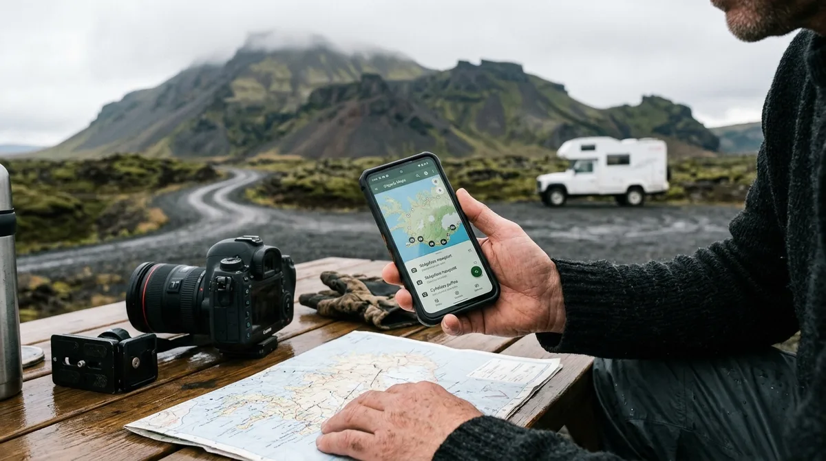
Using an Iceland photography map for Organic Maps provides a robust, offline-first navigation solution that keeps your focus on the landscape. By importing curated GPX data into this lightweight, privacy-focused application, you ensure that your planned locations remain accessible even in the most remote corners of the Icelandic Highlands or the rugged Westfjords. Because these files function without a cellular signal, they are an essential tool for photographers who prioritize reliability over convenience.
Why Choose Organic Maps for Your Iceland Photography Map?
For photographers traversing Iceland, cellular connectivity can be inconsistent, particularly in mountainous terrain or deep valleys. Relying on cloud-based mapping services can lead to frustration when map data fails to load in remote areas. Organic Maps is an offline-first application that stores map tiles locally on your device, ensuring independence from cellular networks as noted in the Organic Maps FAQ.
One of the primary advantages of using Organic Maps for Iceland is its efficiency regarding battery life. Unlike navigation apps that frequently ping cell towers or stream data, Organic Maps operates on a locally stored database. For photographers working in sub-arctic temperatures, where battery performance can be affected by cold, this efficiency is a practical benefit. Furthermore, Organic Maps is open-source and does not track user movements, offering a level of data privacy often preferred by travelers concerned about digital footprint management.
The application is well-suited for handling GPX data structures. Because your Iceland photography map is delivered as a structured set of coordinates, Organic Maps can render these waypoints as a distinct layer over the topography. This allows you to visualize your entire route—whether you are exploring the South Coast or venturing into the Westfjords—without needing a constant data connection. By layering these points, you can see the proximity of various locations, allowing for better logistical planning during the short golden hours of the Icelandic summer or the long, dramatic twilight of the shoulder seasons.
Preparing Your Iceland Photography Map for Organic Maps
Before you begin your journey, proper file management is essential. Iceland Photo Map provides data in the GPX format, which is the standard for offline mapping applications. Once you have purchased your map, download the file directly to your mobile device or transfer it from your desktop. We recommend performing this step at least 48 hours before your flight to ensure all files are correctly indexed by your operating system.
It is helpful to organize these files before you arrive in Iceland. Rather than importing a single, massive file, consider segmenting your data by region or subject matter. If you have downloaded our Aldeyjarfoss location data, ensure the GPX file is saved in a folder accessible via your phone’s "Files" app (on iOS) or your file manager (on Android). Keeping these files labeled by region—such as "North Iceland" or "Golden Circle"—will save you time in the field when you need to quickly switch between different areas of interest.
Note that our datasets are curated to provide specific season and access notes. Before importing your custom waypoints, ensure your device has sufficient storage space to download the regional map tiles for Iceland within the Organic Maps app settings. These tiles are required for the offline interface to function correctly, providing the underlying road and terrain data that makes our waypoints useful.
Step-by-Step: Importing GPX to Organic Maps
The process of importing GPX to Organic Maps is designed to be straightforward. On most mobile devices, the "Open In" function is the most reliable method for triggering the import process.
- Locate the file: Navigate to the folder where you saved your Iceland Photo Map GPX file.
- Select the file: Tap the file to open the system share menu.
- Choose the application: Select "Organic Maps" from the list of available apps. If it does not appear, select "Share" and then scroll to find Organic Maps.
- Verify the import: Once the app opens, it will automatically process the GPX file. You should see your waypoints appear as pins or icons on the map layer.
If you are managing multiple lists, Organic Maps allows you to toggle these layers on or off. We recommend visiting our import guide page for specific visual walkthroughs if you encounter any hurdles during this setup phase. Once imported, the pins will remain on your map until you manually remove them, allowing you to build a permanent library of Icelandic photography spots.
Managing Your Iceland Photography Map for Organic Maps in the Field
Once your data is loaded, effective management is key to a smooth expedition. The volume of locations can clutter your screen, so utilizing the categorization features within your mapping software is recommended. You can filter by waterfalls, lighthouses, or churches to ensure you aren't overwhelmed by pins when navigating.
To keep the app responsive, avoid importing every single location into a single view if you are only exploring one specific region. If you are focusing on the Golden Circle, only load the GPX files relevant to that area. This prevents the app from slowing down when rendering many points simultaneously. Additionally, use the bookmarking feature within Organic Maps to save your priority sunrise or sunset locations, which helps in quickly identifying where you need to be at specific times of the day.
Always remember: the files provide access notes, not live conditions. Because of the volatile nature of the Icelandic climate, you must check vedur.is for weather and road.is for current road status. These tools are the primary sources for real-time safety information in Iceland and should be consulted daily, regardless of how well-planned your route is.
Navigating Iceland: Understanding Waypoints vs. Turn-by-Turn
A common point of confusion for new users is the difference between waypoints and turn-by-turn navigation. The files provided by Iceland Photo Map are waypoints. Your mapping app—such as Organic Maps—handles the routing. When you tap on a location in your imported list, Organic Maps will show you the coordinate and can generate driving directions from your current position. Please be aware that the map does not provide automated "turn-by-turn" guidance between every single location in a pre-planned sequence; you are the navigator, and the app provides the path.
For those planning longer trips, we suggest reviewing our 7-day Iceland photography itinerary to see how these waypoints can be sequenced logically. This helps you balance driving times with the best light for photography. By understanding the difference between a static waypoint and a dynamic route, you can better manage your expectations when navigating the Ring Road or the more challenging F-roads.
Troubleshooting Common Import Issues
If you experience issues where your files fail to render, the most common cause is a corrupted download or an outdated version of the app. Ensure your Organic Maps app is updated to the version available in your device's app store. If the file still does not load, try deleting the imported file from your device and re-importing it. For older mobile devices with limited RAM, try splitting your GPX files into smaller, region-specific chunks to reduce the strain on the processor.
Iceland Photo Map provides downloadable files. If the file does not load on your device, email us within 30 days and we will assist you or provide a refund. We are committed to ensuring that the technical side of your planning is as seamless as the photography experience itself. We constantly test our files against the current versions of major offline mapping software to ensure compatibility for the 2026 season.
Beyond the Map: Building Your 2026 Itinerary
While our curated data provides a foundation, the best results come from combining these locations with your own research. Use our data as a starting point to identify locations, but leave room for the unexpected. Iceland’s weather is a significant factor; you might find that a high-altitude storm forces you to abandon your plan for Búðakirkja in favor of a sheltered valley nearby. Having an offline map allows you to quickly find alternative locations in the immediate vicinity without needing to reconnect to the internet to search for new spots.
Leverage regional data to build a flexible schedule. If you are planning a 2026 expedition, consider the North Iceland region for its lower foot traffic or the East Iceland fjords for dramatic, jagged coastlines. By keeping your itinerary flexible, you can adapt to the shifting light and weather patterns that define the Icelandic photography experience.
Advanced Tips for Professional Photographers
For those carrying professional gear, the utility of an offline map extends beyond simple navigation. Many photographers use the waypoints to plan their gear setup. For instance, knowing that a location requires a significant hike from the parking area allows you to pack your bag appropriately before leaving the vehicle. Furthermore, by marking specific viewpoints as "favorites" in Organic Maps, you can create a custom heat map of your intended shoot locations, which helps in visualizing the density of your itinerary. This level of preparation is particularly useful when shooting in the Highlands, where the terrain is unforgiving and mistakes in navigation can cost you precious hours of light.
Frequently Asked Questions
Can I use Organic Maps for turn-by-turn driving directions in Iceland?
Yes, you can use the app to generate driving directions. However, the files provided by Iceland Photo Map are waypoints. Your mapping app handles the routing to those specific coordinates. often verify the suggested route, especially when driving on F-roads or in remote areas, as apps may not often account for seasonal road closures or specific vehicle requirements. often cross-reference with official signage and local road authorities.
Does the Iceland photography map for Organic Maps require an internet connection?
No. Once you have downloaded the regional map tiles for Iceland and imported your GPX files, the application functions entirely offline. This makes it an ideal tool for the Icelandic backcountry where cellular coverage is intermittent or non-existent.
What should I do if my GPX file doesn't import correctly?
First, verify that you are using the current version of Organic Maps available for your device. If the problem persists, delete the file from your device and attempt the import process again. If the issue remains, please contact us within 30 days of purchase, and we will work with you to resolve the technical hurdle.
Are the locations in the map updated for 2026?
Yes, our datasets are maintained to reflect current access information and regional data for 2026. Note that while our coordinates and access notes are updated, you must cross-reference our data with local resources like road.is for any changes in road accessibility due to weather or maintenance.
Ready to start your expedition? Download your Iceland photography map today and begin planning your route with Organic Maps. Whether you are aiming for the classic landscapes or hidden gems, having your data structured and ready for offline use ensures you spend more time behind the lens and less time worrying about your next turn. By combining our curated waypoints with the reliability of offline mapping, you are setting yourself up for a successful and productive photography trip in 2026.