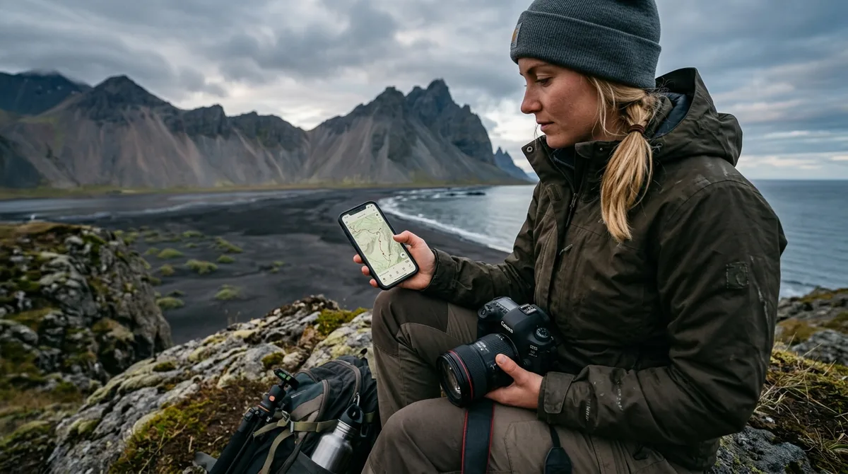
Configuring an
iceland photography map for Gaia GPS is the most effective way to ensure your 2026 expedition remains on track, regardless of how remote your location becomes. By importing our curated GPX waypoints into your device, you gain the ability to navigate to precise landscape, waterfall, and lighthouse sites offline, ensuring you never miss a prime light window due to a lack of cellular connectivity.
Why Gaia GPS is a Top Choice for Iceland Photographers
For photographers venturing into the Icelandic wilderness, reliability is the primary requirement. While standard mapping apps rely on constant data streams, Gaia GPS excels by allowing for comprehensive offline mapping. When you are standing in the middle of the Highlands or navigating the rugged terrain of the Westfjords, your phone will likely lose signal. An offline-capable
iceland photography map for Gaia GPS ensures your location data—including coordinates for specific points of interest—stays accessible on your device’s internal storage.
Gaia GPS is particularly well-suited for large waypoint datasets. Unlike basic consumer mapping tools that may crash or lag when asked to render hundreds of pins, Gaia handles extensive collections with ease. By using a specialized dataset, you can view your potential targets across the entire country or filter them by specific regions like the
South Coast or
North Iceland. The advantage here is twofold: you aren't just looking at a generic map, but a professional-grade set of coordinates specifically curated for the needs of visual storytellers.
Preparing Your Data for Import
Before you begin the import process, it is essential to understand the file structures provided. We deliver our data in standard GPX format, which is the universal language for GPS waypoints. Because our files are designed for portability, they are compatible with a wide range of devices, though Gaia GPS offers one of the most robust interfaces for managing these points.
Ensure your mobile device has sufficient storage space. While coordinate points themselves are small, you will need to cache high-resolution offline map tiles for the areas you intend to visit. We recommend downloading the "Gaia Topo" or "Satellite" layers for the specific regions on your itinerary while you are still connected to a stable Wi-Fi network.
Before importing, organize your folder structure within the Gaia GPS web interface. You can create folders for "Trip 2026," "Waterfalls," "Lighthouses," and "Landscapes" to keep your map clean. A well-organized folder hierarchy prevents your map view from becoming a cluttered mess of icons, allowing you to toggle visibility on or off based on your current focus.
Step-by-Step: Importing Your Iceland Photography Map for Gaia GPS
Importing your data is a straightforward process, but it requires attention to detail to ensure all metadata—such as access notes and seasonal information—remains intact.
- Download the GPX file: Once you have secured your copy from our site, save the file to a location accessible by your phone (such as iCloud Drive or Google Drive).
- Open Gaia GPS: Navigate to the "Saved" or "Folders" tab in the Gaia GPS app.
- Import: Select the import function (usually found under the "+" icon). Choose your GPX file.
- Syncing: Once the file is imported into the app on your primary device, ensure you are logged into your Gaia GPS account. Syncing allows these waypoints to appear on your tablet or secondary phone, which is a vital redundancy for field work.
If you encounter issues, ensure your file is not being blocked by a security setting or a restrictive file manager. Most import errors are caused by trying to open the file directly from a browser rather than using the "Import" function within the app itself. For those transitioning from other platforms, our guide on
importing KML to Gaia GPS may provide additional context if you are working with legacy data.
Optimizing Waypoint Visibility and Organization
The sheer volume of locations in our dataset can be overwhelming if left unmanaged. To maintain a functional workflow, use the waypoint customization features in Gaia GPS. You can assign specific icons to different location categories. For instance, use a "camera" icon for
landscapes, a "water" icon for
waterfalls, and a "church" icon for
churches.
Filtering is your best defense against screen clutter. If you are currently shooting in the
Reykjavik area, hide all waypoints associated with the East Iceland or Westfjords regions. By creating "Active Trip" folders, you can quickly toggle visibility so that only the locations relevant to your current 24-hour window appear on your display. This reduces the cognitive load of scanning a map and prevents you from accidentally missing a nearby turn-off.
Navigating Safely: Using Coordinates and Access Notes
It is vital to understand that the files we provide are waypoints, not turn-by-turn navigation. They are designed to show you exactly where a location is—such as the precise parking area for
Aldeyjarfoss or the viewpoint for
Budakirkja—but your mapping app handles the actual routing from your current position.
We include critical access notes and seasonal metadata with our waypoints. For example, some locations may be inaccessible during winter months due to snow or road closures. Always read the access notes included in the waypoint description before heading out. Furthermore, these files do not provide real-time updates. You must check
the Icelandic Meteorological Office (vedur.is) for the latest weather alerts and consult
road.is for current road conditions. Additionally, for comprehensive safety guidelines, refer to
SafeTravel.is, which provides the latest information on travel hazards and emergency protocols across Iceland. Never rely on a static map file to dictate your safety decisions in Iceland’s rapidly changing environment.
Managing Your Iceland Photography Map Data in the Field
Preparation is the difference between a successful shoot and a missed opportunity. Before departing, perform a full sync of your Gaia GPS account while at home. Verify that all waypoints are visible and that your offline map tiles are fully downloaded.
Battery management is another critical factor. GPS-heavy applications consume power rapidly, especially in cold weather. Carry a high-capacity power bank and consider putting your phone in "Airplane Mode" once your offline maps are loaded. This preserves battery life significantly while allowing the GPS chip to continue tracking your position.
If you find that a file fails to load or appears corrupted, do not panic. First, attempt to re-import the file. If the issue persists, contact us within 30 days. We are committed to ensuring your data works on your device, and we will either troubleshoot the configuration with you or provide a refund if the file remains incompatible.
Advanced Tips for Field Reliability
To further enhance your field experience, consider creating a "Master" folder that contains only the most critical locations for your 2026 trip. By isolating these points, you can reduce the processing load on your device and keep your map interface clean. Additionally, always keep a physical backup of your itinerary. While digital tools are powerful, the combination of extreme wind, moisture, and cold temperatures in Iceland can occasionally lead to hardware failure. Keeping a printed list of your primary coordinates ensures you have a fallback if your mobile device becomes unusable.
Frequently Asked Questions
Does the Iceland photography map for Gaia GPS provide turn-by-turn driving directions?
No. The files provided are waypoint datasets. Once imported into Gaia GPS, the app will show you the exact coordinates of the location, but you must use the app’s routing features or a separate navigation tool to calculate the driving path to the site.
What should I do if my GPX file does not load in Gaia GPS?
First, ensure you are using the "Import" function within the Gaia GPS app rather than just clicking the file in your email or browser. If it still fails, check that your app is updated to the latest version. If you continue to have trouble, email us within 30 days of purchase for technical support.
Are the locations in the map updated with live road and weather conditions?
No. The dataset includes static coordinates, seasonal access notes, and categories. It does not contain live data. You must consult the
Icelandic Road and Coastal Administration for live road closures and the
Icelandic Meteorological Office for real-time weather forecasts.
Can I use these files on other mapping apps besides Gaia GPS?
Yes. Because our data is provided in standard GPX format, it is compatible with most mapping applications, including OsmAnd, Organic Maps, and various Garmin GPS units. However, our support and configuration guides are specifically tailored to Gaia GPS.
How often should I sync my Gaia GPS data?
We recommend syncing your data at least 24 hours before your departure and again whenever you have access to high-speed Wi-Fi during your trip. This ensures that any updates to your saved folders or newly imported waypoints are reflected across all your devices.
Conclusion: Streamlining Your 2026 Iceland Expedition
Configuring your
iceland photography map for Gaia GPS is a foundational step in preparing for a productive trip. By taking the time to organize your folders, download your offline tiles, and familiarize yourself with the access notes for each site, you shift your focus from logistical uncertainty to creative execution. Whether you are exploring the
remote Westfjords or sticking to the classic route, having a reliable digital map ensures that you spend more time behind the lens and less time searching for the right trail.
Ready to hit the road? Download your Iceland Photography Map today and start building your custom itinerary in Gaia GPS.