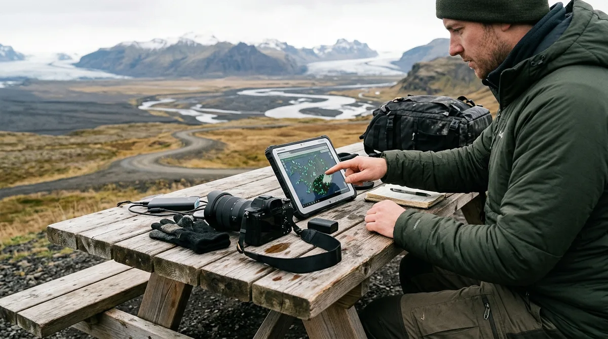
Using a dedicated Iceland photography map for GeoJSON transforms raw geographic coordinates into an interactive, queryable spatial database for planning landscape shoots. By leveraging the standardized JSON geospatial format, photographers can manipulate rich tabular metadata—including seasonal access constraints, subject orientations, and parking locations—inside professional Geographic Information Systems (GIS) and modern web mapping applications.
Whether you are planning a winter aurora expedition or mapping midnight sun compositions across the Central Highlands, relying solely on basic consumer pin drops leaves critical technical gaps. An open spatial format like GeoJSON bridges the gap between field navigation and desktop spatial analysis, allowing you to filter shooting locations programmatically, calculate solar shadows against digital elevation models (DEMs), and render custom scouting overlays offline.
Why Choose an Iceland Photography Map for GeoJSON Over Standard GPX or KML
For decades, outdoor photographers have relied on standard GPS Exchange Format (GPX) and Keyhole Markup Language (KML) files to mark shooting locations. While GPX excels at recording track logs from handheld GPS receivers and KML remains tied to Google Earth's display ecosystem, both formats impose severe structural limitations when managing complex, attribute-rich photography data.
The IETF RFC 7946 Specification standardizes GeoJSON as an open, lightweight format based on JavaScript Object Notation. Unlike XML-based schemas that require rigid, nested markup tags, GeoJSON stores spatial features and their associated metadata inside flexible, key-value property dictionaries. This distinction is critical when managing custom map data for Iceland.
| Feature / Capability | GeoJSON (RFC 7946) | GPX (GPS Exchange Format) | KML / KMZ |
|---|---|---|---|
| Data Structure | Lightweight JSON key-value properties | Rigid XML schema (waypoints, tracks, routes) | XML / Compressed ZIP archive |
| Custom Metadata Extensibility | Native, unlimited custom attributes (e.g., focal length, season, parking) | Limited extensions tag; poorly parsed by web engines | ExtendedData schema (often stripped during conversion) |
| Web Map Integration | Native parser in Mapbox, Leaflet, Felt, OpenLayers, D3 | Requires server-side conversion or third-party plugins | Requires conversion or Google Earth client rendering |
| GIS Compatibility | Full attribute table support in QGIS, ArcGIS, Python (GeoPandas) | Basic waypoint table; nested extensions often flattened | Mixed; multi-geometry KMLs often lose style layers |
| Coordinate System | Strictly WGS84 (EPSG:4326) in decimal degrees [lng, lat] | WGS84 lat/lon attributes | WGS84 lon/lat coordinates |
When organizing shooting locations across diverse Icelandic terrain, you often need to store more than just a name and a coordinate pair. A single vantage point requires distinct properties: optimal seasonal windows, primary composition headings, access category (such as paved Ring Road pull-offs versus rugged F-road river crossings), and separate coordinates for trailheads and parking areas. In GeoJSON, these properties remain directly accessible as structured database fields that you can query, filter, and style dynamically.
Furthermore, transparency in geographic data matters for planning expeditions. The coordinates are published as an open CC-BY dataset. What is sold is the curation, the formats and the season and access notes — not secrecy. You can review the complete data schema on our open dataset page.
Understanding the Anatomy of GeoJSON for Landscape Photography
To use GeoJSON for landscape photography effectively, you must understand how spatial engines interpret its nested hierarchy. A standard dataset is structured as a top-level FeatureCollection containing an array of individual Feature objects.
Here is an illustrative excerpt showing how an iconic shooting location like Aldeyjarfoss or the cascading spring-fed channels of Barnafossar can be structured with descriptive metadata:
{
  "type": "FeatureCollection",
  "features": [
    {
      "type": "Feature",
      "geometry": {
        "type": "Point",
        "coordinates": [-17.3369, 65.3664, 280]
      },
      "properties": {
        "id": "aldeyjarfoss",
        "name": "Aldeyjarfoss",
        "region": "North Iceland",
        "category": "Waterfall",
        "access": "F-Road (F26 / F881)",
        "optimal_season": "Summer / Early Autumn",
        "aurora_viewing_angle": "North-Northwest",
        "parking_coordinates": [-17.3421, 65.3678],
        "tripod_friendly": true,
        "drone_permitted": true
      }
    }
  ]
}
Key Structural Rules to Remember
- Coordinate Ordering: RFC 7946 mandates that coordinates must follow the order
[longitude, latitude, elevation]. Because longitude corresponds to the X-axis (easting) and latitude corresponds to the Y-axis (northing), passing latitude first will invert your coordinates, placing your Iceland photo location in the southern Indian Ocean or Antarctica. - Properties Block: The
propertiesJSON object holds arbitrary key-value pairs. This allows you to tag entries with custom fields, such as drone restrictions, footwear requirements (e.g., waders vs. microspikes), or target focal lengths. - Geometry Types: While most photography waypoints use
Pointgeometries, GeoJSON natively accommodatesLineString(for hiking paths, such as the approach to remote canyon rims) andPolygongeometries (to delineate national park boundaries where drone flights are strictly regulated).
Evaluating Compatible GIS and Web Platforms for GeoJSON Datasets
Once you have an Iceland photography map for GeoJSON, you can integrate it across desktop, browser, and mobile spatial platforms depending on your scouting phase.
1. Desktop GIS: QGIS (Quantum GIS)
For advanced desktop pre-scouting, the open-source platform QGIS is the industry standard. Importing a GeoJSON layer into QGIS allows you to perform complex spatial joins, compute hillshade analysis from Icelandic Digital Elevation Models, and visualize sun azimuth angles across mountain peaks at specific dates and times.
2. Browser-Based Visual Mapping: Felt and Mapbox Studio
If you prefer collaborative, cloud-based visual planning, platforms like Felt and Mapbox Studio allow you to drag and drop GeoJSON files directly into the browser. Felt immediately parses property columns into interactive UI filters, enabling you to isolate locations by region or category with a single click. Mapbox Studio allows custom vector styling, letting you generate high-contrast map themes optimized for dark-sky planning or winter contrast evaluation.
3. Rapid Inspection: geojson.io
For immediate validation, formatting checks, or coordinate verification, geojson.io is a lightweight, web-based tool. It renders points on an interactive Leaflet map side-by-side with an editable JSON code pane, making it easy to confirm that attributes match expected values before exporting to field devices.
4. Mobile GIS Field Tools: QField, Mergin Maps, and Native Converters
For mobile field deployment, mobile GIS apps such as QField and Mergin Maps can synchronize your desktop QGIS projects directly to Android or iOS tablets. Alternatively, you can convert GeoJSON layers into offline MBTiles vector packages or ingest them into mapping apps that support custom layer imports. The KML, GPX and GeoJSON files live on your device, so the waypoints work with no signal. Downloading offline map tiles is a separate step inside your mapping app.
Step-by-Step: Importing GeoJSON Waypoints into Your Scouting Stack
Integrating your spatial dataset into an analytical desktop scouting environment is straightforward. The following step-by-step workflow uses QGIS to prepare a comprehensive Iceland photography planning map.
Step 1: Inspect and Validate Your GeoJSON File
Before importing large datasets into GIS software, open the file in geojson.io or a code editor like VS Code. Confirm that the coordinate arrays are formatted as [lng, lat] and that the root object is a valid FeatureCollection.
Step 2: Load Vector Data into QGIS
- Launch QGIS and create a new project.
- Navigate to the top menu and select Layer > Add Layer > Add Vector Layer....
- Set the source type to File, browse to your downloaded
.geojsonfile, and click Add. - Verify that your layer's Coordinate Reference System (CRS) is set to
EPSG:4326 - WGS 84.
Step 3: Overlay Elevation Models (DEM) for Shadow and Sun Scouting
To evaluate how steep volcanic peaks cast shadows over waterfalls during golden hour, layer a high-resolution Arctic elevation raster behind your waypoints:
- Import an Icelandic digital elevation model (such as public 10m DEMs from Landmælingar Íslands or ArcticDEM).
- Right-click the DEM layer, choose Properties > Symbology, and change the render type to Hillshade.
- Adjust the light altitude and azimuth settings in QGIS to simulate sunrise or sunset angles for your intended travel dates. This confirms whether steep valley walls will block direct light from hitting your composition.
Step 4: Style Waypoints Dynamically by Category and Season
Instead of viewing identical pin markers, use QGIS rule-based rendering to classify your target locations automatically:
- Open layer properties and select the Symbology tab.
- Switch the symbology mode from Single Symbol to Categorized.
- Select
categoryas the Value attribute and click Classify. - Assign distinctive iconography: blue markers for waterfalls, yellow markers for lighthouses, and purple markers for historic turf churches.
- Apply an additional rule filter (e.g.,
"access" = 'Paved') to highlight spots accessible in winter without specialized 4x4 vehicles. For detailed workflows on handling files in specific mobile apps, consult our scouting setup guides.
Building Custom Scouting Maps: Filtering by Season, Lighting, and Terrain
The primary advantage of working with structured geospatial files over flat map images is the ability to run multi-parameter database queries to build tailored expedition itineraries.
Filtering Out Impassable Winter Terrain
Iceland's Interior Highlands present serious hazards outside the short summer window. Routes classified as F-roads (such as F208 to Landmannalaugar or F88 to Askja) remain closed by law through winter and spring due to snowdrifts, thawing mud, and unbridged glacial river crossings. Using simple SQL expressions in QGIS or filtering properties in web GIS platforms, you can instantly strip highland-access points from your winter scouting view:
"optimal_season" NOT LIKE '%Summer Only%' AND "access" != 'F-Road'This query immediately removes points that require highland navigation, leaving only low-elevation coastal and Ring Road locations suited for winter travel.
Layering Meteorological and Road Authority Data
While scouting from home or basecamp, you can overlay authoritative real-time and static vector feeds over your offline waypoint data. The Icelandic Meteorological Office (Veðurstofa Íslands) provides essential data on aurora forecasts, cloud cover projections, and volcanic hazards. Similarly, the Icelandic Road and Coastal Administration (Vegagerðin / road.is) supplies live vector layers of impassable routes, winter icing alerts, and gravel track conditions.
Note that your underlying waypoint dataset provides static environmental properties and seasonal parameters rather than dynamic feeds. The files carry season and access notes, not live conditions. Check vedur.is and road.is for current weather and road status.
Field Deployment: Using Your Iceland Photography Map for GeoJSON in Remote Areas
Executing a photography expedition across rural Iceland requires complete self-reliance when cellular connectivity drops. Deep basalt canyons, glacial valleys along the South Coast, and vast stretches of the Westfjords often lack LTE or 5G coverage entirely.
Offline Vector Handling
Because GeoJSON files are local text files stored directly on your phone, tablet, or ruggedized field laptop, their geographic coordinates and attribute tables remain many functional without an active network connection. You can search location names, read parking notes, and inspect coordinate attributes offline at any time.
However, you must remember that vector waypoints contain only geographic coordinates, not the visual background map. To view topological relief, satellite imagery, or road lines beneath your markers offline, you must download your mapping application's offline raster or vector map packages before departing your accommodation or rental depot.
Understanding Waypoints vs. Navigation Routing
A common point of confusion among photographers is expecting a spatial dataset to operate as an automated driving navigator. The files are waypoints. Your own mapping app — Gaia GPS, OsmAnd, Organic Maps, a Garmin — does the routing. If you plan to navigate using offline smartphone tools, review our walkthrough on configuring OsmAnd for offline field navigation.
Field Hardware and Battery Management
Icelandic sub-zero temperatures and high wind speeds severely degrade lithium-ion battery performance. When running spatial mapping tools in the field:
- Disable Background Network Polling: Switch devices to Airplane Mode to prevent battery drain from cellular modems searching for absent cell towers in remote valleys.
- Keep Master Datasets on Local Solid-State Storage: Ensure your GeoJSON files reside on internal device memory rather than cloud-synced folders (such as iCloud Drive or Google Drive) that may lock up when attempting to sync without cell service.
- Keep Backup Power Warm: Store external power banks inside interior jacket pockets close to body heat to maintain rated voltage output when charging cameras and tablets.
How Iceland Photo Map Structures Custom Spatial Data for Photographers
Building a robust spatial planning workflow requires dependable, transparently structured data. Rather than aggregating crowdsourced pins with inconsistent coordinates, our dataset is engineered specifically for landscape photographers who demand precise spatial metadata.
Our complete collection spans 121 curated Iceland photography locations. In terms of documentation depth, 9 of the 121 locations carry written field notes today. Every location carries coordinates, category and season. Meanwhile, 112 of the 121 locations carry a researched brief compiled from published sources, each listing its sources. These are distinct from the 9 locations with written field notes.
We believe in open standards and transparent licensing. The coordinates are published as an open CC-BY dataset. What is sold is the curation, the formats and the season and access notes — not secrecy. Iceland Photo Map does not publish customer reviews, testimonials or star ratings, and no rating markup appears on the site. Photographers can compare Iceland Photo Map with the alternatives on their own terms rather than claiming a superlative; the site publishes a sourced comparison that concedes where rivals are stronger.
When you purchase our packaged datasets, you receive instant access to optimized multi-format downloads—including GeoJSON, KML, and GPX files—ready for immediate import into QGIS, Google Earth, Gaia GPS, Garmin units, or mobile field tools. Buying does not create an account. The files are emailed and downloadable directly. Furthermore, Iceland Photo Map sells downloadable files. Nothing is printed or posted. If the file does not load on your device, email within 30 days and we either get it working or refund you.
Frequently Asked Questions
What is the difference between a GeoJSON and a GPX file for Iceland photography?
GeoJSON uses lightweight JSON syntax to store rich, structured tabular metadata (such as optimal seasons, composition headings, and separate parking coordinates) alongside geographic points, lines, and polygons. GPX is an XML-based format primarily designed for basic GPS tracks and waypoints, with limited support for custom metadata properties.
Can I open an Iceland GeoJSON file directly in Google Maps?
Google Maps cannot open raw GeoJSON files directly. However, you can convert your GeoJSON file into a KML or CSV file and import it into Google My Maps on desktop. Alternatively, you can use dedicated web GIS viewers like geojson.io, Felt, or desktop applications like Google Earth Pro and QGIS.
Does the Iceland GeoJSON map provide live road closures or weather data?
No. The files carry season and access notes, not live conditions. Check vedur.is and road.is for current weather and road status before heading out into the field.
Which mobile applications can open and display GeoJSON files offline?
Mobile GIS applications like QField and Mergin Maps natively read GeoJSON layers offline. For consumer mapping apps like OsmAnd, Organic Maps, or Gaia GPS, GeoJSON files can easily be imported directly or converted to GPX/KML formats using free tools while retaining waypoint locations.
What coordinate reference system (CRS) is used for Iceland photography GeoJSON data?
Per the RFC 7946 standard, all GeoJSON datasets use the World Geodetic System 1984 (WGS 84 / EPSG:4326) coordinate reference system, expressed in decimal degrees with coordinates ordered as [longitude, latitude].
Download the curated Iceland Photo Map dataset in GeoJSON, KML, and GPX formats to start building your custom spatial scouting map today.