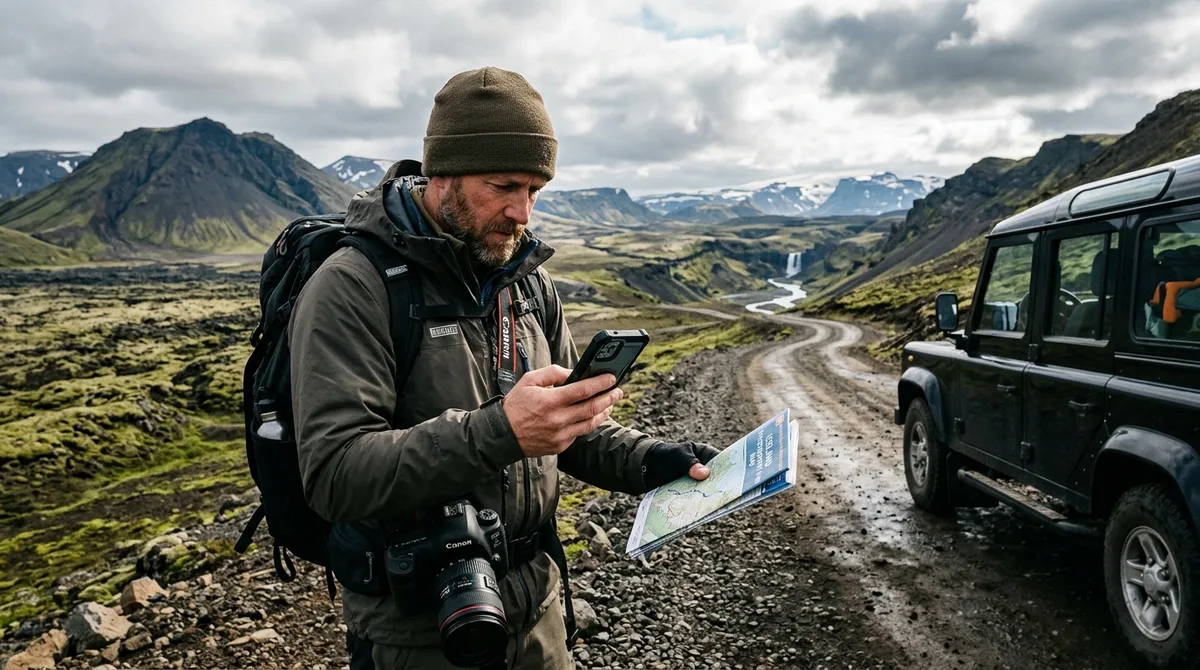
Using a dedicated Iceland photography map for mobile offline navigation ensures you can pinpoint remote trailheads, scouting coordinates, and composition turnouts even when cellular towers vanish behind basalt cliffs and glacial valleys. Relying on streaming map services in the Icelandic wilderness frequently results in stranded vehicles, missed light windows, and severe navigational hazards during sudden sub-Arctic weather shifts.
When shooting along the volcanic coastline or deep within highland canyons, mobile infrastructure drops out rapidly. Navigating these transitions requires an understanding of how standalone Global Navigation Satellite System (GNSS) hardware communicates directly with orbiting constellations, completely independent of local telecom networks. By pairing standalone waypoint coordinates with pre-downloaded offline map layers, photographers can confidently execute multi-day production schedules anywhere on the island.
Why Cellular Dead Zones Demand Offline Navigation in Iceland
Iceland maintains robust 4G and 5G cellular coverage along the primary coastal Ring Road (Route 1) and within major municipalities. However, as you navigate inland toward the Highlands (such as along the F208, F26, or F88 routes), traverse deep canyon basins, or round the jagged peninsulas of the Westfjords, cellular connectivity can become spotty or drop in remote stretches. Tall volcanic topography acts as a physical barrier to terrestrial cell towers, creating vast coverage dead zones that encompass some of the country's most compelling landscape photography locations.
According to technical specifications established by the Open Mobile Alliance, mobile device location subsystems can establish direct satellite positioning using built-in GNSS chipsets (communicating across GPS, GLONASS, Galileo, and BeiDou networks) without requiring cellular network assistance. While your smartphone's internal receiver can calculate your exact latitude and longitude in a complete communications blackout, the visual map interface will fail to render if your mapping application depends on live streaming data.
This reality introduces a critical technical distinction that every traveling landscape photographer must recognize:
- Background Map Tiles: The underlying visual cartography—including topographic contour lines, water bodies, elevation relief shading, and roadway networks—rendered as raster or vector tiles. These must be stored in your phone’s local flash memory prior to departure.
- Standalone Waypoint Data: The discrete coordinate markers (latitude, longitude, elevation) that denote parking spaces, hidden footpaths, stream crossings, and specific tripod setup zones.
Relying on dynamically cached data from standard consumer map apps presents major logistical risks. If an app clears its temporary cache while you are driving down an unmarked gravel track toward a remote waterfall such as Aldeyjarfoss, your screen will display your accurate blue GPS coordinate dot over a blank grey grid. In Arctic weather, where blizzards, gale-force winds, and glacial fog can drop visibility to less than ten meters within minutes, a blank map compromises both your photography schedule and personal safety.
Essential Features of an Iceland Photography Map for Mobile Offline Navigation
A functional Iceland photography map for mobile offline navigation must provide precise, field-tested location data structured specifically for landscape workflows rather than generic tourism sightseeing. When evaluating datasets and waypoint catalogs, prioritize the following attributes:
1. Sub-Meter Coordinate Precision for Specific Field Assets
Generic travel maps frequently drop a single pin in the geographic center of a national park or landmark feature. For a landscape photographer working in twilight, this is insufficient. A purpose-built photo navigation dataset isolates the exact gravel pullout suitable for passenger cars or 4x4s, the designated trailhead marker, and the precise vantage point or cliff edge where the composition aligns.
2. Seasonal Accessibility and Category Metadata
Iceland's landscape shifts dramatically between seasons. Certain basalt columns, sea stacks, and lupine fields are summer-only locations, while ice caves, frozen waterfalls, and aurora backdrops demand winter-specific access strategies. Clear category tagging (e.g., waterfalls, lighthouses, coastal turf churches) combined with seasonal notes allows photographers to filter targets quickly based on their seasonal travel window.
3. Universal Open-Format Data Structure
Proprietary systems that lock coordinates inside a single closed application limit operational flexibility in the field. Professional workflows require universal, non-proprietary data standards—specifically GPX (GPS Exchange Format), KML (Keyhole Markup Language), and GeoJSON. The KML, GPX and GeoJSON files live on your device, so the waypoints work with no signal. Downloading offline map tiles is a separate step inside your mapping app.
Regarding open access, the coordinates are published as an open CC-BY dataset. What is sold is the curation, the formats and the season and access notes — not secrecy. You can review the raw structure directly on the dataset documentation page.
How to Configure Offline Map Files for Iceland Travel Across Mobile Apps
Successfully preparing offline map files for Iceland travel requires setting up both the background cartography and the waypoint layer while connected to a stable high-speed Wi-Fi network before stepping into the field.
Step 1: Choose and Install a Dedicated Offline Mapping Engine
Select a navigation application built specifically for offline wilderness cartography. Leading options include Gaia GPS, OsmAnd, and Organic Maps. Each utilizes localized rendering engines designed to read locally stored map packages and geographic vector layers.
- For Gaia GPS setup instructions, review our guide on importing KML into Gaia GPS.
- If you prefer open-source OpenStreetMap (OSM) tools, consult our walkthrough for importing waypoints into OsmAnd or our guide on loading coordinates into Organic Maps.
Step 2: Pre-Download Offline Vector and Topo Base Maps
Inside your chosen mapping app, navigate to the map download manager and select the entire Iceland country package. In applications like Gaia GPS or OsmAnd, download both the standard OpenStreetMap (OSM) vector layer and a detailed topographic contour layer. OSM data contains detailed gravel track designations, river fords, and walking paths maintained by global mapping contributors.
Storage consideration: A high-resolution vector and topographic layer for the whole of Iceland generally requires between 400 MB and 2.5 GB of internal device storage. Ensure your smartphone has sufficient free space before beginning the download.
Step 3: Import the Photography Waypoint Files
Transfer the downloaded GPX or KML files into your mobile app. On iOS, tap the downloaded file and choose "Open in [Your Mapping App]". On Android, use the app's native "Import Tracks/Waypoints" menu to select the file from your local storage. Once imported, verify that the coordinate pins render accurately across all regions, from the Reykjanes Peninsula to the East Fjords.
Waypoints vs. Routing: Clarifying Navigation Roles in the Field
A frequent point of confusion for photographers traveling across Iceland is the operational difference between raw geographic waypoints and an active turn-by-turn routing engine. Understanding these complementary roles ensures smooth execution along challenging routes.
The files are waypoints. Your own mapping app — Gaia GPS, OsmAnd, Organic Maps, a Garmin — does the routing. Raw waypoint files provide the exact destination markers, whereas the mapping software running on your phone or dedicated GPS unit calculates the driving or hiking route using its stored road vectors.
When navigating Iceland's interior F-roads or rugged coastal gravel routes, automated turn-by-turn driving engines often fail to account for river crossing depths, unmaintained seasonal washouts, or temporary closures. For real-time navigational safety, standalone waypoints must be paired with authoritative operational sources:
- Road Conditions: Always check the Icelandic Road and Coastal Administration at road.is before departing. They publish mandatory updates on gravel pass conditions, winter snow blockage, and spring thaw closures (aurora/mud season).
- Weather & Cloud Forecasts: Monitor the Icelandic Meteorological Office at vedur.is for severe gale warnings, precipitation radar, and aurora activity overlays. The files carry season and access notes, not live conditions. Check vedur.is and road.is for current weather and road status.
- Search and Rescue Safety: Submit your daily travel plan and register with SafeTravel Iceland, especially if you plan to hike alone to backcountry photography locations.
Setting Up Your Iceland Photography Map for Mobile Offline Navigation Workflow
Maximizing the utility of an Iceland photography map for mobile offline navigation involves organizing your files around production logistics, light angles, and geographic clusters.
1. Organize by Regional Clusters
Iceland's weather patterns vary dramatically across mountain ranges. Rather than maintaining a single unwieldy list of 100+ points, organize your imported waypoints into distinct folders or color-coded collections inside your mapping application:
- South Coast: Glacial lagoons, sea stacks, and black sand waterfalls.
- Snæfellsnes Peninsula: Coastal churches, volcanic craters, and sea arches.
- North Iceland & Mývatn: Geothermal fields, canyon waterfalls, and basalt formations.
- East Fjords: Remote winding mountain passes and coastal headlands.
2. Pre-Calculate Solar and Lunar Positions Offline
At high northern latitudes (63° to 66° N), the sun's trajectory changes radically across the seasons. In June, the golden hour lasts for hours during the midnight sun, with the sun skimming the northern horizon. In December, the sun rises only a few degrees above the southern horizon for roughly four hours. Use an offline-capable ephemeris tool alongside your imported waypoints to verify which ridge lines will block the low winter sun or where the aurora oval will align relative to your foreground composition.
3. Establish Redundant Field Hardware
rarely rely on a single smartphone for navigation in remote sub-Arctic environments. Lithium-ion batteries drop voltage quickly in freezing weather, and screens can shatter on volcanic basalt rocks. Load your waypoint dataset onto at least two distinct devices—such as your primary smartphone and an offline-enabled tablet or dedicated handheld Garmin GPS unit.
Selecting the Best Offline Navigation for Iceland Photographers
Choosing the best offline navigation for Iceland photographers depends on your field workflow, your preferred hardware ecosystem, and whether you require advanced topographic elevation tools or simple map visualization. Compare Iceland Photo Map with the alternatives on their own terms rather than claiming a superlative; the site publishes a sourced comparison at iceland-photography-guides-compared that concedes where rivals are stronger.
The following table outlines the leading mobile offline navigation platforms commonly used by landscape photographers in Iceland:
| Mapping Application | Primary Strengths | Supported File Formats | Offline Topo Quality | Battery Efficiency |
|---|---|---|---|---|
| Gaia GPS | Layered topo maps, slope angle shading, satellite caching | GPX, KML | High (Multiple vector/raster sources) | Moderate (Demands battery optimization) |
| OsmAnd | Extensive OpenStreetMap POI detail, offline track calculation | GPX, KML, GeoJSON | High (Contour line plugin available) | Moderate |
| Organic Maps | Extremely fast, low battery consumption, open-source | KML, KMZ | Moderate (Standard OSM contours) | High (Optimized rendering engine) |
| Garmin Explore | Direct sync with rugged Garmin handhelds and inReach units | GPX, KML | High (Garmin TopoActive maps) | High (When paired with standalone unit) |
Evaluating Location Notes and Briefs
When selecting coordinate datasets, note how descriptions and access guidelines are assembled. For transparency across our catalog, 9 of the 121 locations carry written field notes today. Every location carries coordinates, category and season. Furthermore, 112 of the 121 locations carry a researched brief compiled from published sources, each listing its sources. These are distinct from the 9 locations with written field notes.
For Android users, Iceland Co-Pilot is live on Google Play, Android only, and included free with any Iceland Photo Map purchase — it is not sold separately and there is no separate Co-Pilot tier. The location catalog, field notes, parking and access notes, and arrival detection work today; full offline map tiles, light windows, road and weather status, and day routing are still in development.
Regarding commercial purchase terms: Buying does not create an account. The files are emailed and downloadable directly. If the file does not load on your device, email within 30 days and we either get it working or refund you. In addition, Iceland Photo Map does not publish customer reviews, testimonials or star ratings, and no rating markup appears on the site.
Field Protocols: Power, Weather, and Safety in Remote Terrain
Deploying mobile navigation in high-latitude environments introduces physical and electrical challenges that standard city navigation rarely encounters. Follow these core field protocols to maintain hardware integrity and navigational safety.
1. Manage Sub-Zero Battery Degradation
Cold ambient temperatures increase the internal resistance of lithium-ion batteries, causing sudden voltage drops. A phone displaying many battery capacity can shut down immediately upon exposure to a 0°C windchill during an extended outdoor shoot.
- Keep your navigation phone in an internal jacket pocket close to your body heat until needed.
- Use an external power bank equipped with USB Power Delivery (PD) and keep the power bank insulated inside your camera bag.
- Switch your mobile device to Flight Mode (Airplane Mode) with GPS location services active. This prevents the modem from expending high wattage attempting to handshake with non-existent cell towers.
2. Vehicle Power Systems and F-Road Travel
If you are renting a 4x4 camper or SUV for Highland exploration, do not rely exclusively on built-in dashboard USB ports, which frequently output a minimal 2.5W to 5W. Use a dedicated 12V cigarette lighter adapter capable of delivering at least 18W–30W to maintain a net-positive charge while the screen is continuously displaying your map track.
3. Off-Grid Emergency Communication
A mobile phone running offline mapping software is a navigation tool, not an emergency beacon. When operating in remote fjords or interior volcanic tracks where other vehicles may not pass for days, carry a satellite communicator (such as a Garmin inReach or ZOLEO device) operating on the Iridium satellite network. These devices provide two-way SOS communication and emergency location broadcasting anywhere in the Arctic.
Frequently Asked Questions
Do offline photography waypoint files include turn-by-turn driving directions?
No. Offline photography datasets contain exact geographic waypoints (latitude, longitude, category tags, and parking markers). The files are waypoints. Your own mapping app — Gaia GPS, OsmAnd, Organic Maps, a Garmin — does the routing based on its pre-downloaded road network data.
How do I access map tiles when I have no mobile signal in the Icelandic Highlands?
You must pre-download the underlying map tiles over Wi-Fi prior to leaving cellular reception. In mapping apps such as Gaia GPS, OsmAnd, or Organic Maps, download the complete Iceland vector or topographic region package. The KML, GPX and GeoJSON files live on your device, so the waypoints work with no signal. Downloading offline map tiles is a separate step inside your mapping app.
Which mobile applications work best for importing KML and GPX photo waypoints?
Gaia GPS, OsmAnd, Organic Maps, and Locus Map (Android) are among the most capable applications for reading offline geographic data files. Gaia GPS is well-suited for topographic layers and trail scouting, OsmAnd offers deep OpenStreetMap POI detail, and Organic Maps provides a streamlined, lightweight interface that preserves mobile battery life.
Can I use offline photography maps on both iPhone and Android devices?
Yes. Because open-standard files like GPX, KML, and GeoJSON are universally structured, they can be imported into compatible mapping applications across both iOS and Android platforms. Iceland Photo Map sells downloadable files. Nothing is printed or posted. Simply download the files and import them directly into your preferred mobile mapping software.
Download the Iceland Photo Map waypoint dataset today to equip your mobile mapping app with curated, offline-ready coordinates before heading into remote Arctic terrain.