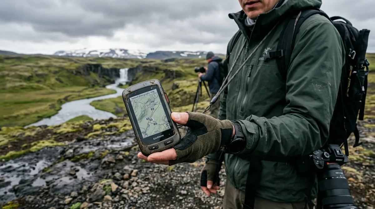
Loading an Iceland photography map for Garmin handheld GPS units and wrist-worn wearables requires transferring a structured GPX (GPS Exchange Format) file containing precise geographic waypoints directly onto your device. Whether you are using desktop management tools like Garmin BaseCamp or wireless syncing via the Garmin Explore mobile app, importing curated waypoints ensures offline visibility of shooting locations across Iceland's Ring Road, remote fjords, and rugged Highlands.
Garmin devices remain trusted tools for wilderness navigation due to their rugged construction, physical button interfaces, dedicated satellite receiver chipsets, and multi-day battery performance. However, because Garmin units treat spatial data strictly according to standard outdoor navigation protocols, understanding how GPX files interact with your device's memory structure is essential before setting foot on Icelandic soil. Iceland Photo Map sells downloadable files. Nothing is printed or posted. Buying does not create an account. The files are emailed and downloadable directly, giving you complete ownership of the data files from the moment of purchase.
Quick Start: Preparing Your Iceland Photography Map for Garmin Devices
Before connecting your Garmin handheld or wearable to a computer, it is vital to understand what a GPX dataset contains and how your device interprets it. A standard outdoor GPX file can contain three primary data types: waypoints, routes, and tracks. An Iceland photography map for Garmin consists primarily of waypoints—discrete geographic coordinates marked with essential metadata such as spot names, recommended photography seasons, and location categories.
When working with Garmin GPS for photographers, understanding this file architecture prevents confusion when browsing your device menus in the field:
- Waypoints (
<wpt>): Specific latitude and longitude coordinates representing static points of interest (such as waterfalls, coastal rock stacks, historic churches, or light structures). Each point stores elevation data, location names, and custom category symbols. - Routes (
<rte>): An ordered sequence of waypoints designed to guide you step-by-step along a calculated path. - Tracks (
<trk>): High-density point logs (often called "breadcrumb trails") that record an actual historic path traveled across the terrain.
It is important to understand the navigation role of these dataset files: The files are waypoints. Your own mapping app — Gaia GPS, OsmAnd, Organic Maps, a Garmin — does the routing. Your Garmin unit takes these imported waypoints and projects them onto whichever underlying vector or raster basemap is installed on your device (such as TopoActive Europe or Garmin TOPO Iceland). For additional guidance on alternative application workflows, explore our step-by-step import documentation.
Method 1: Direct USB Transfer via Garmin BaseCamp
For users of classic or advanced handheld receivers—such as the Garmin GPSMAP series (64, 65, 66, 67), Montana (600, 700 series), eTrex (22x, 32x, SE), and Oregon series—the most robust method for uploading GPX to Garmin hardware is using Garmin BaseCamp, Garmin's official desktop GIS management application for macOS and Windows.
Step 1: Download and Install Garmin BaseCamp
Download and install the official version of Garmin BaseCamp from Garmin's software portal. BaseCamp allows you to organize, preview, and edit waypoints on an interactive map screen prior to writing them to your device's permanent memory or internal storage drive.
Step 2: Import the GPX File into BaseCamp
- Launch Garmin BaseCamp on your computer.
- In the left-hand navigation pane, select My Collection (or right-click to create a new List Folder named "Iceland Photo Map").
- Click File > Import into 'Iceland Photo Map'... from the top application menu.
- Navigate to your downloaded GPX file (e.g.,
iceland-photo-map.gpx) and click Import. - All coordinates will populate inside the list pane, showing distinct icons for each location category.
Step 3: Connect Your Garmin Handheld via USB
Plug your Garmin unit into your computer using a data-certified USB cable. Note that older Garmin devices use Mass Storage Mode (USB MSC) where the device mounts like a standard flash drive, while newer devices (such as the GPSMAP 67 series) utilize Media Transfer Protocol (MTP). BaseCamp automatically detects both protocol types.
Once connected, your device (and its inserted MicroSD expansion card, if present) will appear in the left sidebar under the Devices directory.
Step 4: Transfer Waypoints to Device Memory
- Highlight the imported list folder or select specific waypoints inside BaseCamp.
- Drag and drop the selected items directly onto your connected device's internal storage icon or memory card icon in the left panel.
- Alternatively, select Device > Send to Device > Send 'Iceland Photo Map' to Device.
- Wait for the transfer progress bar to complete.
- Safely eject or unmount the Garmin device volume from your operating system before unplugging the USB cable.
When you power on your handheld in the field, open the Waypoint Manager or use the FIND menu on your device interface to access your imported photo locations.
Method 2: Syncing Your Iceland Photography Map for Garmin Wearables via Garmin Explore
Modern Garmin outdoor watches—such as the Fenix 6/7/8 series, Epix, Enduro, Instinct 2/2X, and Tactix—as well as wireless-enabled handhelds (like the GPSMAP 66i/67i) sync data via cloud storage using the Garmin Explore Web Portal and mobile application. Unlike Garmin Connect (which is built primarily around athletic performance and fitness tracking), Garmin Explore is designed specifically for waypoint, route, and map layer management.
Using Garmin Explore provides a major advantage: you can sync points wirelessly to your wrist or handheld over Bluetooth while in transit without needing a laptop.
Step 1: Upload GPX to the Garmin Explore Web Portal
- Open a web browser and navigate to
explore.garmin.com. Log in using your Garmin user credentials. - Click on the Map or Library tab located in the upper navigation bar.
- In the Library panel, click the Import button (represented by an arrow icon pointing into a box).
- Select Import Waypoints, Tracks, or Routes and upload your downloaded
iceland-photo-map.gpxfile. - Assign the incoming waypoints to a specific Collection (e.g., "Iceland Photography"). Collections keep your map display organized and prevent clutter when browsing other global locations.
Step 2: Sync via the Garmin Explore Mobile App
- Download the Garmin Explore app from Google Play or the Apple App Store on your smartphone.
- Log in with your Garmin account credentials.
- Ensure your Garmin wearable or handheld is powered on, Bluetooth-paired, and connected inside the Garmin Explore app.
- Navigate to the Account > Sync screen, or tap the Sync icon on the Devices tab.
- The app transfers all waypoint coordinates, titles, and icons directly to your watch over Bluetooth.
Once synced, you can navigate directly from your watch face by pressing Start/Stop > Navigate > Waypoints, selecting your desired location, and viewing direction, distance, and off-course prompts directly on your wrist screen.
Managing Custom Waypoint Icons and Location Categories
A well-curated GPX dataset does more than provide spatial coordinates; it helps you prioritize shoot locations based on light conditions, landscape features, and subject types. Garmin system software maps standard GPX category tags to built-in device symbols.
When you import our dataset, Garmin devices automatically classify locations into recognizable visual icon categories on your topographic display screen:
| Location Category | Garmin Standard Icon | Photography Application |
|---|---|---|
| Waterfalls | Water Drop / Blue Falls | Identify dramatic drop locations such as Aldeyjarfoss or long-exposure river targets in our Iceland waterfall photo spots category. |
| Historic / Churches | Building / Church Symbol | Locate iconic architectural subjects like the famous Búðakirkja black church on the Snæfellsnes Peninsula. |
| Coastal / Lighthouses | Lighthouse / Anchorage | Find dramatic cliff edges, sea arches, and coastal beacon towers for sunset compositions. |
| Scenic Vistas | Information / Scenic Area | Plan wide-angle panoramic views across glacial outwash plains and mountain passes. |
Understanding Dataset Metadata and Scope
When reviewing locations inside your Garmin device's waypoint information screen, you will see structured details attached to each coordinate. Transparency regarding dataset scope is essential for realistic planning in the field:
- Select locations carry detailed written field notes alongside coordinates, category designations, and seasonal guidelines.
- A vast majority of locations feature a researched brief compiled from published sources, with references cited for each location.
- The coordinates are published as an open CC-BY dataset. What is sold is the curation, the formats and the season and access notes — not secrecy. The location coordinates are published as an open CC-BY dataset.
To evaluate how our curated GPX format compares against generic web downloads or physical books, see our sourced comparison of Iceland photography guides.
Ensuring Complete Offline Reliability in Iceland's Remote Regions
Iceland's remote geography—particularly across the Highlands, deep Westfjords valleys, and eastern fjord passes—presents severe cellular connectivity gaps. Relying on smartphone apps that require live data network access to stream background map tiles can leave you stranded without visual spatial context.
Understanding device storage and map rendering mechanics ensures total operational safety:
The KML, GPX and GeoJSON files live on your device, so the waypoints work with no signal. Downloading offline map tiles is a separate step inside your mapping app.
While your Garmin handheld or wearable receives direct radio signals from orbiting satellite constellations (GPS, GLONASS, and Galileo) anywhere on Earth without cellular service, your unit must have basemap graphic files pre-installed to display underlying topography under your waypoints.
Pre-Loading Vector Basemaps on Your Garmin
- Verify TopoActive Coverage: Modern Garmin devices come equipped with regional TopoActive Europe maps. Connect your device to Garmin Express on desktop to ensure map software updates are fully installed before leaving home.
- Install Custom OpenStreetMap (OSM) Topo Maps: If your unit lacks factory topographic maps, download free pre-compiled OpenStreetMap topographic image files (
.imgformat) dedicated to Iceland and place them into the/Garmin/directory on your device's MicroSD card. - Field Verification: Before leaving your accommodation or entering signal-dead zones in the Highlands or Westfjords, switch your device to flight mode or disconnect wireless links. Open your Garmin map screen, zoom to your planned destination region, and confirm that both the topographic contour lines and imported photography waypoints render cleanly.
For additional details on setting up backup offline mappings, see our specialized Garmin GPX offline import guide.
Troubleshooting Common Garmin GPX Import Errors
While transferring GPX files to Garmin hardware is straightforward, legacy firmware limitations or file system formatting can occasionally cause errors during import. Below are solutions to common technical issues.
Issue 1: "Maximum Waypoint Limit Exceeded" Warning
Older legacy handhelds (such as early eTrex or GPSMAP 60/62 units) maintain strict system memory limits for active waypoints. If your device already contains hundreds of personal tracks and waypoints, adding a comprehensive photography dataset may trigger a capacity limit warning.
- Solution: Open Garmin BaseCamp, connect your device, and archive or back up older local waypoints to your computer desktop. Delete obsolete waypoints from the handheld's active memory.
- Alternative Solution: If using a legacy unit, filter the dataset in BaseCamp by category (e.g., transferring only "Waterfalls" or "Churches") rather than loading every regional point at once.
Issue 2: Icelandic Character Encoding and Name Truncation
Icelandic place names contain unique non-ASCII characters (such as Þ, þ, Ð, ð, Æ, æ, Ö, ö). Older Garmin hardware operating on outdated regional code pages may truncate location titles or render foreign characters as question marks (e.g., converting "Þingvellir" into "?ingvellir").
- Solution: Our GPX files are encoded in standard UTF-8 format to preserve correct character formatting. If your specific legacy device truncates special characters, use Garmin BaseCamp's batch-rename tool to strip special accents prior to sending the list to your physical device.
Issue 3: Waypoints Do Not Appear on the Map Screen
If you transferred the file via USB desktop copy but points do not populate inside the device menu, the file may have been placed in an incorrect file directory level.
- Solution: Ensure the
.gpxfile is stored strictly inside the device's root/Garmin/GPX/folder, not inside nested sub-folders or root directories. - Compatibility Guarantee: Device compatibility is intended: If the file does not load on your device, contact us by email and we will either get it working or refund your purchase.
Companion App Information
For Android users looking for smartphone-assisted companion tools alongside their Garmin setup, the Iceland Co-Pilot app is currently in development and will be included free with an Iceland Photo Map purchase upon release. It provides access to the location catalog, field notes, parking information, and arrival detection alongside core GPX files.
Field Best Practices for Navigating Iceland's Photo Spots
Operating a GPS unit during an Icelandic photo road trip requires adapting to rapidly changing physical landscapes and seasonal environmental conditions. Implementing these field tactics will streamline your workflow and keep you safe on location.
1. Utilize Waypoint Proximity Alarms
Driving along Iceland's main routes can make it easy to pass subtle roadside pull-offs or unmarked gravel access tracks leading to dramatic shooting spots. Most Garmin handhelds and wearables allow you to establish proximity alerts:
- On your Garmin device, navigate to Main Menu > Proximity Alarms > Create Alarm.
- Select key waypoints along your day's drive and set a suitable proximity radius (such as half a mile or one kilometer).
- Your unit will sound an audible tone or vibrate as you approach the pull-off point, giving you ample time to signal and safely decelerate.
2. Cross-Reference Access Notes with Official Real-Time Reports
While waypoint coordinates pinpoint exact geographic positions, real-time weather changes, winter snowpack, and spring thaw closures dictate whether roads or trails are physically passable.
Safety note: The files carry season and access notes, not live conditions. Check vedur.is and road.is for current weather and road status.
Before heading out each morning, cross-reference your targeted waypoints with active updates from Vegagerðin (road.is) for road condition maps (especially F-road mountain passes) and Veðurstofa Íslands (vedur.is) for wind alerts, precipitation radar, and aurora forecasts.
3. Editorial Transparency Note
To ensure full transparency regarding customer feedback policy: Iceland Photo Map does not publish customer reviews, testimonials or star ratings, and no rating markup appears on the site.
Frequently Asked Questions
Does loading this GPX file give me turn-by-turn driving directions on my Garmin?
No. The files are waypoints. Your own mapping app — Gaia GPS, OsmAnd, Organic Maps, a Garmin — does the routing. When imported onto a route-capable Garmin unit (such as a Montana or GPSMAP series loaded with routable street maps), your device can calculate an on-road path to the selected waypoint, but the GPX file itself contains coordinate points and metadata rather than automated turn-by-turn navigation instructions.
Can I upload the Iceland photography map to my Garmin watch using Garmin Connect?
No, you should use the Garmin Explore app rather than Garmin Connect. Garmin Connect is designed for fitness tracking, workouts, and activity logs, and lacks dedicated GPX waypoint collection management. Garmin Explore is built specifically for managing outdoor waypoints, tracks, and map layers, syncing seamlessly to compatible Garmin wearables over Bluetooth.
Will these waypoints work on my Garmin unit when I have no mobile signal in Iceland?
Yes, absolutely. The KML, GPX and GeoJSON files live on your device, so the waypoints work with no signal. Downloading offline map tiles is a separate step inside your mapping app or Garmin device. Because Garmin handhelds and watches communicate directly with orbiting GPS satellites, your location and saved waypoints will display reliably anywhere in Iceland regardless of cellular coverage.
What should I do if my Garmin handheld says the GPX file limit is exceeded?
If your device reports a waypoint capacity limit warning, connect your unit to a computer using Garmin BaseCamp. Archive older, unused waypoints from your device to your local desktop library to free up memory. Alternatively, you can use BaseCamp to filter and transfer specific geographic regions (such as South Coast or North Iceland) rather than loading the complete dataset simultaneously on older hardware.
Download our curated, offline-ready GPX dataset today to seamlessly sync Iceland's premier photo locations directly to your Garmin device.