Cellular Blackouts and Remote Landscapes: The Reality of Driving Iceland Without Cell Signal
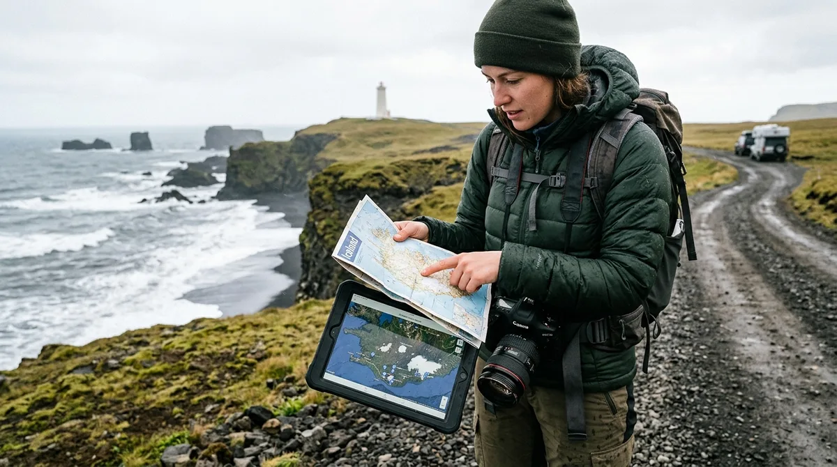
Navigating Iceland's remote photography locations requires reliable location data stored directly on your mobile device or standalone GPS unit, because cellular service frequently drops to zero in deep fjords, mountain passes, and highland interiors. An iceland photography map for offline use ensures you can pinpoint exact parking turnoffs, trailhead coordinates, and composition angles even when commercial mobile networks fail completely. When driving through uninhabited regions or negotiating unpredictable North Atlantic coastal weather, relying on active internet connectivity to fetch map coordinates or stream topographic backgrounds inevitably leads to missed light, lost shooting windows, or dangerous navigational errors.
While urban centers like Reykjavík and major settlements along Route 1 (the Ring Road) feature high-speed 4G and 5G networks, vast swathes of Iceland remain cellular dead zones. The moment you turn off the paved highway toward remote photography destinations, mobile coverage drops rapidly:
- The Westfjords: Mountain passes such as Dynjandisheiði and steep coastal fjords like Arnarfjörður severely attenuate cellular signals, leaving long stretches of unpaved road without data access.
- The Central Highlands: Mountain roads (F-roads) like the F208 through Fjallabak or the F26 across Sprengisandur feature no commercial cellular coverage across dozens of contiguous kilometers. Deep basalt canyons block line-of-sight signal transmission to coastal towers.
- East Iceland Fjords: Coastal valleys around Seyðisfjörður and Borgarfjörður Eystri frequently experience localized outages and signal shadows created by vertical mountain walls.
- South Coast Outwash Plains: Wide sandur fields and glacial river corridors between Vik and Höfn often drop to low-bandwidth 2G or zero connectivity between highway relay stations.
For landscape photographers, losing mobile connectivity is more than a minor inconvenience. Polar and subpolar light moves quickly, especially during shoulder seasons when golden hour shifts rapidly into twilight. Spending thirty minutes sitting in a running vehicle attempting to load a web page or re-query a cloud-based mapping application wastes critical exposure windows. Furthermore, attempting no signal navigation in iceland by relying on cached web browsers often fails when operating systems clear temporary memory to conserve RAM. Pre-loading vector waypoints directly onto your hardware guarantees instant, deterministic access to critical location metadata regardless of network status.
Choosing an Iceland Photography Map for Offline Use Across Key Device Formats
Selecting an Iceland photography map for offline use requires understanding how open geographic file formats interact with offline mapping engines. Vector location files store spatial geometry as absolute coordinate pairs (latitude and longitude) along with alphanumeric metadata, allowing them to render instantly without requiring a data connection.
When selecting spatial data for your expedition, three primary file formats provide maximum flexibility across desktop and mobile platforms:
- KML / KMZ (Keyhole Markup Language): The standard format for visualization in Google Earth and mobile GIS platforms. KML files store point locations, custom icons, and structured text notes. If you rely on mobile tools, reviewing a KML Gaia GPS setup guide or an iPhone GPX import tutorial demonstrates how easily vector coordinates import into offline mapping engines.
- GPX (GPS Exchange Format): The universal standard for handheld GPS hardware (such as Garmin handhelds) and dedicated backcountry navigation apps. GPX files store waypoints, routes, and tracks using light, highly compatible XML schema. Photographers utilizing dedicated rugged units can follow a Garmin GPX offline tutorial to load coordinates directly onto internal storage or SD cards.
- GeoJSON: A lightweight open geospatial format based on JavaScript Object Notation. GeoJSON is ideal for web developers, custom GIS applications, and mobile developers building specialized offline mapping utilities.
The KML, GPX and GeoJSON files live on your device, so the waypoints work with no signal. Downloading offline map tiles is a separate step inside your mapping app. Because the core geometry is stored locally on your device's solid-state memory, access to coordinates, parking notes, and location categories is instantaneous and completely independent of commercial cell towers.
Operational simplicity is critical when preparing for an international expedition. Buying does not create an account. The files are emailed and downloadable directly upon purchase. Additionally, technical compatibility is backed by a straight-forward guarantee: if the file does not load on your device, email within 30 days and we either get it working or refund you.
Offline Location Data vs. Map Tiles: Understanding How No Signal Navigation Works
A common point of confusion among traveling photographers is the functional difference between location point data (waypoints) and background map tiles (cartographic rendering). Understanding this distinction is essential for mastering offline maps for iceland photographers.
Location point data consists of raw mathematical coordinate pairs—latitude, longitude, and elevation—coupled with descriptive attributes such as location names, parking instructions, and seasonal accessibility notes. These vector files are extremely compact (often taking up less than a few megabytes for hundreds of locations) and live permanently inside your application's database.
Background map tiles, by contrast, are the visual graphics displayed underneath your location pins. These can be raster images (satellite imagery, shaded relief maps) or rendered vector shapes (topographic contour lines, road vectors, forest envelopes). Because raster map tiles consume hundreds of megabytes or gigabytes of storage space per region, they are not bundled directly inside spatial vector files.
Downloading offline map tiles is a separate step inside your mapping app. To achieve true no signal navigation in iceland, you must execute two distinct tasks prior to entering field conditions:
- Import the vector waypoint dataset (KML, GPX, or GeoJSON) into your chosen navigation software so that pins, labels, and notes appear on your device screen.
- Select and download the offline map tile region surrounding your planned route inside that same application (for example, downloading the offline base map for South Iceland or the Snæfellsnes Peninsula while connected to Wi-Fi).
It is equally important to understand how routing functions in the field. The files are waypoints. Your own mapping app — Gaia GPS, OsmAnd, Organic Maps, a Garmin — does the routing. The vector waypoint files contain exact coordinates for parking areas and photo perspectives, but they do not contain embedded turn-by-turn driving software. Your chosen mapping application utilizes your device's internal GPS receiver and locally cached road networks to render vector routes to those target coordinates.
For Android users looking for an integrated field reference, mobile companion tools provide streamlined location lookups. Iceland Co-Pilot is live on Google Play, Android only, and included free with any Iceland Photo Map purchase — it is not sold separately and there is no separate Co-Pilot tier. The location catalog, field notes, parking and access notes, and arrival detection work today; full offline map tiles, light windows, road and weather status, and day routing are still in development.
Evaluating Offline Maps for Iceland Photographers: Curation, Notes, and Data Quality
Not all waypoint collections offer equal value to landscape photographers. Standard commercial navigation apps or crowdsourced tourist maps frequently mark abstract geographical centroids rather than actual vehicle pull-offs, or they send drivers down private agricultural tracks that risk vehicle damage or land disputes.
High-quality offline maps for landscape photography must provide specific, actionable attributes designed around field workflows:
- Distinct Parking vs. Framing Coordinates: Indicating where to safely and legally park a vehicle versus where to stand with a tripod to capture an unobstructed composition.
- Seasonal Accessibility Designations: Distinguishing locations accessible year-round via paved roads from remote locations requiring modified 4x4 vehicles or summer-only F-road access.
- Walking Distance and Elevation Profiles: Detail regarding whether a composition requires a 50-meter walk from a paved lot or a strenuous 4-kilometer hike across loose volcanic scree.
- Category Classification: Precise taxonomy allowing photographers to filter locations by subject—such as basalt columns, coastal arches, glacial lagoons, or geothermal areas.
For example, when targeting remote waterfalls like Aldeyjarfoss in northern Iceland, having precise coordinates for the 4x4 parking area on the south side of the Skjálfandafljót river off Road 842 prevents drivers from taking incorrect forks or attempting hazardous river crossings in under-equipped rental cars.
Transparency regarding dataset compilation is essential for trip planning. Every location carries coordinates, category and season. Furthermore, 112 of the 121 locations carry a researched brief compiled from published sources, each listing its sources. These are distinct from the 9 locations with written field notes.
Rather than relying on proprietary lock-in or artificial scarcity, location coordinates should be accessible and verifiable. The coordinates are published as an open CC-BY dataset. What is sold is the curation, the formats and the season and access notes — not secrecy. Photographers interested in examining the raw data structure can inspect the open photography dataset directly.
Photographers are encouraged to evaluate mapping tools objectively based on their specific hardware preferences and technical requirements. Compare Iceland Photo Map with the alternatives on their own terms rather than claiming a superlative; the site publishes a sourced comparison at iceland-photography-guides-compared that concedes where rivals are stronger.
Pairing Offline Waypoints with Live Conditions and Safety Sources
While an offline photography map provides absolute spatial awareness on your device, static spatial files cannot predict dynamic environmental hazards. Iceland's subpolar climate is defined by atmospheric volatility, rapid polar low-pressure developments, and extreme road surface shifts. Understanding the boundary between static offline data and dynamic live safety data is essential for survival and successful shooting.
The files carry season and access notes, not live conditions. Static access notes inform you that a specific mountain pass typically closes in October due to snow pack, but they cannot tell you if a unseasonable blizzard closed the road this morning. Therefore, field photographers must combine static offline waypoints with daily live safety routines before driving outside cellular coverage.
Every morning before leaving accommodation or areas with Wi-Fi/cellular signal, cross-reference your offline route with official Icelandic safety infrastructure:
- Live Weather and Aurora Forecasts: Monitor the Icelandic Meteorological Office (Veðurstofa Íslands) for gale-force wind warnings, precipitation radar, and upper-atmosphere cloud coverage updates for northern lights shoots.
- Road Surface and Closure Tracking: Check the Icelandic Road and Coastal Administration (Vegagerðin) for real-time webcams, road temperature readings, river crossing advisories, and official road closures (marked as Ófært or Lokað).
- Travel Safety and Rescue Services: Register your travel plan and check regional hazard advisories with SafeTravel Iceland, operated by the Icelandic Association for Search and Rescue (ICE-SAR).
During shoulder seasons (October–November and March–April) and winter months, wind gusts along coastal cliffs like Reynisfjara or Vestrahorn can exceed 30–40 m/s (67–90 mph), capable of blowing car doors off hinges or carrying volcanic sand that strips vehicle paint. Having offline access to vehicle pull-offs allows you to alter course or retreat quickly to safe coordinates when live weather reports indicate approaching polar fronts.
How to Set Up Your Iceland Photography Map for Offline Use Before You Travel
Preparing your digital navigation stack before departure eliminates technical friction in the field. Follow this step-by-step workflow to ensure your **iceland photography map for offline use** renders properly without cellular data:
Step 1: Download Vector Files to Your Local Storage
Upon completing your digital download, save the KML, GPX, or GeoJSON files directly to your smartphone's internal file system or desktop computer. Do not leave the files sitting inside cloud storage drives (such as Google Drive or iCloud) without saving them locally, as cloud services require active internet to access un-synced files.
Step 2: Import Files Into Your Primary Mapping Engine
Open your preferred navigation application and execute the file import process. Depending on your choice of platform, review specific technical setup guides to ensure smooth integration:
- For handheld mapping and mobile track logging, follow the Gaia GPS KML import instructions.
- For privacy-focused offline vector mapping, review the Organic Maps integration guide.
- For advanced open-source geospatial customization, follow the OsmAnd setup tutorial.
- For dedicated outdoor handheld units, use the Garmin offline GPX import instructions.
Step 3: Download Background Region Map Tiles
Inside your chosen mapping software, select the region tile download manager. Draw a bounding box or select administrative regions covering your planned photography route—including the South Coast, Snæfellsnes Peninsula, Westfjords, or North Iceland. Select topographic vector tiles or 1:50,000 scale terrain layers for detailed elevation contour lines around river valleys and waterfalls.
Step 4: Execute an Airplane Mode Verification Test
Before stepping onto your flight or driving into remote valleys, perform a offline field simulation:
- Enable Airplane Mode on your mobile device and turn off Wi-Fi entirely.
- Open your mapping application and navigate to a remote target coordinate (e.g., a interior waterfall or coastal headland).
- Verify that the background topographic map renders clearly at high zoom levels without pixelation or missing tile grids.
- Tap on a photography waypoint to confirm that latitude/longitude coordinates, parking details, and location notes display instantly from internal memory.
Digital Workflows for Field Photographers: Keeping Gear and Navigation Streamlined
Modern landscape photography requires carrying substantial physical equipment—camera bodies, wide-angle and telephoto lenses, sturdy carbon fiber tripods, neutral density filters, and winter weather clothing. Eliminating physical guidebooks from your pack reduces weight and protects your travel setup.
Iceland Photo Map sells downloadable files. Nothing is printed or posted. Digital vector files add zero physical grams to your camera bag, ensuring that critical navigation data is permanently stored alongside your photography gear on the single device you carry everywhere: your smartphone or dedicated GPS receiver.
However, operating digital navigation tools in Arctic and sub-Arctic environments introduces environmental challenges—primarily thermal battery degradation. Sub-zero temperatures severely diminish the effective capacity of Lithium-ion batteries in smartphones and camera bodies. Implement these field tactics to maintain device power during extended outdoor shoots:
- Keep Devices Near Body Heat: Store smartphones and spare camera batteries in interior jacket pockets close to your core body heat when moving between shooting spots, rather than leaving them in exterior camera bag pockets.
- Carry Sealed Power Banks: Pack a external 10,000 mAh to 20,000 mAh power bank rated for low-temperature discharge in your camera pack to recharge phones or GPS units during long night shoots while waiting for northern lights activity.
- Optimize Screen Brightness and Display Timeout: Lower display brightness and set display timeout to 30 seconds when reviewing map coordinates in the field to conserve screen power.
By pre-configuring offline waypoints, storing local map tiles, and maintaining battery health, you streamline your field workflow. Instead of wasting valuable blue hour light managing connection errors or deciphering vague physical maps, your mental bandwidth remains focused on framing compositions, evaluating ambient exposure, and capturing Iceland's light.
Frequently Asked Questions
Does an offline photography map work without any cell service in Iceland?
Yes. Spatial vector files (KML, GPX, GeoJSON) live locally on your device's internal storage, allowing your phone or GPS unit to read coordinates, location notes, and parking details without any cellular signal or internet connection. However, displaying a detailed visual background map underneath those waypoints requires pre-downloading offline map tiles inside your chosen mapping app while connected to Wi-Fi prior to entering cell dead zones.
Do I need to create an account to download the map files?
No. Buying does not create an account. The vector map files are emailed to you immediately upon purchase as direct download links, allowing you to save them straight to your phone, tablet, or desktop computer without managing usernames, passwords, or cloud logins.
What mapping apps can import KML and GPX offline photo waypoints?
Standard KML and GPX vector files are universally compatible with a wide range of mobile and desktop mapping applications. Popular choices for offline navigation include Gaia GPS, Organic Maps, OsmAnd, Locus Map, Maps.me, Google Earth, and Garmin BaseCamp, as well as dedicated outdoor handheld GPS devices.
Does the offline map provide live weather and road closure updates?
No. The files carry season and access notes, not live conditions. Static offline files cannot monitor active weather fronts, volcanic advisories, or temporary road closures. Photographers should always check vedur.is for current weather and aurora forecasts and road.is for real-time road surface conditions before driving into remote locations.
Start Planning Your Iceland Photography Expedition
Download the complete Iceland Photo Map digital bundle today to get instant KML, GPX, and GeoJSON files ready for offline use on your device.