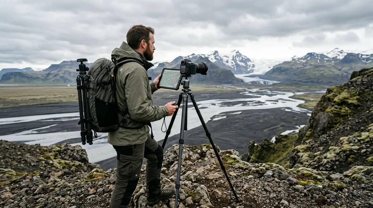
Rigorous Iceland photography location scouting for landscape pros requires replacing speculative on-the-ground driving with systematic multi-layer geospatial modeling before leaving your studio. By cross-referencing high-resolution Digital Elevation Models (DEM), sub-Arctic ephemeris data, tidal charts, and localized meteorological models, photographers can pinpoint precise optical sightlines, sun-ridge alignments, and safe access vectors across Iceland's most volatile terrain.
Executing a productive photography expedition in the sub-Arctic is fundamentally a logistics challenge. Iceland's maritime climate, rapid weather shifts, and extreme seasonal lighting dynamics mean that arriving at a viewpoint without prior spatial analysis often leads to blocked sightlines, backlit atmospheric haze, or dangerous tidal washouts. Professional pre-trip scouting turns uncertain conditions into calculated photographic opportunities.
Introduction: Why Pre-Trip Digital Scouting Dictates Field Success in Iceland
Iceland sits between 63°N and 67°N latitude, an oceanic transition zone where Arctic air masses collide with the North Atlantic Current. This geographic position creates dramatic localized microclimates where a clear valley can sit merely five kilometers away from a ridge trapped in dense katabatic cloud cover. For professional landscape photographers operating on compressed production schedules, relying on spontaneous location discovery carries an unacceptable failure rate.
A standard 7-to-14-day field expedition represents significant capital investment in 4x4 vehicle rentals, specialized gear, and fuel. When field time is lost to blocked mountain tracks, unfordable glacial rivers, or light obscured by unrecognized topography, overall portfolio yield drops significantly. Systematic pre-arrival planning transforms a high-risk trip into a sequence of predictable, high-probability shooting sessions.
A professional desktop scouting workflow integrates four technical layers:
- Digital Elevation Models (DEM) and Topographic Data: To evaluate terrain steepness, elevation profiles, and physical subject-to-camera line-of-sight.
- Sub-Arctic Ephemeris Modeling: To calculate exact solar azimuth, elevation angles, and terrain shadow casting across steep volcanic ridges.
- Hydrographic and Coastal Models: To synchronize swell vectors, ebb/flood tidal stages, and black sand drainage patterns.
- Meteorological and Access Databases: To track low-, mid-, and high-level cloud layers alongside official road status telemetry.
Structuring these elements into an integrated pre-trip dossier allows you to build primary shooting plans and secondary contingency targets for every light window.
Foundations of Iceland Photography Location Scouting for Landscape Pros
Effective scouting iceland photo spots begins with high-resolution topographic and elevation mapping. Standard consumer satellite maps flatten vertical relief, frequently concealing deep ravines, shear basalt bluffs, and impassable glacial runoff channels that lie between marked parking areas and potential tripod placements.
Professional landscape scouting leverages 1-meter to 5-meter resolution Digital Elevation Models (DEM) sourced from the National Land Survey of Iceland (Landmælingar Íslands). By inspecting tightly spaced 5-meter contour lines, you can determine whether a distant volcanic ridge will occlude low-angle morning sunlight or whether an elevated cliff edge provides an unobstructed view into a braided river delta.
Terrain Analysis Checklist for Remote Compositions:
- Calculate Slope Inclines: Slopes exceeding 30 degrees covered in wet volcanic tephra or saturated oceanic moss present severe slip hazards and require technical approach routes.
- Analyze Hydrological Runoff: Glacial river braids shift continuously throughout the summer melt season. Aerial surveys taken during late spring provide critical insight into channel density and sandbar stability.
- Measure True Distance-to-Subject: Calculate the exact millimeter focal length required to fill the sensor frame from an accessible ridgeline, avoiding unusable ultra-wide perspectives on distant geological features.
There is a distinct compositional difference between well-trodden roadside viewpoints and elevated geological perches. Standard roadside pull-offs often compress the foreground, blending river braids or lava fissures into a flat, indistinct mass. High-angle vantage points, identified through digital contour analysis, allow photographers to isolate abstract textural patterns across volcanic plains, geothermal vents, and outwash fields (Iceland landscape map waypoints provide curated starting coordinates across these varied terrain types).
Ephemeris and Light Modeling: Calculating Sun Angles for High Latitudes
Light behavior at sub-Arctic latitudes diverges dramatically from mid-latitude models. In mid-latitude regions, golden hour transitions rapidly over 20 to 40 minutes as the sun dips sharply toward the horizon. In Iceland, the sun's trajectory moves at a shallow, oblique angle relative to the earth's surface.
During the June summer solstice, the sun barely dips below the horizon, creating a continuous twilight window where golden hour seamlessly transitions into blue hour over several hours. Conversely, during the December winter solstice, the sun peaks at an elevation of only 2 to 3 degrees above the southern horizon at noon, casting low-raking, directional light throughout the brief four-hour daylight window.
| Season | Solar Noon Elevation | Golden Hour Duration | Primary Complicating Factor |
|---|---|---|---|
| Mid-Summer (June–July) | 48°–50° | 3 to 5 hours (continuous twilight) | Harsh overhead noon contrast; midnight sleep fatigue |
| Equinox (March / September) | 24°–27° | 60 to 90 minutes | Rapidly shifting weather fronts; freeze-thaw mud |
| Mid-Winter (December–January) | 2.5°–3.5° | Entire daylight period (~4 hours) | Deep terrain shadow occlusion; short operating window |
Because the sun travels at such low angles, 3D sun-tracking and shadow-simulation tools are essential. For example, when scouting northern volcanic gorges like Aldeyjarfoss or the steep rhyolite valleys of the Fjallabak Nature Reserve, high canyon rims can block direct low-elevation sunlight entirely, plunging unique columnar basalt formations into shadow hours before local sunset. Simulating solar azimuth against high-resolution terrain models allows you to calculate the precise 20-minute window when sunlight illuminates your specific compositional subject.
For night photography, calculating twilight phases is equally critical. To capture the aurora borealis or dark-sky foregrounds, the sun must reach astronomical twilight (at least 18 degrees below the horizon). In southern Iceland, astronomical darkness disappears completely from late April until late August, making late autumn, winter, and early spring the only viable windows for night-sky planning.
Tidal and Coastal Modeling for Black Sand and Basalt Formations
Coastal landscape photography along Iceland's South Coast, Snæfellsnes Peninsula, and the Westfjords requires coordinating marine hydrodynamics with terrestrial terrain. Locations such as Breiðamerkursandur (Diamond Beach) and the black sand tidal flats of Stokksnes look entirely different depending on whether the tide is at full ebb, slack, or maximum flood.
When scouting reflective tidal flats, an outgoing ebb tide is generally optimal. As water recedes across hard-packed volcanic sand, it leaves a thin, continuous film of water that functions as an optical mirror for mountain reflections. Conversely, a rising flood tide pushes incoming swells across the flats, creating turbulent chop that destroys mirror reflections and moves foreground ice blocks erratically.
Safety scouting must be integrated into pre-trip coastal planning. Atlantic swell energy hits Iceland's southern coastline with immense force, unimpeded by continental landmasses. Certain locations, notably Reynisfjara and Kirkjufjara, are notorious for hazardous sneaker waves—unusually large swells that surge significantly higher up the beach shelf following long sets of smaller waves.
Coastal Hydrographic Scouting Protocol:
- Swell Height and Period: Cross-reference offshore marine forecasts. Swells exceeding 2.5 meters with wave periods over 12 seconds create hazardous surf zones and excessive salt spray that coats front lens elements within seconds.
- Tidal Range Analysis: Spring tides (occurring around new and full moons) generate extreme water movement, cutting off narrow headlands and submerging safe tripod positions on basalt platforms.
- Shoreline Orientation: Align shoreline cardinal headings with incoming swell vectors to identify sheltered coves where clean, rhythmic water motion can be captured using long exposures.
Integrating Weather and Road Databases into Professional Photography Planning Iceland Workflows
Executing successful shoots requires structured professional photography planning iceland workflows that continuously layer meteorological telemetry over topographic maps. The Icelandic Meteorological Office (Veðurstofa Íslands) provides cloud cover forecasts segmented into three distinct atmospheric layers.
- Low Clouds (0–2 km altitude): Determines whether ground-level fog, mist, or sea smoke will obscure valley floors and waterfall basins.
- Mid-Level Clouds (2–5 km altitude): Dictates whether mountain peaks and plateau ridges will be enveloped in gray stratus cloud decks.
- High Clouds (5–10 km altitude): Crucial for predicting vibrant sunrise and sunset color transmission, as high-altitude cirrus clouds catch early and late solar rays above the horizon.
The files carry season and access notes, not live conditions. Check vedur.is and road.is for current weather and road status. While desktop planning provides baseline timing and seasonal orientation, field execution requires monitoring live telemetry to adapt to fast-moving frontal systems.
In addition to weather tracking, seasonal access logistics dictate what is physically reachable. Iceland's interior mountain roads (designated as F-roads) traverse unbridged rivers and snowpacks that remain impassable throughout winter and spring. The Icelandic Road and Coastal Administration (Vegagerðin) tracks road opening dates and river conditions. Most F-roads do not open until mid-June or early July, closing again at the first heavy autumn snowfall in September.
A professional plan accounts for these access constraints by establishing primary, secondary, and tertiary shooting targets within a 60-minute driving radius. If a localized maritime fog bank rolls into a planned coastal shoot, your pre-scouted dossier should immediately point to an inland canyon or waterfall gorge that benefits from flat, diffused light.
Managing Coordinate Datasets: Offline Mapping and Waypoint Preparation
Cellular data coverage across Iceland's Ring Road (Route 1) is generally reliable, but deep volcanic canyons, glacial outwash plains, and interior highlands frequently experience complete signal loss. Relying on cloud-based maps or streaming navigation while in the field can leave you stranded or cause you to miss tight lighting windows.
Preparing structured geospatial datasets (GPX, KML, and GeoJSON formats) before departure ensures uninterrupted navigation. The KML, GPX and GeoJSON files live on your device, so the waypoints work with no signal. Downloading offline map tiles is a separate step inside your mapping app. You can review how to configure these workflows in our tutorial on importing KML files into Gaia GPS.
Geospatial Data Structure for Photographers:
- Primary Point of Interest (POI): Exact composition point, marked down to 5-decimal precision (e.g., 64.12345, -19.12345).
- Vehicle Parking & Trailheads: Distinct from the shooting point to avoid routing GPS units toward impassable terrain or walking paths.
- Orientation Metadata: Cardinal facing direction (e.g., NE, SSW) and optimal light window (e.g., Summer Sunrise, Equinox Evening).
- Access Classification: Paved access, standard gravel track, or high-clearance 4x4 required.
The coordinates are published as an open CC-BY dataset. What is sold is the curation, the formats and the season and access notes — not secrecy. If you are structuring your own navigation database or planning extended travel, you can inspect the raw structure on our open photography dataset page or cross-reference logistical timelines using our 10-day Iceland photography itinerary.
Advanced Execution: Iceland Photography Location Scouting for Landscape Pros in Action
To see how multi-layer digital scouting works in practice, consider the workflow for capturing an isolated, unnamed volcanic gorge in the southern Highlands.
Step 1: Topographic Discovery and Occlusion Analysis
Initial inspection of satellite imagery reveals a distinct geological rift with high vertical canyon walls. Analyzing contour data in a GIS viewer reveals that the western canyon wall rises 80 meters above the canyon floor, while the eastern wall sits at 40 meters. This vertical asymmetry means that direct evening light will be blocked early by the western rim, while morning light from the east will illuminate the inner canyon walls and moss-covered ledges directly.
Step 2: Focal Length and Distance Calculation
Using digital measurement tools, calculate the horizontal distance from the accessible eastern clifftop to the primary waterfall cascade at the canyon head—in this case, 320 meters. A standard 24mm wide-angle lens would render the waterfall as a tiny element against vast empty sky. To frame the waterfall while compressing the layered basalt columns behind it, the calculation indicates a telephoto focal length between 100mm and 135mm on a full-frame sensor.
Focal Length vs Field-of-View Reference Table (Highland Canyons):
- 14mm–20mm: Immense foreground emphasis; requires placing tripod legs within 1–2 meters of dramatic foreground elements (e.g., ice chunks, water pools).
- 24mm–35mm: Environmental context; best for wide fjord vistas where mountain peaks frame the composition without excessive distortion.
- 70mm–200mm: Subject isolation and compression; necessary for pulling distant glacier tongues, volcanic cones, or river braids into prominent frame positions.
Step 3: Environmental Stewardship and Regulatory Compliance
Professional scouting requires verifying land ownership, national park boundaries, and environmental protection statuses. The Environment Agency of Iceland (Umhverfisstofnun) designates fragile ecosystems where foot traffic and drone flights are restricted or strictly prohibited.
Sub-Arctic moss (Racomitrium lanuginosum) grows over lava fields at a rate of only a few millimeters per year. Walking on dry moss crushes the plant structure, leaving footprints that remain visible for decades. Pre-scouting must identify established gravel paths, rocky outcroppings, and official parking areas to ensure complete environmental compliance before stepping into the field.
Conclusion: Building a Resilient Pre-Arrival Scouting Dossier
Successful landscape photography in Iceland is the result of disciplined pre-trip planning. By moving beyond surface-level inspiration and implementing rigorous technical scouting—analyzing DEM elevation data, running high-latitude sun simulations, tracking tidal hydrodynamics, and organizing offline coordinate datasets—you ensure that every hour in the field delivers maximum photographic return.
When unpredictable sub-Arctic weather forces rapid tactical adjustments, a structured scouting dossier allows you to pivot instantly to pre-planned secondary locations. Build your waypoint libraries, map terrain shadows, inspect access routes, and arrive prepared to capture Iceland's extraordinary landscape at its absolute peak.
Frequently Asked Questions
How far in advance should landscape photographers start scouting Iceland locations?
Professional scouting should begin 3 to 6 months before departure. This timeline allows sufficient time to analyze seasonal sun trajectories, secure appropriate 4x4 vehicle classes for planned terrain types, monitor historic F-road opening dates, and build structured offline navigation files.
Which satellite imagery tools provide the most reliable resolution for Iceland's terrain?
Open-access topographic data and high-resolution orthoimagery from the National Land Survey of Iceland (Landmælingar Íslands / Kortasjá) provide the most accurate elevation contouring and recent terrain surveys. Complementing national survey data with 3D terrain viewers enables precise line-of-sight and sun-angle modeling.
How do sub-Arctic sun angles change camera settings compared to mid-latitude shooting?
Because the sun skims the horizon at low angles for extended durations, lighting transitions are slower and directional shadows are significantly longer. Photographers frequently need multi-stop graduated neutral-density (GND) filters or bracketing techniques to balance extreme dynamic range between bright skies and deep shadows in volcanic rock.
What are the best methods for tracking seasonal F-road closures during pre-trip planning?
Review historic opening and closing condition reports published by Vegagerðin (the Icelandic Road and Coastal Administration). For pre-trip planning, assume Highland interior tracks are closed from October through mid-June, and structure early summer itineraries around paved coastal routes until road openings are officially confirmed.
Explore our curated landscape waypoint packages to import georeferenced coordinates and field access notes directly into your preferred offline GPS tool.