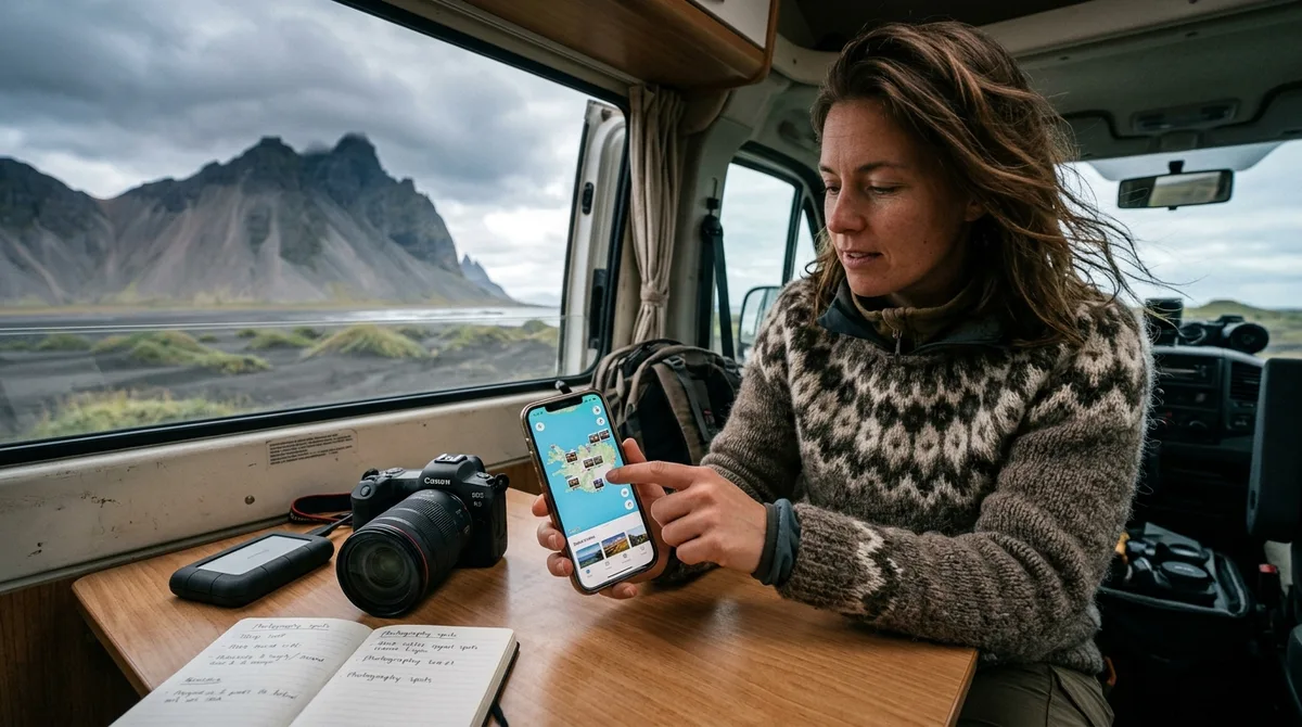
Importing an Iceland photography map for mobile apps allows you to navigate directly to precise landscape vantage points, waterfalls, and coastal compositions without relying on an active cellular connection. By downloading standalone geospatial files—specifically KML, GPX, or GeoJSON—you can load curated coordinate markers directly into offline mapping engines like Gaia GPS, Organic Maps, or OsmAnd before heading into the field.
Iceland's subarctic terrain presents significant navigation challenges for photographers. Mobile data coverage drops sharply once you leave the Route 1 Ring Road and enter deep coastal fjords, highland interior tracks, or glaciated valleys. Setting up an Iceland photography map for mobile apps on your smartphone or dedicated GPS unit ensures that critical shooting coordinates, parking pull-offs, and seasonal access notes remain instantly accessible regardless of your network connectivity. This guide walks you through selecting the correct file formats, importing waypoints across major mobile operating systems, configuring offline basemaps, and troubleshooting common geospatial rendering issues in 2026.
Choosing the Right File Format: KML, GPX, and GeoJSON Explained
Geospatial data comes in multiple file types, each designed around distinct data structures and mobile application ecosystems. Choosing the right format prevents coordinate truncation, missing metadata, or application crashes when preparing for your shoot.
The three universal formats for field photography mapping are:
- KML (Keyhole Markup Language): Maintained under the Open Geospatial Consortium (OGC) standards, KML uses an XML-based schema to express geographic annotation and visualization. A KML file for Iceland photography is ideal if your mobile app supports rich text descriptions, custom point-of-interest (POI) icons, and nested folder hierarchies (such as sorting locations by waterfalls, coastal sea stacks, or turf churches). It is the native format for Google Earth and imports seamlessly into Organic Maps and Gaia GPS.
- GPX (GPS Exchange Format): The longstanding open XML standard for GPS data interchange. GPX waypoints for Iceland are universally supported by dedicated field units (Garmin, Lowrance) as well as mobile navigation apps like OsmAnd and Gaia GPS. GPX excels at raw waypoint reliability—storing latitude, longitude, elevation, and basic metadata tags—making it the most resilient format across legacy and modern navigation devices.
- GeoJSON (Geographic JavaScript Object Notation): Structured according to the IETF RFC 7946 specification, GeoJSON represents geographic features alongside their non-spatial attribute properties. A GeoJSON photography map provides clean, lightweight data structures that GIS tools, custom mapping software, and modern web map engines can parse with minimal memory overhead.
The table below summarizes how each format behaves across key decision criteria for field photography:
| Decision Criteria | KML (.kml / .kmz) | GPX (.gpx) | GeoJSON (.geojson) |
|---|---|---|---|
| Best Mobile Apps | Organic Maps, Google Earth, Gaia GPS | Gaia GPS, OsmAnd, Garmin Explore, Locus Map | CalTopo, Mapbox, Custom Web GIS Viewers |
| Metadata & Notes Support | High (supports rich formatting, HTML notes, folders) | Moderate (supports basic description and comment fields) | High (structured key-value property pairs) |
| Hardware GPS Compatibility | Limited (requires conversion on many legacy units) | Universal (native hardware standard) | Very Low (rarely supported on handheld units) |
| Mobile Import Simplicity | Single-tap via iOS/Android share sheet | Single-tap via share sheet or file picker | Requires file selection or developer-oriented apps |
When selecting your format, remember that the underlying coordinate data remains consistent. The coordinates are publicly accessible. What is sold is the curation, the formats and the season and access notes — not secrecy.
Why Use an Iceland Photography Map for Mobile Apps Instead of Cloud-Only Tools
Many visiting photographers make the mistake of relying on standard cloud-based mapping apps. While cloud map apps function reliably in downtown Reykjavík or along major towns in the South Coast, they introduce significant failure points across rural Iceland.
Standard consumer maps depend on live network connections to fetch coordinate search queries, render high-detail topography, and retrieve descriptive metadata. In remote photography destinations such as the Westfjords, the Tröllaskagi peninsula, or highland approaches like the road toward Aldeyjarfoss, cellular service can fluctuate or drop completely. If your navigation tool relies on dynamic cloud queries, searching for a specific composition point or parking coordinate will fail precisely when you need it most.
The KML, GPX and GeoJSON files live on your device, so the waypoints work with no signal. Downloading offline map tiles is a separate step inside your mapping app. By decoupling the waypoint markers from live cloud servers, your phone acts as a standalone GPS navigator reading locally cached coordinates directly from its internal storage.
It is equally important to understand how waypoint files interact with your software: The files are waypoints. Your own mapping app — Gaia GPS, OsmAnd, Organic Maps, a Garmin — does the routing. The waypoint file pinpoints the exact shooting location, parking space, and composition angle; your navigation software calculates the driving trajectory and trail path using your locally downloaded offline map layers.
Step-by-Step: Importing Waypoints into Gaia GPS on iOS and Android
Gaia GPS is a widely used field navigation app among landscape photographers due to its robust layer management, offline satellite map caching, and cross-platform syncing. Buying does not create an account. The files are emailed and downloadable directly, allowing you to load them without complex sign-up gates.
Importing on iOS (iPhone & iPad)
- Open the download email on your iOS device and tap the download link for your chosen format (KML or GPX).
- Save the file to your local storage using the native Files app (typically in your
Downloadsfolder). - Locate the downloaded
.kmlor.gpxfile in the Files app, tap and hold the file icon, and select Share. - From the iOS Share Sheet, tap the Gaia GPS app icon. If Gaia GPS does not appear in your default row, scroll to the right, tap More, and select Gaia GPS from your list of available applications.
- Gaia GPS will launch automatically and prompt you to import the waypoints. Confirm the import and assign the markers to a dedicated folder (e.g., "Iceland Photo Map").
For a detailed breakdown of Gaia-specific folder structures and layer controls, consult our KML import guide for Gaia GPS.
Importing on Android
- Download the
.gpxor.kmlfile directly via your mobile browser. - Open your device's file manager (e.g., Files by Google or Samsung My Files) and navigate to your Downloads folder.
- Tap the downloaded file. Android will display an "Open with" dialogue; select Gaia GPS and tap Just Once or often .
- Alternatively, open Gaia GPS directly, tap the + (Add) button in the top navigation bar, select Import File, and browse to your downloaded waypoint file.
- Verify that the imported points appear on your map view.
Once imported, organize your waypoints into categorical folders inside Gaia GPS. Separating your markers by category—such as waterfalls, coastal sea cliffs, and turf churches like Búðakirkja—allows you to toggle entire categories on or off to keep your map clutter-free while scouting compositions.
Step-by-Step: Loading KML and GPX Files into Organic Maps and OsmAnd
If you prefer dedicated open-source or offline-first mapping utilities, Organic Maps and OsmAnd are two exceptional choices. Both operate with zero network tracking, consume minimal battery power, and feature fast vector rendering engines built on OpenStreetMap (OSM) data.
Loading KML Files into Organic Maps (iOS & Android)
Organic Maps provides one of the cleanest, fastest bookmarking workflows available on mobile devices. It processes KML bookmark files natively.
- Ensure you have the Organic Maps application installed on your phone.
- Open your mobile file browser or email client and tap the downloaded
.kmlfile. - When prompted by your operating system, choose Organic Maps to open the file.
- Organic Maps will parse the file in a fraction of a second, displaying a confirmation banner indicating that your bookmarks have been loaded into a new list.
- Open the Bookmarks and Tracks menu (star icon at the bottom of the screen) to view all imported photography locations, check individual coordinate notes, or toggle bookmark visibility.
Loading GPX Files into OsmAnd (Android & iOS)
OsmAnd is an advanced GIS viewer that gives photographers deep control over topographic contour lines, hillshading, and POI management. GPX is the preferred format for OsmAnd.
- Open OsmAnd and tap the Menu (three horizontal lines) in the bottom corner.
- Select My Places, then navigate to the Tracks or Favorites tab.
- Tap the + (Add / Import) button at the bottom of the screen.
- Browse your device's internal storage and select your
.gpxfile. - Once imported, tap the imported track list, select Show on Map, and choose a high-contrast display color (such as bright orange or cyan) so that photography waypoints stand out clearly against topographic contours.
For more detailed configuration options, see our walkthrough on importing waypoint files into OsmAnd.
Managing Offline Map Tiles vs. Waypoint Data in the Field
A critical technical distinction that trips up many photographers in Iceland is the fundamental difference between waypoint data and basemap tiles.
Importing an Iceland photography map for mobile apps adds point features (latitude, longitude, titles, elevation, and field descriptions) to your device. These files are lightweight—typically between 500 KB and 5 MB. However, the background map you see beneath those pins—the roads, terrain contours, rivers, and satellite imagery—consists of raster or vector map tiles that require separate offline caching.
The KML, GPX and GeoJSON files live on your device, so the waypoints work with no signal. Downloading offline map tiles is a separate step inside your mapping app.
To prepare your mobile device for complete offline reliability, follow this caching protocol before leaving your hotel or airport Wi-Fi:
- In Gaia GPS: Tap the + icon, choose Download Maps, drag the selection box over the entire geographic region you plan to photograph (e.g., the Snæfellsnes Peninsula or South Coast), and select your desired layers (such as Gaia Topo and High-Resolution Satellite). Set the detail slider to maximum zoom level (1:24k or higher) to preserve fine topographical detail.
- In Organic Maps: Zoom out to view Iceland and tap the download prompt that automatically appears for the entire country.
- In OsmAnd: Navigate to Download Maps > Europe > Iceland and download the "Standard Map", "Contour Lines", and "Terrain (Hillshade)" packages.
For Android users, Iceland Co-Pilot is live on Google Play, Android only, and included free with any Iceland Photo Map purchase — it is not sold separately and there is no separate Co-Pilot tier. The location catalog, field notes, parking and access notes, and arrival detection work today; full offline map tiles, light windows, road and weather status, and day routing are still in development.
Pairing Your Iceland Photography Map for Mobile Apps with Live Road and Weather Feeds
A static waypoint map is an indispensable tool for location scouting and composition planning, but safe travel in Iceland requires real-time situational awareness. The files carry season and access notes, not live conditions. Check vedur.is and road.is for current weather and road status.
9 of the 121 locations carry written field notes today. Every location carries coordinates, category and season. Furthermore, 112 of the 121 locations carry a researched brief compiled from published sources, each listing its sources. These are distinct from the 9 locations with written field notes. These notes provide structural guidance on seasonal viability, recommended footwear, and typical light angles, but they do not replace official monitoring bodies.
When executing a photography itinerary across Iceland, incorporate these two authoritative resources into your daily workflow:
- Veðurstofa Íslands (Icelandic Meteorological Office): Visit en.vedur.is every morning and evening. Use their high-resolution multi-layer cloud cover forecast to track low, mid, and high-altitude cloud movements for sunrise and sunset shoots. In winter, consult their aurora forecast page to cross-reference geomagnetic activity (Kp index) against localized cloud gaps.
- Vegagerðin (The Icelandic Road and Coastal Administration): Access
road.isbefore turning onto any secondary road, gravel track, or highland F-road. Road conditions change rapidly due to sudden blizzards, river swelling, or thawing ice. Check the interactive map for color-coded road classifications (e.g., passable, easily passable, impassable, or closed).
Establish a structured morning routine: review the live road map on road.is, check the wind and cloud models on vedur.is, and then open your offline mapping app to select which photography coordinates align best with the day's viable routes.
Troubleshooting Common Mobile Import and Coordinate Rendering Errors
If you encounter issues while loading or viewing your photography map files, work through these standard technical resolutions:
1. Misplaced Waypoints and Datum Mismatches
If a waypoint appears several hundred meters offshore or shifted away from the actual landmark, verify that your mapping application is reading coordinates in the WGS84 datum (EPSG:4326) standard. All standard KML, GPX, and GeoJSON files are compiled in decimal degrees using WGS84. If your software is set to a regional grid projection (such as ISN93 or Lambert Conformal Conic) without active on-the-fly reprojection, manual coordinate re-entry or app setting adjustments may be required.
2. iOS Safari and Zip Extraction Glitches
When downloading geospatial files in iOS Safari, the browser occasionally appends a .txt or .html extension to raw data files, or fails to extract bundled archives. If Gaia GPS or Organic Maps reports an "unsupported file format" error:
- Open the Files app and navigate to your downloaded file.
- Tap and hold the file, select Rename, and verify that the file ends strictly in
.kml,.gpx, or.geojson. Remove any trailing extensions like.txt. - If the download was delivered as a ZIP archive, tap the ZIP file once in the Files app to unpack it into a clean folder before sharing it to your mapping software.
3. Default Application Association Conflicts on Android
If tapping a GPX or KML file on Android repeatedly opens the wrong app (such as an office document reader), reset your default app associations: navigate to Settings > Apps > Default Apps, find the misconfigured application, and clear its "Open by default" permissions. The next time you tap your waypoint file, Android will prompt you to select your preferred mapping tool.
If the file does not load on your device, email within 30 days and we either get it working or refund you. You can also explore how our dataset balances against other resources in our detailed guide comparison.
Frequently Asked Questions
Do I need an active internet connection to view the photography waypoints in Iceland?
No. The KML, GPX and GeoJSON files live on your device, so the waypoints work with no signal. Downloading offline map tiles is a separate step inside your mapping app. Once you have imported the waypoint file and downloaded your chosen regional basemap tiles over Wi-Fi, your smartphone uses its internal GPS hardware to display your exact position alongside all photography markers with zero cellular reception.
Can I use these map files for turn-by-turn driving navigation?
The files are waypoints. Your own mapping app — Gaia GPS, OsmAnd, Organic Maps, a Garmin — does the routing. The files provide exact coordinates, parking areas, and composition references. Your mapping application handles the route calculation, trail tracking, and navigation between those waypoints based on the offline road and trail layers installed on your device.
What should I do if a file fails to import into my mobile mapping app?
First, verify that the file extension matches the format your application accepts (e.g., .kml for Organic Maps or .gpx for OsmAnd). Ensure the file is completely unzipped and stored in your device's local internal storage rather than on an un-synced cloud drive. If the file does not load on your device, email within 30 days and we either get it working or refund you.
Are live weather and road closure alerts included in the waypoint files?
No. The files carry season and access notes, not live conditions. Check vedur.is and road.is for current weather and road status. often consult official Icelandic government sources—specifically the Icelandic Meteorological Office (Veðurstofa Íslands) and the Road Administration (Vegagerðin)—before departing on your shoots.
Download curated Iceland photography waypoint files in KML, GPX, and GeoJSON formats to load directly into Gaia GPS, OsmAnd, or Organic Maps before your trip.