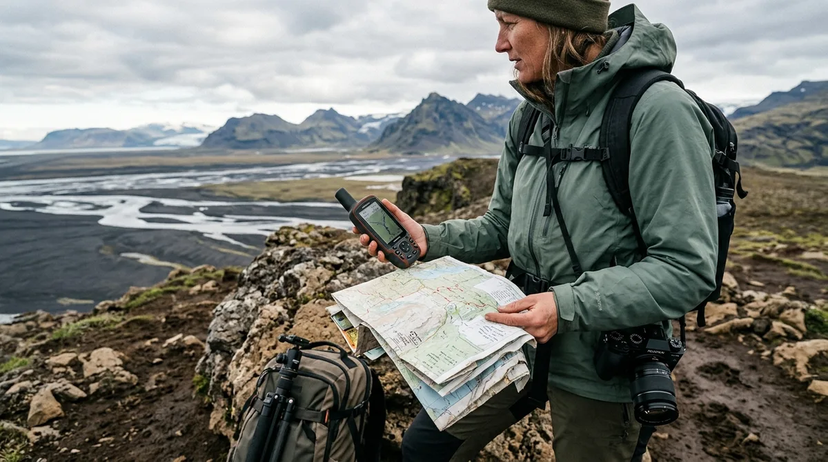
An iceland photography map download from Iceland Photo Map provides immediate access to 121 field-checked photography locations across Iceland packaged as GPX, KML, and GeoJSON files. Delivered instantly via email after checkout with no account creation required, the download includes verified shooting coordinates, exact parking pull-offs, vehicle clearance requirements, and seasonal light guidance. You load these standard spatial files directly into offline navigation tools—including Organic Maps, OsmAnd, Gaia GPS, Google Earth, and standalone Garmin devices—allowing full GPS tracking when cellular networks fail across the Highlands and coastal fjords. The complete dataset costs $29, while a free sample pack is available at /sample.
What You Receive with Your Iceland Photography Map Download
When you purchase a digital iceland photo map at /maps/All, delivery is immediate and automated. As soon as payment completes via Stripe, an email arrives in your inbox containing direct download links to the complete spatial dataset. Buying does not create an account. The files are emailed and downloadable directly, with no login portals to manage or subscriptions to cancel.
The core deliverable is a self-contained archive containing three universal GIS and GPS file formats: iceland-photo-map.gpx, iceland-photo-map.kml, and iceland-photo-map.geojson. Each format contains the exact same 121 field-checked locations distributed across all seven regions of the country, from the Reykjanes Peninsula to the remote peninsulas of the Westfjords. Instead of generic scenic labels, every single entry contains:
- Precise Composition Coordinates: Latitude and longitude coordinates accurate to six decimal places, pinning the exact spot where a tripod should stand to frame the scene rather than a generic tourist visitor center.
- Dedicated Parking Coordinates: Separate geographic coordinates for legal parking areas, pull-offs, or trailheads to prevent parking on fragile moss, soft gravel shoulders, or private farm lanes.
- Road and Clearance Classifications: Checkable access data indicating whether a location sits on paved Route 1, maintained gravel (such as Road 842), or designated F-roads requiring a high-clearance 4x4 vehicle.
- Optimal Seasonal Windows: Seasonal tags outlining access feasibility, snowpack risks, river-crossing statuses, and solar elevation profiles across winter, shoulder season, and midnight sun.
- Shooting Orientation Metadata: Recommended focal lengths, azimuth angles, and sun directions (such as low northern light during June midnight sun versus southern low-arc light in December).
For Android users wanting quick field references alongside their mapping software, companion mobile access is also included. Iceland Co-Pilot is live on Google Play, Android only, and included free with any Iceland Photo Map purchase — it is not sold separately and there is no separate Co-Pilot tier. The location catalog, field notes, parking and access notes, and arrival detection work today; full offline map tiles, light windows, road and weather status, and day routing are still in development.
File Formats Breakdown: GPX, KML, and GeoJSON Waypoints
Different navigation environments require specific data serialization formats. When you choose an iceland photography map download, you do not need to convert proprietary formats using third-party software. The package natively provides the three industry-standard geographic formats.
1. GPX 1.1 (GPS Exchange Format)
GPX is an open XML schema established by TopoGrafix to transfer GPS waypoint, route, and track data across marine, outdoor, and mobile GPS platforms. Within the paid map file, every location is structured as an individual <wpt> element containing explicit lat and lon attributes based on the WGS 84 datum. Inside each waypoint, the <name>, <desc>, and <cmt> elements store parking positions, access warnings, and composition angles. This structure imports directly into rugged outdoor GPS receivers, motorcycle navigation units, and mobile mapping apps such as OsmAnd and Organic Maps without conversion errors.
2. KML (Keyhole Markup Language)
Maintained by the Open Geospatial Consortium (OGC), KML uses an XML syntax optimized for three-dimensional geographical visualization. In our KML implementation, locations are grouped using <Folder> structures organized by categories (landscapes, waterfalls, coastal features, and historic architecture). Each <Placemark> contains styled descriptions formatted with standard HTML tags, allowing apps like Google Earth and Gaia GPS to display clean, readable typography when you inspect viewpoint metadata. The KML format is ideal for desktop pre-scouting: you can drop the file into Google Earth Pro on a desktop computer to inspect 3D terrain ridges, elevation contours, cliff lines, and shadow angles before arriving in the country.
3. GeoJSON (RFC 7946)
GeoJSON is the open standard format for encoding geographic data structures using JavaScript Object Notation, governed by the IETF RFC 7946 standard. The file contains a single FeatureCollection object containing 121 individual Point geometries. Every feature carries an extensive properties object containing machine-readable keys: name, category, season, parking_lat, parking_lon, f_road_required, and full research briefs. If you maintain custom mapping scripts, manage a private spatial database in PostGIS, or scout compositions inside QGIS with high-resolution digital elevation models (DEMs) from the National Land Survey of Iceland (Landmælingar Íslands), GeoJSON provides the clean tabular integration you need.
The KML, GPX and GeoJSON files live on your device, so the waypoints work with no signal. Downloading offline map tiles is a separate step inside your mapping app.
Evaluating the Complete Map vs Single-Category Downloads
We structure our catalog to support both photographers planning an exhaustive Ring Road journey and specialists focusing exclusively on specific subject matter. You can buy iceland photography map datasets as single-subject catalogs or as an all-inclusive package.
The standalone options include:
- Landscape Map ($14): Contains 62 GPS viewpoints spanning volcanic craters, geothermal valleys, glacial lagoons, black sand sea arches, and mountain vantage points.
- Waterfall Map ($14): Covers 30 major and tucked-away waterfalls, complete with spray distance warnings, footwear recommendations, and polarization notes.
- Lighthouse Map ($14): Details 15 coastal navigation structures set against Atlantic headlands, with cliff exposure notes and tidal access warnings.
- Church Map ($14): Focuses on 14 isolated turf, timber, and concrete rural chapels, specifying private land boundaries and night-sky foreground angles.
Sum of the four category maps is a measurable budget so Complete is the cheaper path to everything. The Complete Iceland Photo Map costs a measurable budget consolidating all 121 locations into a single, synchronized download file across all three formats.
| Package Name | Location Count | Price (USD) | Formats Included | Includes Iceland Co-Pilot |
|---|---|---|---|---|
| Complete Iceland Photo Map | 121 waypoints | $29 | GPX, KML, GeoJSON | Yes (Android) |
| Landscape Map | 62 waypoints | $14 | GPX, KML, GeoJSON | Yes (Android) |
| Waterfall Map | 30 waypoints | $14 | GPX, KML, GeoJSON | Yes (Android) |
| Lighthouse Map | 15 waypoints | $14 | GPX, KML, GeoJSON | Yes (Android) |
| Church Map | 14 waypoints | $14 | GPX, KML, GeoJSON | Yes (Android) |
The coordinates are published as an open CC-BY dataset. What is sold is the curation, the formats and the season and access notes — not secrecy. Photographers who wish to inspect raw coordinates without field advice or formatted files can access the underlying data at our open repository at /dataset.
How to Load Your Iceland Photography Map Download into Offline Apps
The files are waypoints. Your own mapping app — Gaia GPS, OsmAnd, Organic Maps, a Garmin — does the routing. Once you complete your iceland photography map download, transfer the files into your chosen offline navigation environment using the operating procedures outlined below.
1. Organic Maps (iOS and Android)
Organic Maps is an open-source, privacy-focused offline mapping tool powered by OpenStreetMap (OSM). It consumes minimal battery and renders vector contour lines quickly, making it a reliable tool for backcountry driving.
- Download the
iceland-photo-map.kmlor.gpxfile directly onto your mobile phone via your email confirmation link. - Open the downloaded file using your phone’s file manager. Tap Share or Open With and select Organic Maps. (Consult our complete step-by-step documentation at /import/organic-maps).
- Organic Maps will automatically create a dedicated bookmark group named after the file.
- Prior to leaving your accommodation or the airport at Keflavík (KEF), open the Organic Maps menu, search for "Iceland", and tap Download Map. This downloads the complete 150 MB country vector base map, ensuring all roads, hiking tracks, and contours display when airplane mode is active.
2. OsmAnd (Android and iOS)
OsmAnd provides advanced topographic map rendering, hillshading plugins, and configurable GPS point displays tailored for technical travel photographers. (See the detailed workflow at /import/osmand).
- Transfer
iceland-photo-map.gpxto your phone storage. - Launch OsmAnd, navigate to My Places > Tracks, and tap the + button (or import icon).
- Select the GPX file. OsmAnd will parse the waypoints into your favorites or point-of-interest layers.
- Open Download Maps inside OsmAnd and cache the complete Iceland Standard Map, along with the optional Contour Lines and Terrain (Hillshade) data packages for accurate elevation visualization around glacial valleys and canyon rims.
3. Gaia GPS (Web, iOS, Android)
Gaia GPS is widely used for overlaying satellite imagery against topographic tracks. For setup details, see /import/kml-gaia-gps.
- Log in to your account at gaiagps.com on your desktop browser.
- Click Upload Data and drop the
iceland-photo-map.kmlfile into the import window. - Confirm that the waypoints populate inside a designated "Iceland Photo Map" folder.
- Open the Gaia GPS app on your mobile device and initiate a cloud sync.
- Under the map layers menu, activate your preferred base map (e.g., Gaia Topo or Satellite Imagery), use the Map Box selection tool to highlight the sections of Iceland you will visit, and tap Save Offline Map. Ensure layers are stored locally before you enter valleys with zero cellular reception.
4. Standalone Garmin Handhelds and Vehicle Units
For photographers operating in rugged mountain terrain with dedicated handheld units (such as the Garmin GPSMAP 66/67 series or Montana 700), a direct hardware upload is straightforward. (Full hardware instructions are documented at /import/garmin-gpx-offline).
- Connect your Garmin device to your computer using a data-rated USB cable.
- Open your computer's file browser and mount the device storage.
- Navigate to the internal file directory:
Garmin/GPX/. - Copy
iceland-photo-map.gpxdirectly into this folder. Alternatively, import the file into Garmin BaseCamp, organize the waypoints into user-defined lists, and send them directly to your internal storage or microSD card.
5. Google Maps for iPhone and Android
While Google Maps does not support direct offline GPX file imports natively in its mobile app, you can display your custom waypoints using Google My Maps. To see how to export these points for mobile field use, follow our guide at /import/gpx-google-maps-iphone.
Field-Checked Access Notes, Parking Coordinates, and Research Briefs
One of the primary failure points when navigating Iceland with generic mapping pins is the confusion between where a camera stands and where a vehicle can legally stop. Stopping on the narrow, asphalt shoulders of Route 1 (the Ring Road) is strictly illegal under Icelandic traffic law and carries severe fines. In rural areas, stopping on gravel shoulders frequently results in vehicles sinking into soft volcanic sand or tipping into drainage ditches.
Every point in our map files provides distinct coordinates for the shooting vantage point and the corresponding safe vehicle turnaround or parking area. This separation ensures you can navigate directly to the vehicle parking area first, secure your vehicle safely off the carriageway, and then follow designated footpaths to the tripod location.
To remain transparent about our documentation sources: 9 of the 121 locations carry written field notes today. Every location carries coordinates, category and season. For the broader collection, 112 of the 121 locations carry a researched brief compiled from published sources, each listing its sources. The briefs ship inside the paid KML, GPX and GeoJSON files as a section headed "Background (from published sources, not a field visit)". These are distinct from the 9 locations with written field notes.
Iceland Photo Map does not publish customer reviews, testimonials or star ratings, and no rating markup appears on the site. We focus strictly on factual, verifiable navigation and geographic details.
Consider the logistical requirements documented for Aldeyjarfoss in North Iceland:
- Vantage Coordinate: 65.3665° N, 17.3369° W (framing the Skjálfandafljót river plunging through symmetrical hexagonal basalt columns).
- Parking Coordinate: 65.3662° N, 17.3421° W (a gravel parking area equipped with a basic dry toilet, terminating the driveable path).
- Route Details: Reached via Road 842 south through the Bárðardalur valley, which transitions into Mountain Road F26 (Sprengisandur route) for the final 4 kilometers. While Road 842 is compacted gravel, the final stretch over the farm boundary gate onto F26 contains steep washboard sections and exposed bedrock, requiring high undercarriage clearance.
- Seasonal Constraints: In winter, the gate on Road 842 at the farm Mýri is frequently locked due to heavy drifting snow, requiring an 8-kilometer snowshoe or superjeep approach.
- Light Profile: The gorge opens to the north-northwest. Optimal illumination on the basalt amphitheater occurs in late afternoon and summer evening light; morning shoots leave the southern wall cast in deep, harsh shadows.
Similar detailed structural separation is applied to locations like Barnafossar on Road 518 in the west and the coastal vantage points outside Bíldudalur in the southern Westfjords, eliminating guesswork before you step out of your vehicle.
Handling Weather and Road Constraints Alongside Your Waypoints
A digital map file provides spatial locations, but it cannot predict rapid sub-Arctic weather shifts. The files carry season and access notes, not live conditions. Check vedur.is and road.is for current weather and road status.
Safe, productive landscape photography in Iceland requires cross-referencing your offline map points with two authoritative official services every morning and evening:
- Vegagerðin (road.is): The Icelandic Road and Coastal Administration updates this portal continuously with physical road conditions: color-coded indicators for clear pavement, slippery frost, heavy wet snow, or closed roads (marked Ófært). If your route takes you past highland tracks or coastal passes (like the Öxi pass on Road 939 or Dynjandisheiði in the Westfjords), verify this site before losing cellular coverage.
- Veðurstofa Íslands (vedur.is): The Icelandic Meteorological Office issues severe wind alerts, precipitation models, and cloud-cover forecasts. Pay critical attention to mean wind speeds and wind gusts (measured in meters per second). Sustained winds exceeding 15 m/s make shooting with telephoto lenses on tripods difficult; gusts exceeding 25–30 m/s can blow gravel into camera front elements and catch vehicle doors off their hinges when opened facing the wind.
Use the seasonal flags embedded in your digital waypoint descriptions to sequence your itinerary logically. If our waypoint data flags a location as "F-road only / Late June to Early September," do not attempt to reach it during April or October in a standard passenger car, even if Google Maps or your in-car GPS displays the road as passable.
Testing the Free Sample Pack Before You Buy
Device operating systems handle file systems differently. A workflow that imports effortlessly into OsmAnd on Android may require an extra sharing step into Organic Maps on iOS. To eliminate technical friction before your departure, we provide an identical sample pack for testing.
Navigate to /sample to download Free.gpx, Free.kml, and Free.json. No account creation, email registration, or payment information is required to access these test files. Download them directly to your phone, tablet, or GPS unit and test the following setup steps:
- Verify that the file downloads, unzips, and stores cleanly on your device.
- Ensure your navigation app of choice (such as Organic Maps or Gaia GPS) recognizes the coordinate pins and renders the text descriptions cleanly.
- Test offline access: Put your device into Airplane Mode, disable Wi-Fi, and confirm that the waypoint markers remain fully selectable over your downloaded base maps.
- Check the location of the parking points versus the viewpoints to understand how the two coordinate sets interact.
Iceland Photo Map sells downloadable files. Nothing is printed or posted. If you choose to buy iceland photography map data from us, your purchase is covered by an operational compatibility promise: If the file does not load on your device, email within 30 days and we either get it working or refund you.
Frequently Asked Questions
What file formats do I get with the Iceland photography map download?
You receive three open spatial data formats inside a single zipped folder: GPX 1.1 (standard GPS exchange XML for handheld GPS units and apps like OsmAnd), KML (Keyhole Markup Language for Google Earth and Gaia GPS), and GeoJSON (RFC 7946 compliant JSON for custom mapping, GIS pipelines, or QGIS analysis). All three files contain the exact same 121 photography locations, coordinates, parking positions, and access notes.
Does the download include turn-by-turn driving navigation?
The files are waypoints. Your own mapping app — Gaia GPS, OsmAnd, Organic Maps, a Garmin — does the routing. The download provides the spatial coordinates, parking positions, and field access metadata. When loaded into apps like Organic Maps or OsmAnd, your phone uses its internal GPS receiver to calculate driving directions and routing paths along local road networks.
How does the map work when driving outside cellular coverage in Iceland?
The KML, GPX and GeoJSON files live on your device, so the waypoints work with no signal. Downloading offline map tiles is a separate step inside your mapping app. As long as you download the underlying regional map tiles in your host app (such as the OpenStreetMap base layer in Organic Maps or topo layers in Gaia GPS) while connected to Wi-Fi, your phone will pinpoint your live position and display our waypoints without requiring an active cellular connection.
Can I test the file compatibility on my phone before purchasing?
Yes. You can visit /sample and download Free.gpx, Free.kml, and Free.json without entering an email address or creating an account. This allows you to test importing, layering, and offline performance on your specific phone or GPS device prior to purchasing the full catalog.
Download the complete package of 121 curated GPS waypoints in GPX, KML, and GeoJSON formats at /maps/All for $29, or test file compatibility on your device first with the free sample pack at /sample.