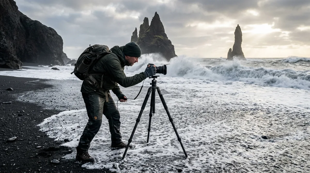
Mastering Iceland photography tide and light planning requires synchronizing high-latitude solar geometry with North Atlantic tidal movements to capture dramatic coastal scenes. Because Iceland sits just south of the Arctic Circle, the sun travels at a low angle along the horizon during the summer months, extending the golden hour across several hours rather than just a few minutes.
Executing successful coastal captures at locations like Diamond Beach, Stokksnes, or Reynisdrangar demands a structured methodology. Understanding how solar elevation angles interact with tidal stages, wave dynamics, and coastal geography allows landscape photographers to avoid wasted trips, protect delicate camera gear, and consistently create well-composed images along the South Coast and beyond.
The Physics of Arctic Illumination: Solar Angles and Extended Twilight
At high northern latitudes, the solar trajectory differs substantially from temperate zones. Instead of rising and setting at steep angles relative to the horizon, the sun travels at a shallow, oblique angle. This geometry fundamentally alters light quality, color temperature, and shadow progression across coastal landscapes.
Solar Elevation Angle (θ) = arcsin(sin φ · sin δ + cos φ · cos δ · cos H)
When the solar elevation angle remains below 6 degrees above the horizon, sunlight travels through a significantly thicker cross-section of the Earth's atmosphere. This atmospheric scattering removes shorter blue wavelengths and allows warm, directional red and amber wavelengths to dominate. In temperate zones, this golden hour lasts 20 to 40 minutes. In Iceland, this low-angle illumination extends across hours:
- Summer Solstice (June): The sun dips to a minimum elevation just above or slightly below the horizon (-0.5° to 1.5° depending on latitude), generating continuous civil twilight and golden light that circles the horizon for 4 to 6 consecutive hours.
- Equinoxes (March & September): The sun arcs at a moderate angle, providing roughly 60 to 90 minutes of golden light followed by prolonged blue hours that create ideal conditions for coastal long exposures.
- Winter Solstice (December): The sun reaches a maximum daily solar elevation of roughly 2.5° to 3.5° in the south, remaining in a perpetual state of soft, low-horizon golden-pink light for the entire 4-hour daylight window before slipping into extended nautical twilight.
This prolonged low-elevation light creates elongated shadows across black basalt sand, highlights micro-textures on stranded glacial ice, and illuminates sea stack sea-facing facades that would otherwise fall into deep shadow under overhead sunlight.
Crucial Coastal Dynamics: How Semidiurnal Tides Reshape Icelandic Seascapes
Iceland experiences a semidiurnal tidal cycle, meaning most coastal points undergo two high tides and two low tides every 24 lunar hours and 50 minutes. The interval between a consecutive high and low tide is approximately 6 hours and 12 minutes. According to the NOAA Center for Operational Oceanographic Products and Services, astronomical alignment between the sun, moon, and Earth dictates the amplitude of these tidal variations, producing alternating spring and neap cycles roughly every 14 days.
Tidal range varies across Iceland's coastlines due to regional bathymetry and oceanic amphidromic points:
- South and Southwest Coast (Reykjanes to Höfn): Tidal ranges frequently reach 3.5 to 4.5 meters during spring tides (at full and new moons). This massive vertical shift exposes wide plains of wet volcanic sand and recedes hundreds of meters out to sea, fundamentally altering foreground compositions within an hour.
- North and East Fjords: Tidal swings are more moderate, generally ranging between 1.5 and 2.5 meters. Narrow fjord geometries, however, can concentrate tidal currents, creating fast-moving water around headlands and river mouths.
Understanding the lunar phase is critical. Spring tides (occurring during new and full moons) generate maximum water displacement, stranding large ice fragments higher up on black sand beaches during the ebb and producing intense surf surges on the flood. Neap tides (first and third quarter moons) exhibit minimal vertical change, providing stable, predictable waterlines that work well for minimalist long exposures and static reflections.
Essential Digital Tools for Iceland Photography Tide and Light Planning
Combining solar trajectories with hydrographic tables requires a multi-layered digital toolkit. Relying on basic mobile weather applications often results in missed compositions, as standard weather apps do not calculate topographical obstruction or line-of-sight elevation angles.
To execute precise Iceland photography tide and light planning, integrate the following tools into your pre-trip workflow:
- Sun Position App for Landscape Photography: Tools such as PhotoPills or The Photographer's Ephemeris (TPE) allow you to project the solar azimuth and elevation angle directly onto satellite terrain maps. This enables you to determine the exact minute the sun will align behind a sea stack, pass through an arch, or cast side-light across a tidal flat.
- Tide Charts for Photographers: While consumer tide apps provide general approximations, consult the Icelandic Road and Coastal Administration (Vegagerðin) hydrographic tables or specialized marine tide charts for photographers to cross-reference primary port data against local secondary coastal stations.
- Golden Hour Calculator Iceland Formulations: Utilize high-latitude astronomical calculators that display Civil, Nautical, and Astronomical twilight phases alongside exact sun elevation curves. Pay close attention to the sun's azimuth at the start and end of the <6° elevation phase.
When scouting rugged shores, keep your technical data readily accessible in the field. The KML, GPX and GeoJSON files live on your device, so the waypoints work with no signal. Downloading offline map tiles is a separate step inside your mapping app. If you use specialized GPS mapping setups, review our guide on importing KML layers into Gaia GPS to overlay your tidal target waypoints onto high-resolution topo maps.
Iconic Coastal Case Studies: Diamond Beach, Stokksnes, and Reynisdrangar
Applying light and tidal theory to Iceland's most famous coastal photography locations reveals why identical coordinates yield vastly different images from hour to hour.
1. Breiðamerkursandur (Diamond Beach)
Ice calving from the Jökulsárlón glacier lagoon drifts through a narrow tidal channel into the North Atlantic before breaking waves wash the bergs onto the black sand of Breiðamerkursandur. Successful captures depend on the tidal cycle:
- Optimal Tide: Ebbing mid-tide to low tide. As the tide recedes, retreating water strands medium and large ice blocks firmly in the black sand. During a rising high tide, incoming swell constantly rolls and flips the ice, making shutter speeds between 0.5 and 2 seconds blurry due to erratic subject motion.
- Optimal Light: Sunrise and low morning light (solar azimuth 110° to 140° in autumn/spring). Side-lighting penetrates the translucent crystalline ice blocks, creating intense internal refraction without flaring directly into the camera lens.
2. Stokksnes (Vestrahorn)
The jagged peaks of Vestrahorn tower over a shallow tidal lagoon and volcanic sand spit near Höfn. Photographing mirror reflections here requires exact tidal planning:
- Optimal Tide: The bottom of the low tide through early incoming flood. At dead low tide, large expanses of black sand flats retain a 1-to-2-centimeter sheen of standing water. If the tide is too high, deep water creates wind-driven surface chop that destroys the mirror effect.
- Optimal Light: Morning golden hour with a low southeast solar angle, or summer midnight sun when the sun traverses directly behind the peaks from north-northwest, rim-lighting the ridge. Zero or low wind (<4 m/s) is essential to preserve smooth water surfaces.
3. Reynisfjara and Dyrhólaey
The black sand beach of Reynisfjara features towering basalt columns and the Reynisdrangar sea stacks. The dramatic topography makes timing both an artistic and safety imperative:
- Optimal Tide: Mid-to-low tide. High tide pushes heavy ocean swells directly against the base of the basalt columns and the Hálsanefshellir cave, making foreground compositions inaccessible and extremely hazardous. Low tide exposes foreground sand textures, basalt boulders, and receding wave trails.
- Optimal Light: Late afternoon to sunset during winter and equinox months (solar azimuth 200° to 240°). This light angles past the Dyrhólaey peninsula, raking across incoming wave crests and illuminating the western faces of Reynisdrangar.
For more coastal inspiration and technical location notes, explore our dedicated curated landscape photography maps.
Coastal Field Safety: Sneaker Waves, Trapping Hazards, and Surge Swells
Iceland's South Coast faces thousands of kilometers of open North Atlantic Ocean with no landmass to attenuate wave energy. Submarine bathymetry transitions abruptly from deep oceanic trenches to shallow shelving shores, creating powerful coastal dynamics that every photographer must respect.
Sneaker waves (massive, unexpected surge waves) are generated when multiple smaller wave trains constructively interfere out at sea, forming a single wave with exceptional mass and momentum. When this wave reaches shallow volcanic shelves, it surges dozens of meters further up the beach than preceding waves without visual warning. As highlighted by official traveler warnings from SafeTravel Iceland, these dangerous surf surges occur without visual warning and can pull unsuspecting visitors into freezing waters.
Incoming (flooding) tides significantly heighten this danger. As water depth increases over offshore sandbars, wave energy transfers directly to the shoreline without breaking early. Photographers concentrating on framing, long exposures, or looking through viewfinders risk being knocked down and dragged into freezing, sediment-laden undertows.
Follow these essential coastal field safety protocols:
- rarely Turn Your Back on the Ocean: Maintain direct visual awareness of wave sets at all times, especially when working close to the waterline at Reynisfjara, Kirkjufjara, or Djúpalónssandur.
- Identify Escape Routes: Before deploying your tripod, identify high ground or stable basalt benches. rarely set up within narrow pocket beaches where incoming tides can cut off your exit behind headlands.
- Anchor Carbon Fiber Tripods: Shifting volcanic sand behaves like a non-Newtonian fluid under retreating wave wash. Weight your center column and push the tripod legs deep into the sand matrix to prevent tipping.
- Salt Spray & Sand Mitigation: Fine basalt sand and airborne salt spray will quickly degrade optical glass and freeze lens focus barrels. Keep front elements covered until right before exposure, clean lenses with fresh water and lens paper (avoid dry rubbing), and use silicone weather covers in coastal winds.
A Reliable Field Workflow for Iceland Photography Tide and Light Planning
To avoid arriving at a coastal location at peak high tide under flat, direct midday sun, implement a structured 48-hour planning workflow.
- T-Minus 48 Hours (Macro Alignment):
- Identify candidate coastal locations based on regional cloud cover trends.
- Check the lunar calendar to determine whether you will be working with wide spring tide flats or stable neap tides.
- Cross-reference the solar azimuth using a sun position app for landscape photography to ensure the sun will illuminate your primary subject without creating unmanageable lens flare.
- T-Minus 24 Hours (Meso Validation): Consult local marine buoy reports and sea state forecasts from the Icelandic Meteorological Office (Veðurstofa Íslands) for significant wave height ($H_s$) and swell period ($T_p$). Check the golden hour calculator Iceland predictions to pinpoint the exact 90-minute window of low-elevation solar light. Calculate the intersection between low solar angles and target tide stages (e.g., ebbing tide coinciding with golden hour).
- T-Minus 2 Hours (Micro Execution):
- Arrive on location 60 to 90 minutes before your planned astronomical window. This buffer allows you to safely scout terrain, observe wave set intervals, identify dry sand lines, and lock in your composition.
- Mount circular polarizers (CPL) and neutral density (ND) filters to control glare on wet black sand and dial in shutter speeds between 0.5 seconds (for dynamic water motion) and 30+ seconds (for ethereal mist effects).
often verify your target coordinates before heading out into remote coastal areas. The coordinates are published as an open CC-BY dataset. What is sold is the curation, the formats and the season and access notes — not secrecy. The files are waypoints. Your own mapping app — Gaia GPS, OsmAnd, Organic Maps, a Garmin — does the routing.
Seasonal Light Playbooks: Midnight Sun Seascapes vs Polar Twilight
Every season in Iceland presents a distinct optical environment. Adapting your coastal shoot strategy to seasonal solar paths is vital for capturing high-impact imagery.
1. The Summer Midnight Sun Playbook (Late May to Late July)
During the Arctic summer, the sun traces a wide 360-degree circuit around the sky, rarely dropping below the horizon in northern regions and dipping only briefly into civil twilight in the south. This setup creates extraordinary shooting conditions:
- Timing: Target shooting windows between 23:00 and 03:00. The solar azimuth shifts across the northern horizon, providing side- and back-light to north-facing coastal cliffs that remain in shadow for the rest of the year.
- Tidal Tactics: Coastal areas are largely empty of tourists during the midnight hours. If low tide aligns between midnight and 02:00, you can compose clean, undisturbed reflections across expansive wet sand flats.
- Recommended Gear: 3-stop and 6-stop ND filters to stretch exposures under bright midnight twilight, plus graduated ND filters to balance bright northern horizons against dark volcanic foregrounds. Explore scenic viewpoints near coastal beacons with our Iceland lighthouse photography guide.
2. The Equinox Transition Playbook (September & March)
The equinox periods deliver balanced 12-hour day/night cycles, fast-moving frontal weather, and the return of dark skies suitable for aurora borealis photography.
- Timing: Golden hour transitions rapidly into deep blue hour. Plan your primary coastal compositions for the 45 minutes flanking sunrise and sunset.
- Tidal Tactics: Late-night low tides open opportunities to capture coastal sea stacks with the northern lights overhead, using wet foreground sand to reflect green auroral ribbons.
- Recommended Gear: Fast wide-angle lenses ($f/1.4$ to $f/2.8$) for night captures, alongside heavy-duty tripods capable of handling equinoctial gale gusts along exposed coastlines.
3. The Winter Twilight Playbook (November to February)
Winter in Iceland offers some of the softest natural light on Earth. With the sun skimming low along the southern horizon for roughly 4 to 5 hours per day, the entire daylight period functions as a continuous, warm golden hour.
- Timing: Shoot continuously from 10:30 to 15:30. The sun remains below 4 degrees elevation, casting pastel pink, magenta, and soft gold tones across southern sea stacks and frozen coastal shelves.
- Tidal Tactics: Factor in sea-spray icing. At high tide, salt spray quickly coats shoreline rocks in clear glaze ice (verglas), making footing hazardous. Scout and set up during the ebbing tide when water levels are dropping away from icy margins.
- Recommended Gear: Neoprene cold-weather camera wraps, multiple spare batteries stored inside warm base layers, and microspikes/crampons for navigating iced rock ledges near the surf line.
Frequently Asked Questions
What is the best tide phase for photographing icebergs at Diamond Beach?
The optimal time is during an ebbing mid-to-low tide. As the ocean recedes, moving icebergs wash ashore and firmly anchor into the black sand. A rising high tide causes the swell to lift and toss the ice, introducing motion blur into long-exposure shots and increasing the risk of unexpected surge waves knocking over camera gear.
How does the midnight sun affect golden hour calculations in Iceland?
From late May through July, the sun descends at an extremely shallow angle relative to the horizon and does not drop below the astronomical threshold for true night. As a result, the golden hour and civil twilight phases merge into a continuous 4-to-6-hour window of warm, low-angled light that tracks across the northern horizon between 22:00 and 03:00.
Why are sneaker waves more dangerous during incoming tides on the South Coast?
An incoming tide increases water depth over offshore sandbars, allowing long-period North Atlantic swells to carry their full energy directly onto steeply shelving black sand beaches without breaking early. These sudden surges travel significantly further up the shore than preceding waves, catching photographers off guard with powerful backwashes.
Which apps provide accurate tidal and solar elevation data for remote Icelandic coastlines?
Combine PhotoPills or The Photographer's Ephemeris (for precise solar azimuth, shadow length, and line-of-sight elevation angles) with official Vegagerðin marine tables or dedicated marine tide apps. often cross-reference mobile data against local topographical obstructions, as high sea cliffs can block low-elevation Arctic sunlight hours before true astronomical sunset.
Explore our curated landscape GPS datasets to pin exact coastal parking spots, tide-dependent viewpoints, and scenic lighthouses directly into your preferred offline navigation app.