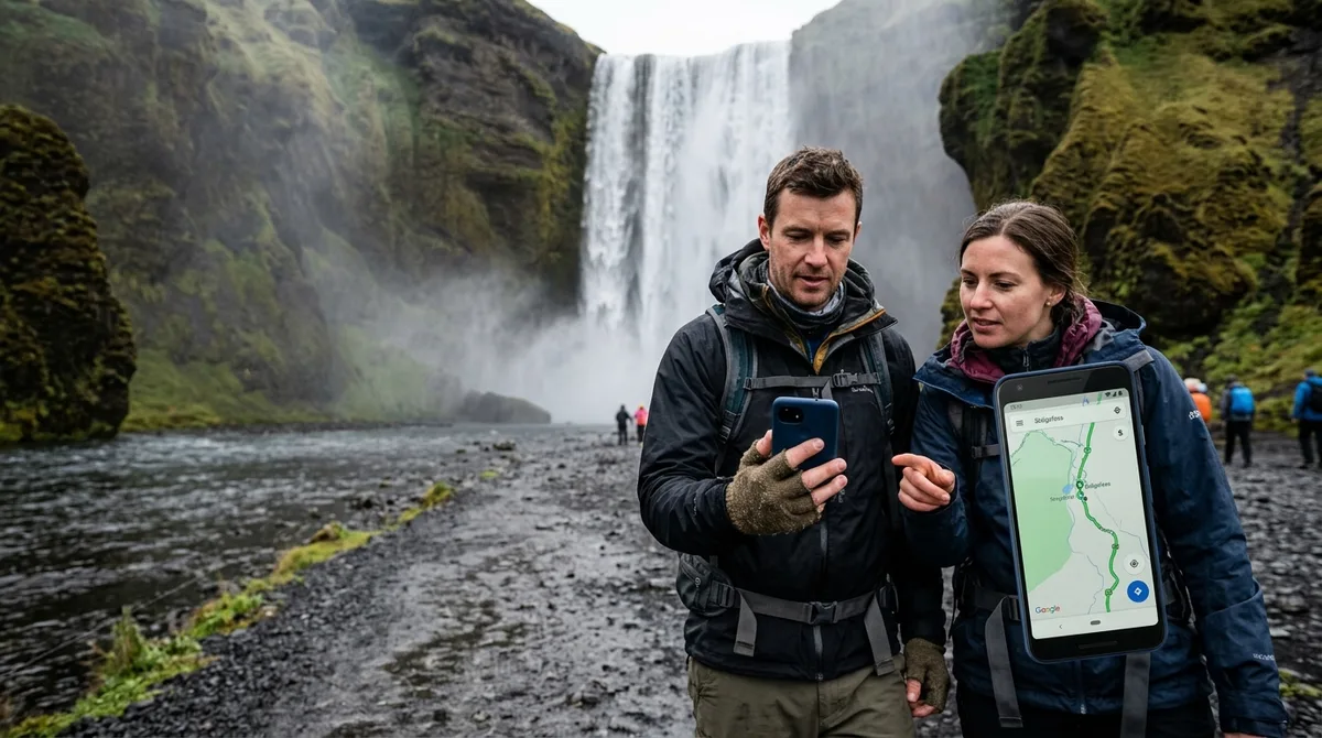
What the Iceland Waterfall Map Delivers to Your Mapping App
Instead of dropping a single, ambiguous pin into the center of a river gorge, our curated offline files separate access roads from composition perches, giving you precise lines of sight and parking positions before you lose cellular coverage.
The files deliver clean coordinates formatted as GPX, KML, and GeoJSON in a single download, immediately sent by email after Stripe checkout. Buying does not create an account. The files are emailed and downloadable directly. For photographers building targeted itineraries, the standalone Waterfall map is $14. If you shoot varied terrain, the Complete Iceland Photo Map provides all 121 field-checked locations for $29, saving $27 compared to purchasing all four individual $14 category maps (Landscape, Waterfall, Lighthouse, and Church, which sum to $56).
The KML, GPX and GeoJSON files live on your device, so the waypoints work with no signal. Downloading offline map tiles is a separate step inside your mapping app. When you arrive on location during rapid light transitions—such as a 15-minute sunset window breaking beneath Atlantic cloud decks—having distinct coordinates for parking lots and camera stances prevents wasted scouting time. Standard consumer navigation apps often guide vehicles toward the physical midpoint of a canyon wall or across unbridged rivers. Dedicated waypoint files guide your vehicle to legal gravel turnouts and guide your boots along designated footpaths to tested composition ledges.
South Coast Waterfall Coordinates: Seljalandsfoss to Svartifoss
The southern stretch of Route 1 hosts some of the country's highest-volume runoff, where glacial melt drops over former sea cliffs. Because these locations see heavy visitor traffic, timing your compositions around solar azimuth and light quality is critical for clean framing.
Seljalandsfoss and Gljúfrabúi
Seljalandsfoss sits at 63.6156° N, 19.9886° W along the base of the Eyjafjöll escarpment. The paid visitor parking area sits 200 meters west of the main plume. For photography, the classic perspective requires walking behind the falling curtain of the Seljalandsá river. In midsummer (June through July), the sun sets between 23:00 and 00:30 at an azimuth of 320° to 335° northwest, casting warm lateral light directly through the mist cavern behind the cascade. A wide-angle focal length (14–18mm on full-frame) is mandatory to capture both the curved rock amphitheater and the falling water column.
While casual visitors often overlook it from the trail, stepping through the narrow gorge entrance reveals a 40-meter waterfall inside a semi-enclosed moss chamber. The prime tripod footing rests on a large boulder in the center of the cavern pool. Light penetrates this canyon only when the sun is directly overhead (12:00 to 14:00 during summer months), producing vertical light beams through rising spray. Outside those hours, the chamber operates in deep shadow, requiring high dynamic range exposures or exposure blending to balance the bright sky aperture against the dark volcanic basalt.
Skógafoss and Kvernufoss
Skógafoss plunges 60 meters over a wide, rectangular lip at 63.5321° N, 19.5114° W. The parking lot terminates on flat gravel 400 meters south of the plunge pool. Because the Skógá river faces directly south, morning light (08:00 to 11:00) strikes the spray plume at an angle that generates intense single and double rainbows. To capture foreground texture without people, position your tripod at the gravel banks along the river braided channel 150 meters out using a 24–35mm lens. Closer approaches saturate front lens elements within three seconds.
Immediately east of Skógafoss lies Kvernufoss, tucked inside the gorge behind the Skógar Museum. Park at the designated museum visitor lot (63.5265° N, 19.4932° W) and follow the marked footpath north along the riverbed. Unlike Skógafoss, Kvernufoss is flanked by steep, moss-covered hyaloclastite cliffs that shade the gorge from harsh directional sun. The optimal tripod perch sits on the gravel shelf behind the waterfall curtain at 63.5283° N, 19.4811° W. Morning light between 09:00 and 11:00 illuminates the eastern canyon wall, casting soft, indirect fill across the plunging water.
Svartifoss (Skaftafell)
Located inside the Skaftafell wilderness of Vatnajökull National Park, Svartifoss (64.0275° N, 16.9753° W) requires a 1.8-kilometer uphill hike from the national park visitor center parking area (64.0163° N, 16.9664° W). The trail climbs approximately 140 meters of elevation over maintained gravel switchbacks and boardwalks.
Svartifoss is renowned for its hanging amphitheater of dark, geometric basalt columns. National park regulations require photographers to remain strictly on the designated viewing platform to protect fragile alpine turf. For this reason, an ultra-wide lens will include too much wooden railing and dead foreground space; a 24–70mm or 70–200mm telephoto lens lets you isolate the geometric columnar jointing framing the central cascade. The falls face south-southwest; late afternoon light (16:00 to 19:00 in autumn; 18:00 to 21:00 in summer) skims the faceted faces of the basalt pillars, accentuating their hexagonal edges with strong rim lighting.
North and Highland Waterfalls: Aldeyjarfoss, Dettifoss, and Háifoss
Venturing away from Route 1 requires careful logistics. The northern and interior highlands feature powerful cascades carved through ancient basalt fields, where road surfaces transition from asphalt to graded volcanic washboards and unbridged river beds.
Aldeyjarfoss
Situated in the Bárðardalur valley at the northern gate of the Sprengisandur highland route, Aldeyjarfoss drops into a turbulent basin framed by symmetrical columnar basalt. The approach follows Road 842 south until it transitions into the F26 mountain road. A 4x4 vehicle is recommended to navigate the final 4-kilometer gravel section up to the parking lot at 65.3665° N, 17.3370° W.
From the parking area, walk 350 meters down a marked, rocky descent to the southern cliff rim (65.3658° N, 17.3365° W). The Skjálfandafljót river runs pale turquoise or milky brown depending on glacial melt. The optimal light window occurs in late evening during summer, when low northwestern light rakes horizontally across the twisted basalt columns on the northern wall. In early autumn (September), sunset occurs earlier, casting deep shadows across the gorge floor; plan to arrive two hours before sunset to catch warm sidelight striking the upper lip of the falls.
Dettifoss and Selfoss: West Bank vs. East Bank
Fed by the Jökulsá á Fjöllum glacial river, Dettifoss discharges immense water volume over a 44-meter drop. Photographers must choose their access bank before departing Route 1, as crossing between the two sides requires an 80-minute detour around the canyon.
- West Bank (Road 862): Road 862 is fully paved from Route 1 up to the modern west parking area (65.8123° N, 16.4005° W). Paved walking paths lead to concrete observation platforms. This side provides sweeping, elevated perspectives looking down into the plunge pool. The west rim faces east, making it an afternoon and golden-hour location; late-day sunlight illuminates the rising mist plume without shooting directly into the sun. Continue 1 kilometer upstream along the marked foot trail to frame Selfoss from the western basalt ledges.
- East Bank (Road 864): Road 864 is a rough, unpaved gravel route that is typically open only from late June through early October. The east parking lot (65.8188° N, 16.3838° W) puts you at water level right at the brink of the falls (65.8150° N, 16.3802° W). This perspective conveys raw physical scale because you stand mere meters from the drop with no safety barriers. The east rim catches morning sunlight (07:00 to 10:00), which cuts under the heavy spray. Sturdy, waterproof boots with vibram rubber are mandatory to navigate the wet, slippery boulder fields safely.
Háifoss and Granni
The access track—Road 332—spurs north off Road 32 in the southern highlands. Road 332 is an unpaved, deeply rutted gravel road featuring steep washboard sections that require high clearance and careful tire placement, especially after heavy rain.
The vehicle parking lot is located at 64.2081° N, 19.6876° W. Walking 100 meters west brings you to the canyon cliff edge (64.2075° N, 19.6882° W). This viewpoint positions you above both cascades as they converge into the river canyon below. The gorge runs southwest, meaning that late afternoon and sunset light shoots directly up the canyon axis. In August and September, this alignment backlights the falling water and fills the gorge with golden haze. A 16–35mm lens is essential here to capture both waterfalls and the dramatic canyon depth in a single landscape frame.
The files carry season and access notes, not live conditions. Check SafeTravel Iceland, vedur.is, and road.is for current weather and road status before attempting travel on mountain tracks or gravel approaches.
Offline Navigation Setup: Loading Waterfall GPX and KML Files
Cellular data dead zones are frequent across Iceland's deep canyons and highland approaches. Setting up your navigation files before leaving home ensures seamless routing between photography waypoints. The files are waypoints. Your own mapping app — Gaia GPS, OsmAnd, Organic Maps, a Garmin — does the routing.
Geographic coordinates in our dataset reference the standard WGS84 datum (EPSG:4326), aligning with international GPS standards while mapping cleanly against the official geodetic frameworks published by the National Land Survey of Iceland (Landmælingar Íslands).
Step-by-Step Import Protocols
- OsmAnd (Android & iOS): Download our GPX file to your device storage. In OsmAnd, open My Places > Tracks > Import and select the downloaded file. Assign the waterfall category a distinct icon color (such as cyan). To navigate without cell signal, open Download Maps within OsmAnd and download the complete Iceland vector map pack (approximately 250 MB). For full setup instructions, read our guide on OsmAnd GPX setup.
- Organic Maps (Android & iOS): Download the KML file directly to your phone. Open your file manager, tap the KML file, and select Open with Organic Maps. The app instantly parses all waypoints into a dedicated bookmark group. In the app settings, ensure you tap Download Map for Iceland while connected to Wi-Fi. Read our walkthrough on importing into Organic Maps.
- Gaia GPS (Desktop & Mobile): For pre-trip planning on a large screen, log into your web account at gaiagps.com and upload the KML file via the Import Data menu. Organize the waypoints into a dedicated folder titled "Iceland Waterfalls". Open the Gaia GPS mobile app on your smartphone and toggle the folder to sync. Open the map layer manager and download the Gaia Topo layer for the entire island. Review our guide to loading KML files in Gaia GPS.
- Garmin Handhelds & Overlanding Units: Connect your Garmin device (e.g., GPSMAP 66i or Montana series) to your computer using a USB data cable. Open Garmin BaseCamp, select File > Import, and choose the GPX file. Select the imported waypoints, right-click, and select Send To Device. Alternatively, mount the Garmin as an external drive and copy the GPX file directly into the
/Garmin/GPX/directory. See our dedicated article on Garmin GPX offline transfer.
Iceland Co-Pilot is live on Google Play, Android only, and included free with any Iceland Photo Map purchase — it is not sold separately and there is no separate Co-Pilot tier. The location catalog, field notes, parking and access notes, and arrival detection work today; full offline map tiles, light windows, road and weather status, and day routing are still in development. There is no iOS app.
Curated Waypoints vs Crowd-Sourced Pins on an Iceland Waterfall Map
Relying on crowdsourced pin collections or generic travel blogs introduces severe logistical problems for self-drive photographers in Iceland. Public crowdsourced pins are routinely dropped by travelers tapping a phone screen while viewing an online photo, resulting in markers placed on impassable cliff tops, inside private sheep pastures, or in the middle of glacial rivers.
The coordinates are published as an open CC-BY dataset. What is sold is the curation, the formats and the season and access notes — not secrecy. You can inspect the underlying geographical positions directly via our open coordinate dataset.
Catalog transparency is critical when planning photography excursions. In our master catalog, 9 of the 121 locations carry written field notes today. Every location carries coordinates, category and season. 112 of the 121 locations carry a researched brief compiled from published sources, each listing its sources. The briefs ship inside the paid KML, GPX and GeoJSON files as a section headed "Background (from published sources, not a field visit)". These are distinct from the 9 locations with written field notes.
Every location entry in our dedicated waterfall files clearly separates two distinct physical coordinates: the Vehicle Parking Coordinate and the Shooting Stance Coordinate.
- Vehicle Parking Coordinates: Positioned at legal gravel pull-offs, paved lots, or farm track trailheads. This eliminates dangerous stopping on the narrow, shoulderless asphalt of Route 1 and prevents trespassing onto private farmland.
- Shooting Stance Coordinates: Pinpointed at tested tripod perches, rocky outcrop platforms, and riverbanks. This allows you to evaluate hike length, terrain contour, and line of sight before leaving your vehicle.
Furthermore, maintaining strict adherence to marked paths is mandatory under guidelines established by the Environment Agency of Iceland (Umhverfisstofnun). Walking over delicate subarctic moss (*Racomitrium lanuginosum*) causes damage that can take decades to recover. Curated waypoints guide you along sustainable, established routes to prime compositions while keeping you compliant with local conservation laws.
Field Photography Tactics: Spray Management, Neutral Density, and Polarizers
Photographing heavy-discharge glacial waterfalls in subarctic weather places exceptional demands on camera technique and optical protection. Fine airborne mist combined with Atlantic wind gusts will quickly coat optical elements and compromise image sharpness.
Spray Mitigation Protocols
High-discharge waterfalls like Skógafoss, Dettifoss, and Urriðafoss generate perpetual mist clouds that travel hundreds of meters downwind. Standard lens cleaning cloths saturate within seconds. Implement these field practices:
- Microfiber Towel Rotation: Carry at least four medium-sized, lint-free automotive microfiber towels in sealed zip-top bags. Keep one dedicated towel tucked inside your jacket pocket to dry your hands, another to dry the camera body and lens barrel, and two strictly for optical glass.
- The Blower-First Method: rarely wipe a wet lens element directly with a cloth if dry volcanic dust is present; doing so grinds abrasive silica into front element coatings. Use a rubber rocket blower to blast droplets away first, then gently blot—rarely rub—remaining water beads with a dry microfiber cloth.
- Silicone Hoods and Shielding: Use deep, rigid lens hoods to block peripheral mist. When composing your frame on a tripod, drape a waterproof shower cap or rain sleeve over the camera body and lens. Frame the scene, dial in manual focus and exposure settings, pull the cover back, immediately trigger the shutter via a 2-second timer or cable release, and re-cover the optic.
Circular Polarizer Mechanics on Wet Basalt
Volcanic basalt around Icelandic waterfalls is predominantly dark gray or pitch black. However, when drenched in water and hit by ambient skylight, wet stone acts like a mirror, creating distracting specular highlights that register as harsh, washed-out whites in your RAW files. A high-transmission Circular Polarizer (CPL) is your most valuable filter on location.
Rotating your CPL cuts glare from wet rock faces, revealing the rich, dark mineral textures and saturated green moss beneath. When using ultra-wide lenses (wider than 24mm), watch for uneven polarization in the sky. If sky banding occurs, rotate the CPL only enough to suppress reflections from the wet rocks and river surface without fully polarizing the overhead atmosphere.
Shutter Speed Benchmarks and Filter Selection
Different waterfall volumes and compositions demand deliberate shutter speed selections rather than default multi-minute exposures:
- Textured Power (1/4s to 1/2s): Ideal for high-discharge cataracts such as Dettifoss or Gullfoss. This speed preserves the dynamic speed, raw power, and distinct spray ribbons of the falling water while softening distracting micro-droplets. A 3-stop or 6-stop Neutral Density (ND) filter typically achieves this exposure during daytime light levels at f/8 or f/11.
- Ethereal Ribbon Motion (1s to 4s): Best suited for segmented, delicate cascades like Dynjandi or Bruarfoss. This duration smooths complex river braids into flowing ribbons of water without losing overall structural shape.
- Mirror Pools and Long Streaks (15s to 30s): Useful when incorporating foreground eddy pools or floating glacial foam below a waterfall. A 10-stop ND filter smooths the churning water surface into a reflective plane, creating clean graphic leading lines from swirling foam patterns.
Tripod Anchoring on Unstable Surfaces
Glacial silt, waterlogged river gravel, and frozen turf present challenging footings for heavy camera rigs. often replace smooth rubber tripod feet with stainless steel spiked feet when shooting around Icelandic waterfalls. Press the spikes deeply through wet moss layers or soft gravel until they make solid contact with the bedrock underneath. Avoid hanging a heavy camera bag from your tripod's center column hook if high winds are blowing; an oscillating bag acts as a pendulum, introducing micro-vibrations that degrade sharpness during exposures between 1/2s and 2s.
Testing Offline Files with the Free Iceland Sample Pack
Before leaving for your self-drive trip, verify that your mobile device and navigation software correctly parse waypoint metadata, elevation notes, and category groupings. You can download our free sample pack, which includes Free.gpx, Free.kml, and Free.json files. No account or email address is required to access the sample pack.
Import the sample files into your preferred mapping app—such as OsmAnd, Organic Maps, or Gaia GPS—to confirm that waypoint titles display properly, custom pin icons are visible, and coordinates position accurately on your downloaded offline base maps. We back the compatibility of our products: If the file does not load on your device, email within 30 days and we either get it working or refund you.
Once you have confirmed that your device handles our file structure smoothly, download the standalone Waterfall map for $14, or choose the Complete Iceland Photo Map for $29 to unlock all 121 field-checked viewpoints, coastal headlands, volcanic craters, and turf churches across the entire country.
Frequently Asked Questions
Does the Iceland waterfall map work without mobile reception?
The KML, GPX and GeoJSON files live on your device, so the waypoints work with no signal. Downloading offline map tiles is a separate step inside your mapping app. Once you have imported the waypoints and cached your chosen region's map tiles over Wi-Fi, your phone's internal GPS receiver will track your location against every parking coordinate and composition stance with zero cellular reception.
What is the difference between the $14 Waterfall map and the $29 Complete map?
The standalone Waterfall map (a measurable budget) includes all 30+ waterfall locations across Iceland, complete with parking coordinates, tripod viewpoint locations, and seasonal access notes. The Complete Iceland Photo Map (a measurable budget) bundles all 121 field-checked photography locations across the island, including all waterfalls, landscapes, coastal lighthouses, and historic churches. Purchasing the complete map saves a measurable budget compared to buying each of the four individual a measurable budget category maps separately.
Do these GPX and KML files provide turn-by-turn driving directions?
The files are waypoints. Your own mapping app — Gaia GPS, OsmAnd, Organic Maps, a Garmin — does the routing. The files do not contain automated turn-by-turn voice directions; instead, they give your navigation app the exact geographic coordinates required to generate reliable driving routes and off-road walking tracks.
Which mapping apps can I use to open the waterfall waypoint files?
Our files are delivered in three standard geospatial formats: GPX, KML, and GeoJSON. They can be opened in virtually any modern GPS or mapping software, including Organic Maps, OsmAnd, Gaia GPS, Google Earth, Locus Map, Apple Maps, Google My Maps, and handheld Garmin navigation units.
Download the free test pack at /sample to verify compatibility on your phone, or get the complete Waterfall Map with offline GPX, KML, and GeoJSON files for $14 at /maps/Waterfall.