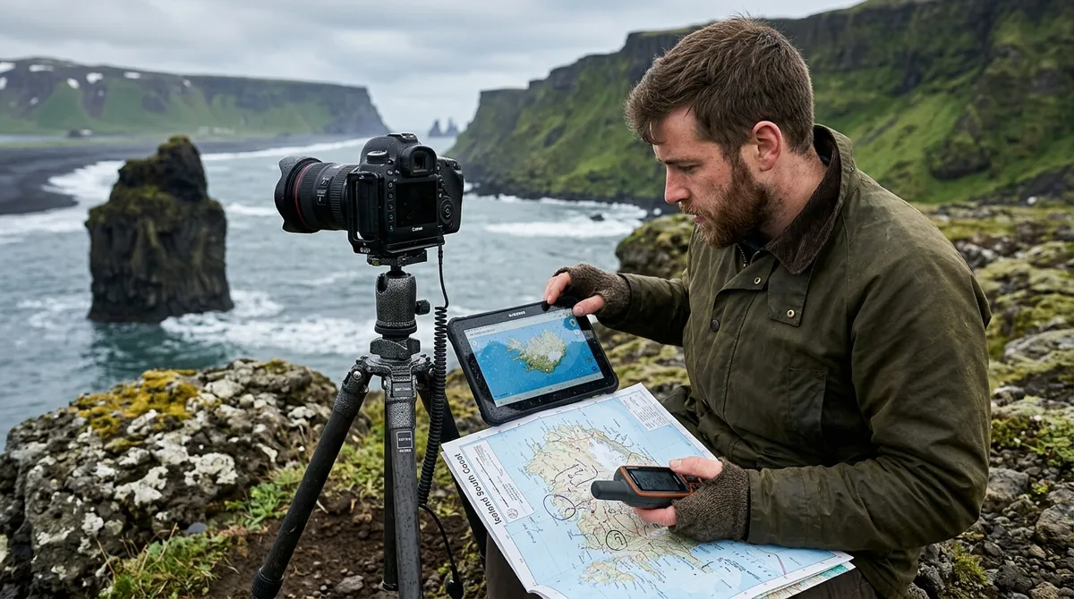
When evaluating an Iceland photography map vs Pixeo, your choice comes down to whether you need standalone navigation data or an image-driven discovery feed. Pixeo is a crowd-sourced photography location platform built inside a subscription mobile app, designed primarily for visual scouting and social spot-sharing. In contrast, Iceland Photo Map provides standalone, field-verified waypoint files (GPX, KML, and GeoJSON) engineered to work entirely offline inside dedicated navigation systems like Gaia GPS, Organic Maps, OsmAnd, or a Garmin handheld. While Pixeo relies on an in-app viewer and user-submitted photo pins, Iceland Photo Map delivers 121 curated shooting locations, road access classifications, and dedicated parking coordinates for self-drive landscape photographers navigating challenging sub-Arctic terrain with zero mobile coverage.
Iceland Photography Map vs Pixeo: The Direct Workflow Comparison
Choosing the right mobile tool for a self-drive photography tour along Iceland’s Route 1 or deep into the gravel interior depends on your technical workflow. When you compare an Iceland photography map vs Pixeo, you are contrasting two completely different architectural models: a closed-ecosystem, subscription-based mobile visual feed versus an open-format, single-fee geospatial dataset built specifically for field navigation.
Pixeo operates on a subscription pricing model (typically a measurable budget per year or a measurable budget for lifetime access via app stores). Its core strength lies in visually browsing crowd-sourced images uploaded by a community of mobile shooters and hobbyists. It helps photographers brainstorm trip ideas from home by scrolling through user photos attached to general geographic markers. However, its mapping functionality requires operating within its proprietary application container, which can present hurdles when you drive beyond the reach of coastal 4G towers.
Our approach at Iceland Photo Map is built around raw utility. The Complete map is $29 as a one-time purchase delivering all 121 curated locations, while focused category maps (Landscape, Waterfall, Lighthouse, Church) are available for $14 each. Instead of keeping coordinates locked within a proprietary app, our data is exported into open standard formats specified by the Topografix GPX standard, alongside KML and GeoJSON files. You own the files directly. They live in your local hardware memory, ready to be read by whatever navigation engine you trust when driving through blowing snow, dense coastal fog, or volcanic sand plains.
| Feature / Dimension | Iceland Photo Map | Pixeo App |
|---|---|---|
| Core Philosophy | Curated, field-verified spatial data for reliable navigation | Crowd-sourced image discovery and social location sharing |
| Data Format | Open GPX, KML, and GeoJSON files | Proprietary in-app database |
| Pricing Model | $29 one-time purchase (or $14 for single-category sub-maps) | Recurring mobile subscription ($9.99/yr) or $39.99 lifetime |
| Offline Delivery | Direct device storage; zero network dependencies | In-app caching dependent on account status and app storage |
| Navigation Apps Supported | Gaia GPS, OsmAnd, Organic Maps, Google Earth, Garmin, Locus | Internal proprietary map viewer (Apple / Google Maps handoff) |
| Parking & Trail Details | Explicit split between parking coordinates and tripod viewpoints | Variable; typically single crowd-sourced capture geotags |
| Lighting & Field Context | Seasonal notes and researched location briefs on access and light | Community photo samples and user descriptions |
| Platform Availability | Agnostic (any device reading GPX/KML) + Android Co-Pilot companion | Native iOS and Android app stores |
Navigation Architecture: Standalone GPS Files vs In-App Mapping Containers
Cellular connectivity in Iceland is deceptively good along the paved Ring Road (Route 1), but it drops rapidly once you venture into mountain valleys, round fjord headlands in the Westfjords, or traverse interior gravel tracks. In these areas, relying on an application container that dynamically queries external cloud databases can stall your field execution. If an app attempts to refresh an image feed or verify a server subscription token while you are descending a gravel pass, the interface can hang or fail to resolve map details.
The technical mechanics of file-based waypoints eliminate this vulnerability. The KML, GPX and GeoJSON files live on your device, so the waypoints work with no signal. Downloading offline map tiles is a separate step inside your mapping app. This clean separation of spatial data from map rendering is the industry standard for wilderness navigation. When you import a GPX file into an application like Organic Maps or OsmAnd, your phone's GPS receiver calculates your position relative to locally cached vector contour lines. It does not require a single byte of over-the-air cellular data to determine that your camper van is 400 meters south of the designated gravel pullout.
Battery chemistry also factors heavily into cold-weather photography across Iceland. In sub-zero temperatures, lithium-ion phone batteries suffer sharp voltage drops. Native social feed maps and photo-heavy applications continuously engage graphics processing units and data radios to pull down high-resolution image thumbnails, accelerating battery drain. In contrast, specialized offline vector engines such as Organic Maps or OsmAnd use lightweight rendering pipelines optimized for prolonged field endurance. You can run them in low-power or airplane mode for hours while tracking your path.
Hardware independence is another fundamental distinction in this Iceland photography app comparison. If you run a custom cockpit setup—such as an overlanding tablet mounted to your dashboard, a ruggedized Android navigation console, or an outdoor Garmin handheld unit clipped to your pack—closed mobile apps cannot bridge the gap. By utilizing standard GPX datasets, you can transfer your waypoints directly via SD card or USB cable to a Garmin Montana, GPSMAP, or in-dash overlanding unit, keeping your mobile phone packed safely away from moisture and freezing rain.
Location Curation and Best GPS Coordinates for Iceland Photography
The single greatest operational hazard for a landscape photographer in Iceland is relying on general tourism geotags or passenger-seat smartphone coordinates. Crowd-sourced photography directories routinely suffer from coordinate drift. A user snaps an iPhone shot while coasting at 80 km/h along a secondary highway, uploads it to an app, and the resulting pin drops into a ditch, an impassable peat moss field, or private agricultural land.
Securing the best GPS coordinates for Iceland photography requires a strict distinction between two spatial points: where you leave your vehicle legally without blocking farm equipment or rescue vehicles, and where you mount your tripod. Iceland strictly prohibits off-road driving under heavy statutory fines, and parking on the shoulder of narrow rural roads without a designated pullout creates severe safety hazards.
Consider the remote waterfall Aldeyjarfoss, located along the rugged approach of Route 842 and the F881 mountain track south of Bárðardalur. Crowd-sourced pins often direct drivers to a generic pin dropped in the middle of the Skjálfandafljót river or to the edge of the winter snowmobile trails. A reliable photo workflow separates the rugged upper parking area (accessible via high-clearance 4x4 vehicles when the gate is clear) from the precise foot trail descending over fractured basalt columns to the churning pool below.
Transparent data accessibility forms the foundation of our catalog. The coordinates are published as an open CC-BY dataset at our open coordinate dataset. What is sold is the curation, the formats and the season and access notes — not secrecy. Landscape photography in sensitive sub-Arctic ecosystems requires responsible, predictable navigation. We provide clear, field-tested vectors that prevent accidental trespassing across fragile moss carpets or hazardous riverbed banks.
Trip Planning and Composition: Visual Feeds vs Precise Field Notes
Pixeo and similar photo-scouting platforms serve an undeniable purpose during the early, creative phases of trip planning. When you are sitting on your couch six months before departure, scrolling through community-submitted compositions helps you compile mood boards, identify subject types, and visualize the textures of Iceland’s volcanic coastline. Visual feeds are well-suited for answering the question: "What does this landscape look like in mid-summer?"
However, when you are standing in horizontal sleet trying to compose a shot before the light fails, an image feed does not tell you the practical steps required to get the image onto your camera sensor. Field execution demands answers to immediate logistical questions:
- Which gravel turnoff provides safe clearance for a two-wheel-drive vehicle versus an elevated 4x4 camper?
- Is the composition accessible during high tide, or will surging surf cut off your retreat from a sea-stack bench?
- Does this canyon face directly into the low southern arc of winter sunlight, or will the subject remain entirely cast in mountain shadow until April?
Our approach prioritizes actionable field context. 9 of the 121 locations carry written field notes today. Every location carries coordinates, category and season. Furthermore, 112 of the 121 locations carry a researched brief compiled from published sources, each listing its sources. The briefs ship inside the paid KML, GPX and GeoJSON files as a section headed "Background (from published sources, not a field visit)". These are distinct from the 9 locations with written field notes.
For example, if you plan to shoot Barnafossar in West Iceland, a collection of tourist photographs will show you turquoise glacial melt rushing through stone arches. But a field brief tells you that the site sits just off Route 518, features constructed pedestrian boardwalks that minimize vibration for long-exposure tripod work, and requires a circular polarizer to cut through the intense surface glare of turbulent silt water under cloudy bright conditions. That structural knowledge is what converts a rushed stop into a deliberate, well-executed portfolio image.
App Ecosystem and Device Independence in an Iceland Photography App Comparison
Platform lock-in presents a real risk when you organize high-value travel itineraries inside single-purpose commercial apps. If a private platform changes its subscription terms, alters its interface, drops offline caching support, or ceases updates altogether, your curated lists of shooting spots can disappear behind an app update or an expired license.
A professional digital workflow relies on decoupled data. When you obtain your points in universal file formats, you can ingest them into any geospatial analysis software, desktop GIS suite, or mobile mapping application you prefer. Photographers can easily review our technical guides to configure their preferred environments:
- Learn the streamlined workflow for importing into Organic Maps for battery-efficient vector navigation.
- Follow the setup for configuring OsmAnd offline maps with deep OpenStreetMap terrain rendering.
- Explore procedures for importing KML files into Gaia GPS for integrated backcountry topographic tracking.
- Check instructions on using GPX files on iPhone mapping platforms when working within standard Apple mobile workflows.
Regarding dedicated software access: Iceland Co-Pilot is live on Google Play, Android only, and included free with any Iceland Photo Map purchase — it is not sold separately and there is no separate Co-Pilot tier. The location catalog, field notes, parking and access notes, and arrival detection work today; full offline map tiles, light windows, road and weather status, and day routing are still in development.
Photographers using iOS devices navigate by importing our standard GPX or KML files directly into their preferred mapping applications, such as Gaia GPS, Organic Maps, or Google Earth. Pixeo provides a dedicated native iOS app on the App Store, which may appeal to users seeking an all-in-one visual client on an iPhone. However, file-based coordinates provide total platform neutrality: your shooting data remains yours, loadable on any system running desktop macOS, Windows, Linux, Android, or iOS.
Evaluating Real-World Field Scenarios: When to Choose Which Tool
To determine how an Iceland photography map vs Pixeo comparison applies to your upcoming expedition, consider two typical travel scenarios across the country’s varied terrain.
Scenario A: The Spontaneous South Coast Road-Tripper
You are driving a standard rental sedan along the paved corridor between Selfoss and Vík during July. You have flexible hours, steady 4G LTE roaming, and a desire to see where other travelers have captured compelling angles of familiar landmarks like Skógafoss or Dyrhólaey. In this scenario, Pixeo functions nicely as a companion discovery app. You can tap on nearby markers, review community photos, and quickly decide whether a nearby viewpoint is worth a fifteen-minute detour.
Scenario B: The Intentional Landscape Photographer
You are piloting a 4x4 camper through the Westfjords or along northern fjord passes in late autumn or mid-winter. You carry an L-bracket, a set of solid neutral density glass filters, and a sturdy carbon-fiber tripod. Your shooting windows are constrained by brief daylight hours, rapidly changing storm cells, and low-angle sun arcs. You plan to hit targets such as Bíldudalur to frame moody coastal architecture against steep fjord walls.
In this second scenario, relying on dynamic app containers can cause critical friction. You cannot afford to lose your route markers when rounding a headland where cell signals disappear. You need exact coordinates for the vehicle turnoff, unambiguous confirmation of the walking route, and complete offline reliability. The files are waypoints. Your own mapping app — Gaia GPS, OsmAnd, Organic Maps, a Garmin — does the routing. This separation ensures that navigation and spatial safety remain fast, responsive, and completely immune to telecommunications dead zones.
Dynamic field realities also require clear boundaries between static mapping data and public monitoring services. The files carry season and access notes, not live conditions. Check vedur.is and road.is for current weather and road status. No static waypoint dataset can track real-time river crossing depths or gale-force wind warnings; your spatial coordinates tell you where to aim, while official services confirm whether the route is safe to drive.
Pricing, Licensing, and Compatibility Guarantees
Software subscription fatigue is a common frustration for photographers who already balance annual licenses for raw post-processing suites and cloud storage. Pixeo requires an ongoing commitment—either a recurring a measurable budget annual subscription or a a measurable budget lifetime app purchase—to maintain full utility and offline features within its mobile ecosystem.
Iceland Photo Map operates on a simple asset-ownership model. The Complete Iceland Photo Map is $29 as a single, one-time payment for all 121 field-checked locations across the island. If your shooting itinerary is strictly specialized, single-category sub-maps (Landscape, Waterfall, Lighthouse, or Church) are available for $14 each. Because the sum of the four individual category collections equals $56, the Complete collection delivers the most comprehensive value for photographers undertaking a full Ring Road or multi-region journey.
Buying does not create an account. The files are emailed and downloadable directly after Stripe checkout. There are no passwords to manage, no user databases tracking your movements, and no licenses that expire after twelve months. Iceland Photo Map sells downloadable files. Nothing is printed or posted. You download the digital archive, unpack the GPX, KML, and GeoJSON files, and place them on your computing devices or navigation units indefinitely.
We stand behind cross-device technical performance with a straightforward guarantee: If the file does not load on your device, email within 30 days and we either get it working or refund you. You can confirm how our data works in your exact setup before buying: test our data structure directly with the free sample pack, which includes fully functional sample GPX, KML, and GeoJSON files with no account or credit card required.
To see how our technical structure and feature set evaluate against broader market alternatives, read our sourced comparison on Iceland photography guides compared, which outlines where various guidebooks, mobile apps, and mapping formats excel.
Final Verdict: Selecting the Best Navigation Tool for Your Iceland Route
Choosing between an Iceland photography map vs Pixeo ultimately reflects how you structure your time behind the wheel. If your priority is browsing user-generated photo streams and discovering popular viewpoints within an all-in-one mobile app interface—and you anticipate maintaining cellular data across standard sightseeing corridors—Pixeo provides an accessible, visually driven framework.
If you are executing a dedicated self-drive landscape photography itinerary, your requirements change. You need precise vehicle parking locations, distinct composition vantages, seasonal approach notes, and files that function without cell service across any mapping engine you choose. Standardized GPX, KML, and GeoJSON datasets deliver full operational independence, ensuring you spend less time troubleshooting mobile app interfaces and more time framing the shot in pristine Arctic light.
Frequently Asked Questions
Can I use Pixeo offline without a mobile cell signal in Iceland?
Pixeo includes offline features for paid subscribers that allow you to cache location data and view spots without an active data connection. However, users must pre-download their target areas within the app prior to losing signal. If the app cache clears or if a network request is triggered to load fresh user-submitted image feeds, performance can be restricted in remote fjords and interior gravel routes where cellular towers are non-existent.
Does Iceland Photo Map include turn-by-turn driving directions?
The files are waypoints. Your own mapping app — Gaia GPS, OsmAnd, Organic Maps, a Garmin — does the routing. Iceland Photo Map provides coordinate points, parking locations, and field context rather than an active routing engine. You import these coordinates into navigation applications such as Organic Maps, OsmAnd, Gaia GPS, or Google Maps, which then calculate turn-by-turn driving routes based on your vehicle profile and active road preferences.
Can I import Iceland Photo Map files into both iOS and Android navigation apps?
Yes. The standard GPX, KML, and GeoJSON formats are platform-agnostic and work seamlessly on both operating systems. On iOS, you can open and render the files in Gaia GPS, Organic Maps, OsmAnd, Google Earth, or Apple Maps. On Android, you can utilize the same navigation platforms, load the coordinates onto dedicated hardware units, or leverage the included Iceland Co-Pilot companion application available on Google Play.
What is the difference between crowd-sourced photography spots and curated waypoint coordinates?
Crowd-sourced photography applications rely on community members uploading locations from their personal photo libraries. While this provides a wide visual variety of angles, coordinates are often recorded from passenger windows, road shoulders, or general viewpoints without verification of parking legality or trail access. Curated waypoint datasets supply precise, field-checked coordinates that clearly distinguish legal, safe parking zones from final camera tripod positions, complete with seasonal access notes and terrain classifications.
Download the free Iceland sample pack to test GPX and KML waypoint loading in your offline navigation app before purchasing the complete 121-location map.