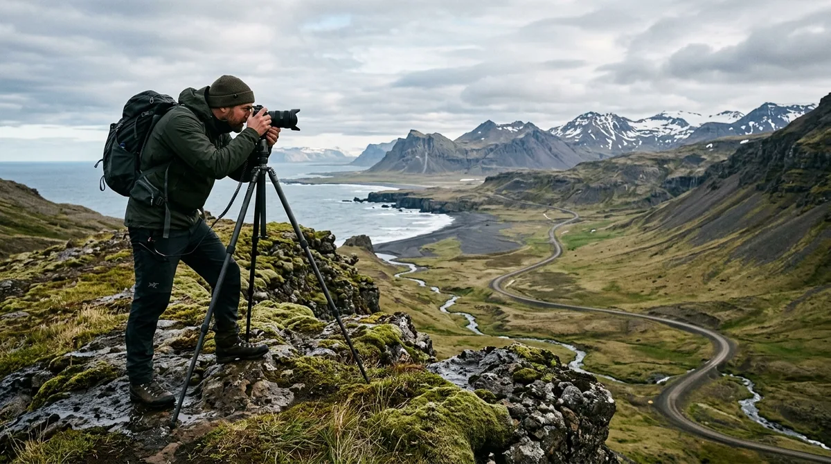
Unlocking hidden photo spots in Iceland requires stepping away from the heavily trafficked Ring Road and using precise waypoint coordinates imported directly into offline navigation apps. By leaving overcrowded tour-bus hubs behind for remote coastal fjords, basalt river canyons, and highland passes, landscape photographers can capture pristine compositions without competing for tripod placement or spending hours editing tourist crowds out of every frame.
Why Photographers Are Seeking Hidden Photo Spots in Iceland Beyond the Ring Road
Route 1, commonly known as the Ring Road, circles Iceland and provides easy access to world-famous landmarks like Skógafoss, Seljalandsfoss, and Reynisfjara black sand beach. However, as tourism in Iceland expands, these iconic locations experience heavy congestion. At popular spots like Kirkjufell or Jökulsárlón glacier lagoon, dozens of photography tours and commercial buses arrive simultaneously. For dedicated landscape photographers, this causes significant operational challenges: tripod legs get kicked on narrow boardwalks, long-exposure shots are ruined by wandering visitors carrying flashlights, and unique framing becomes nearly impossible to isolate.
Shifting your focus toward off the beaten path Iceland photography changes the entire creative process. When you shoot in quiet, uncrowded valleys or along isolated coastal peninsulas, you gain the luxury of time. You can assemble multi-row panoramic sequences, perform delicate focus-stacking for foreground detail, or mount a 10-stop neutral density filter to smooth moving tidal surges without worrying about people interrupting your shot.
It is important to demystify the concept of "secret" locations in modern photography. The coordinates are published as an open CC-BY dataset. What is sold is the curation, the formats and the season and access notes — not secrecy. The real value for a traveling photographer lies in structured organization, field accessibility data, and seamless offline navigation workflow.
10 Exceptional Hidden Photo Spots in Iceland for Uncrowded Compositions
To help you plan an expedition away from the tourist buses, here are 10 exceptional locations spread across North Iceland, West Iceland, the Westfjords, and East Iceland. Each location offers striking geological features and clean framing opportunities.
1. Aldeyjarfoss (North Iceland)
Located at the northern margin of the Sprengisandur highland route, Aldeyjarfoss is one of the most dramatically framed waterfalls in North Iceland. The Skjálfandafljót river plunges into a wide basin enclosed by dark, geometrical basalt columns.
- Compositional Focus: Use an ultra-wide angle lens (16–24mm) mounted low on your tripod near the northern edge of the riverbank to feature the swirling white foam foreground against symmetrical basalt columns.
- Access & Constraints: Reached via Road 842 and the start of F26. A 4x4 vehicle is required for the final unpaved stretch. Detailed coordinates and access details are available on the Aldeyjarfoss waterfall location guide.
2. Kálfshamarsvík Lighthouse & Basalt Formations (Skagi Peninsula)
Positioned on the remote Skagi peninsula in North Iceland, Kálfshamarsvík features an unassuming small white lighthouse perched atop intricate hexagonal basalt stepping stones that drop directly into the Arctic Ocean.
- Compositional Focus: Position your camera at sea level during mid-tide. Use a 6-stop ND filter to capture wave motion receding across the dark basalt polygons toward the lighthouse background.
- Access & Constraints: Accessible via Road 745 (gravel). Winds here can be severe, so keep your camera tripod weighed down.
3. Klakkur Vantage Point above Bíldudalur (Westfjords)
The Westfjords region receives a fraction of the traffic seen on the South Coast. Overlooking Arnarfjörður, the high ridge at Klakkur offers sweeping elevated vistas of dramatic fjord walls dropping into deep water. Exploring the Westfjords remote region map reveals dozens of similar elevated pull-offs, including the Bíldudalur coastal photography spots.
- Compositional Focus: A 70–200mm telephoto lens is ideal here to compress distant fjord layers and capture low-lying sea mist drifting through the valleys during golden hour.
- Access & Constraints: Narrow gravel mountain roads with steep drop-offs. Road 63 access is weather-dependent outside high summer.
4. Hraunfossar and Barnafossar Upper Overlooks (West Iceland)
While Hraunfossar receives visitors, most stay on the main lower viewing platform. Walking slightly further along the marked trail network leads to secluded upper perspectives where glacial water pours directly out of the Hallmundarhraun lava field across a wide rock stretch. Review the Barnafossar waterfall point guide for exact spatial orientation.
- Compositional Focus: Use a circular polarizing filter (CPL) to cut glare off wet volcanic rock and accentuate the brilliant cyan color of the Hvítá river.
- Access & Constraints: Paved access off Road 518. Suitable for standard vehicles year-round, though boardwalks can be icy in spring.
5. Stórurð / The Giant Boulders (East Iceland)
Tucked beneath the sheer wall of the Dyrfjöll mountains in East Iceland, Stórurð consists of massive meadows dotted with colossal tuff boulders and turquoise glacial meltwater pools.
- Compositional Focus: Wide-angle reflection compositions featuring giant moss-covered boulders set against the jagged gray ridges of Dyrfjöll.
- Access & Constraints: Requires a multi-hour hike each way from Road 94. Accessible only between late June and September when snow has cleared.
6. Þakgil Canyon / Thakgil (South Coast Hinterland)
Located just northeast of Vík, Þakgil offers a sheltered alpine canyon filled with steep emerald-green mossy walls, towering rock spires, and hidden waterfall caves that feel entirely separated from the crowded beaches nearby.
- Compositional Focus: Atmospheric canyon landscape photography. Overcast conditions work best to avoid extreme dynamic range light variations on the bright green moss.
- Access & Constraints: Accessed via Road 214, an unpaved gravel road with small creek crossings suitable for cross-over SUVs in summer.
7. Lómagnúpur Western Reflection Ponds (South Coast)
Lómagnúpur is an iconic sheer cliff face visible from the Ring Road. Most drivers take a quick photo from the highway layby and move on. However, navigating unpaved agricultural tracks around the western base reveals quiet drainage ponds that mirror the towering rock face.
- Compositional Focus: Symmetrical mirror reflections at calm sunrises or under evening light using a 24mm prime lens.
- Access & Constraints: Unpaved pull-offs off Route 1. Park only in designated gravel spaces—stopping on main highway shoulders is strictly prohibited under traffic regulations enforced by the Icelandic Road and Coastal Administration.
8. Strandarkirkja Coastal Shelf (Reykjanes Peninsula)
Strandarkirkja is a historic wooden church perched on the southern shore of the Reykjanes peninsula. Beyond the church lies a wild, uncrowded volcanic shoreline where heavy North Atlantic swells crash over jagged basalt shelves.
- Compositional Focus: Fast shutter speeds (1/1000s) using a telephoto lens to freeze explosions of ocean sea-spray against dark coastal rock.
- Access & Constraints: Easily accessible via Road 427 on paved surfaces. Highly vulnerable to strong sea winds.
9. Krossneslaug Coastal Edge (Strandir Coast, Westfjords)
Located near the end of Road 643 on the remote Strandir coast, this region features dramatic coastline where open northern waters smash against steep mountain sides. Finding secret photo locations Iceland travelers rarely see requires venturing this far north.
- Compositional Focus: Moody arctic marine landscapes. Capture floating driftwood, lonely sea stacks, and low hanging coastal clouds.
- Access & Constraints: Long drive on unpaved coastal roads. Farthest northern reach of the Westfjords; seasonal snow can close the pass into late spring.
10. Sveinstindur & Langisjór Vantage (Highland Border)
Langisjór is an expansive highland lake tucked between mountain ridges deep in the southern interior. Climbing Sveinstindur provides a high-altitude panorama across black volcanic sand plains, bright green mossy ridges, and clear blue water.
- Compositional Focus: Epic high-altitude landscape vistas using a medium focal length (35–50mm) to detail texture contrast between black sand and neon green moss.
- Access & Constraints: F-road travel (F225 / F208 / F235) requiring a robust high-clearance 4x4 with river crossing capability. Summer access only (typically July through August). Using an organized Iceland hidden gems map dataset ensures you have exact coordinates loaded before entering signal-dead interior valleys.
Seasonal Access and Safety Guidelines for Remote Photography
Photographing remote regions in Iceland requires thorough safety preparation. Weather conditions across the North Atlantic change rapidly, and cell phone towers do not cover deep mountain valleys or isolated coastal corridors.
Before leaving your lodging each morning, consult official forecast tools. Always review cloud cover, wind speeds, and severe weather warnings on the Icelandic Meteorological Office portal. Pair weather reports with current road conditions on official transportation portals like road.is.
When traveling off paved highways onto unpaved mountain routes (designated as F-roads), pay attention to road closures and vehicle requirements:
- F-Road Regulations: Driving 2WD passenger vehicles on F-roads is illegal under Icelandic law and voids rental insurance completely. High-clearance 4x4 vehicles are mandatory.
- River Crossings: Glacial rivers swell significantly in late afternoon heat or following heavy rain. Safety guidance published by SafeTravel Iceland emphasizes that drivers should never attempt river crossings alone in a single vehicle, inspect water depth on foot if unsure, and enter slowly at an angle upstream.
- Off-Road Driving Prohibition: Off-road driving is strictly illegal across Iceland. Tire tracks in volcanic ash or arctic moss leave scars that persist for decades. Park strictly in marked pull-offs or roadside gravel parking areas.
Curated navigation waypoint files streamline trip planning by highlighting access constraints directly in the waypoint descriptions. The files carry season and access notes, not live conditions. Check vedur.is and road.is for current weather and road status.
How to Navigate Remote Waypoints with Offline Mapping Formats
When you travel into deep fjords or interior highland valleys, mobile internet coverage often drops completely. Relying on cloud-based map applications that require real-time data connections leads to lost navigation and wasted daylight.
Downloading offline waypoint files in standardized geospatial formats—such as GPX, KML, and GeoJSON—ensures your route data remains accessible at all times. These files contain precise latitude and longitude coordinates, location names, and operational notes that load into mobile navigation software or dedicated GPS handsets.
Here is how the digital workflow functions when preparing your device:
- Format Selection: Download your waypoint package in KML for mobile apps like Gaia GPS, GPX for Garmin devices, or GeoJSON for GIS applications. You can follow step-by-step guides like our Gaia GPS KML import guide or OsmAnd offline setup tutorial.
- Import Waypoints: Open the file inside your preferred mapping application. The waypoints will appear as categorized pins on your digital map canvas.
- Routing Functionality: It is important to understand device software roles: The files are waypoints. Your own mapping app — Gaia GPS, OsmAnd, Organic Maps, a Garmin — does the routing.
- Offline Tile Download: Importing location coordinates is separate from downloading background terrain imagery. The KML, GPX and GeoJSON files live on your device, so the waypoints work with no signal. Downloading offline map tiles is a separate step inside your mapping app. Be sure to download the underlying topological map layers for all of Iceland before leaving Wi-Fi coverage.
Researching Locations: Field Notes vs. Researched Briefs
When selecting photography spots, understanding how location data is compiled helps you set realistic expectations for light conditions, hiking difficulty, and seasonal timing. Reliable datasets differentiate between direct observational field notes and synthesized secondary research.
Our curated location database uses a clear, transparent methodology across its 121 indexed photography sites:
- Field Notes: 9 of the 121 locations carry written field notes today. Every location carries coordinates, category and season. These locations reflect direct on-the-ground observations regarding composition angles, foreground elements, and wind exposure.
- Researched Briefs: 112 of the 121 locations carry a researched brief compiled from published sources, each listing its sources. These are distinct from the 9 locations with written field notes. These briefs organize public geological data, trail reports, and regional access records into actionable photographic summaries.
When evaluating planning tools for your expedition, consider how different products format their information. Compare Iceland Photo Map with the alternatives on their own terms rather than claiming a superlative; the site publishes a sourced comparison at Iceland Photography Guides Compared that concedes where rivals are stronger.
Ethical and Responsible Photography in Iceland's Fragile Ecosystems
Iceland's subarctic landscape is fragile. High latitude vegetation grows slowly due to short growing seasons and cold soil temperatures. Increased tourist traffic off designated paths causes serious, long-term ecological damage.
Adhering to responsible outdoor photography ethics protects these landscapes for future visitors:
- Protect Arctic Moss (*Racomitrium lanuginosum*): Thick green woolly moss grows extremely slowly in arctic conditions and can take decades to recover once trampled or torn away by foot traffic, as emphasized by environmental conservation guidelines from the Environment Agency of Iceland. Never walk on moss-covered lava fields; stay strictly on exposed rock, gravel trails, or designated wooden footpaths.
- Drone flights in Iceland's national parks and protected areas are governed by specific park rules and permit requirements rather than a total ban. Additionally, drone usage is forbidden near nesting bird colonies between May and July to prevent disturbing species like puffins, arctic terns, and eiders.
- Midnight Sun Etiquette: During summer, continuous daylight allows photographers to shoot at 2:00 AM. Maintain low noise levels near rural farms, private property boundaries, and guesthouses. rarely camp or park overnight outside of designated campsites.
Structuring Your Uncrowded Photography Itinerary for 2026
Planning a successful landscape trip for 2026 requires balancing vehicle driving times with optimal lighting windows. Driving times on narrow gravel roads are significantly longer than standard highway estimates, so building margin into your daily schedule is vital.
A smart strategy for avoiding crowds is structuring your days around a central region rather than attempting to loop the entire Ring Road in a few days. For instance, following a dedicated 10-day Iceland photography itinerary allows you to group primary geographic anchors with nearby hidden secondary waypoints.
| Itinerary Focus | Primary Anchor Locations | Nearby Hidden Photo Spots | Recommended Vehicle Type |
|---|---|---|---|
| Westfjords Deep Fjords | Dynjandi Waterfall, Ísafjörður | Klakkur Ridge, Strandir Coast, Krossneslaug | 4x4 SUV (Required for high passes) |
| North & Highland Margins | Mývatn, Goðafoss | Aldeyjarfoss, Kálfshamarsvík, Lake Langisjór | High-clearance 4x4 (F-road compliant) |
| East Fjords & Valleys | Vestrahorn, Seyðisfjörður | Stórurð Boulders, Múlagljúfur hidden rims | Standard AWD or 4x4 |
| West Iceland & Snæfellsnes | Kirkjufell, Arnarstapi | Barnafossar Upper Trails, Hraunfossar lava streams | Standard 2WD or AWD |
When purchasing your map assets, transparency and ease of access are paramount:
- No Account Sign-Up: Buying does not create an account. The files are emailed and downloadable directly.
- Digital Download Format: Iceland Photo Map sells downloadable files. Nothing is printed or posted.
- Compatibility Support: If the file does not load on your device, email within 30 days and we either get it working or refund you.
- Independent Ratings Transparency: Iceland Photo Map does not publish customer reviews, testimonials or star ratings, and no rating markup appears on the site.
- Future Software Ecosystem: Iceland Co-Pilot has not been released and cannot be downloaded. It is in development, Android first, and will be included free with any Iceland Photo Map purchase — it is not sold separately and there is no Co-Pilot tier to pre-order.
Frequently Asked Questions
How do I access hidden photo spots in Iceland without cellular service?
To access hidden photo locations without cellular service, download offline waypoint files (such as GPX or KML) onto your smartphone or dedicated GPS unit before departing. Import these waypoints into mapping applications like Gaia GPS or OsmAnd, and ensure you download the surrounding offline map terrain tiles so your background maps render smoothly without mobile data.
Do I need a 4x4 vehicle to reach remote photography locations in Iceland?
Yes, a 4x4 vehicle is legally required if your photography route includes mountain roads marked with an "F" prefix (F-roads) or unpaved highland tracks with unbridged river crossings. While some hidden coastal spots in West Iceland can be reached with a 2WD car on gravel roads, remote sites like Aldeyjarfoss or highland vantage points strictly require high-clearance 4x4 SUVs.
Where can I check current weather and road conditions for remote photography spots?
Always check official Icelandic portals daily before traveling. For severe weather alerts, precipitation models, and aurora forecasts, visit the Icelandic Meteorological Office (vedur.is). For real-time updates on road closures, unpaved road conditions, and river levels, consult road.is and SafeTravel Iceland.
Are secret photography coordinates in Iceland kept private?
The coordinates are publicly available. What photography map services provide is organized curation, standardized GPX/KML file formatting, seasonal accessibility notes, and structured geographic categorizations that save photographers dozens of hours of manual trip preparation.
Explore Iceland Photo Map downloadable waypoint collections formatted for Gaia GPS, Garmin, and OsmAnd to organize your next landscape expedition.