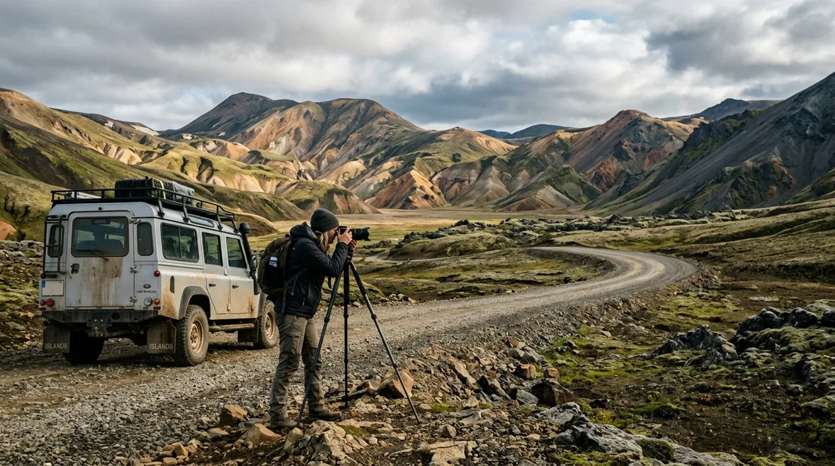
Photographing the Icelandic Highlands requires precise seasonal timing, a capable 4x4 vehicle with high clearance, and deliberate focal length choices to capture rhyolite ridgelines, braided glacial rivers, and stark volcanic deserts. This comprehensive Iceland Highlands photography guide details everything you need to navigate mountain tracks (F-roads), photograph iconic locations like Landmannalaugar and Thorsmork, manage unpredictable arctic lighting, and safeguard your equipment in one of Europe's most extreme wilderness environments.
Seasonal Windows: Timing Your Iceland Highlands Photography Guide Route
The interior highlands of Iceland are completely inaccessible to standard vehicular traffic for nine to ten months of the year. Heavy winter snowpacks, spring mud thaws, and river swells create impassable terrain until road grading teams clear the routes in early summer. Understanding historical seasonal windows is critical to planning an effective highland shoot.
Opening dates for mountain tracks—designated by the prefix "F"—vary drastically based on snow depth, elevation, and late-spring temperatures. The Icelandic Road and Coastal Administration (Vegagerðin) monitors road conditions daily and typically opens northern and southern highland tracks in stages:
- Early June to Mid-June: Lower elevation F-roads (such as the southern approach of F208 toward the edge of Landmannalaugar or the initial stretches of F26 Sprengisandur) occasionally open, though river crossings run deep and fast with glacial meltwater.
- Late June to Early July: The core interior routes, including Fjallabaksleið Nyrðri (F208 north), Kaldidalur (550), and access to Kerlingarfjöll (F35 / Kjolur), normally open for 4x4 vehicles. High-altitude passes around Askja and deep Fjallabak tracks often remain closed until early July.
- Late August to Mid-September: Prime window for stable track beds, lower glacial river water levels, and vibrant autumnal tundra tones. First dustings of autumn snow typically hit high passes by mid-September, triggering route closures by late September or early October.
Lighting conditions shift dramatically across this short operational window. From late June through late July, photographers experience the midnight sun. The sun skims just below the horizon, providing a four-to-six-hour window of continuous golden and blue hours between 22:00 and 03:00. This prolonged low-angle light cuts across rhyolite ridges and highlights geothermal steam plumes without creating harsh overhead specular highlights.
By late August and September, true astronomical night returns. The interior transitions into a palette of fiery red dwarf birch, golden sedge grass, and deep black volcanic sand. Late-season travel introduces colder operating temperatures and sudden frost, but grants the opportunity to capture the aurora borealis dancing over remote volcanic calderas without light pollution.
F-Roads Iceland Photography: Vehicle Selection, River Forging, and Safety
Navigating the interior requires specialized transport and absolute respect for Icelandic driving laws. Standard passenger sedans, two-wheel-drive crossovers, and low-clearance city SUVs are legally prohibited on all routes designated with an "F" as well as non-F backcountry tracks like Kaldidalur.
For standard F-roads such as the northern approach to Landmannalaugar (via Route 26 and F208 North, which features no unbridged river crossings), a medium 4x4 SUV (e.g., Toyota Land Cruiser, Land Rover Defender) offers adequate ground clearance and low-range gearing. However, routes that traverse unbridged glacial torrents—such as the southern F208, F210 (Fjallabaksleið syðri), F26, and the tracks into Thorsmork—require modified 4x4s with snorkel air intakes, extended differential breathers, and minimum 33- to 35-inch tires.
The files carry season and access notes, not live conditions. Check vedur.is and road.is for current weather and road status before you leave paved surfaces.
Standard Operating Procedures for River Crossings
Most catastrophic vehicle failures in the interior stem from improper water crossings. Standard rental insurance policies—including collision damage waivers—explicitly exclude water damage caused by submerging the chassis or flooding the engine intake. Use this step-by-step checklist at every unbridged ford:
- Stop, Disembark, and Scout on Foot: rarely drive directly into a river without inspecting the water depth, current speed, and riverbed substrate. If the water reaches above your knees or is moving too swiftly to wade safely, do not attempt to drive through.
- Identify the Natural Ford: Glacial rivers are widest and shallowest where ripples break over gravel bars. Avoid narrow, dark, smooth channels, which indicate deep water and steep underwater drop-offs.
- Engage 4WD and Low Range: Lock the center differential. Deactivate automatic traction control systems that may cut engine power if wheels slip on submerged stones.
- Enter Slowly and Drive Downstream: Enter the water in first or second gear at a steady walking pace (5–8 km/h). Create a gentle bow wave ahead of the vehicle bumper, which lowers the water level inside the engine bay. Angle the vehicle slightly downstream with the current rather than fighting straight across or upstream.
- Maintain Continuous Momentum: rarely stop or shift gears mid-river. If wheels lose traction, steer gently into the slip to regain grip on the riverbed gravel.
Always review emergency guidelines on SafeTravel.is and register your travel plan with local search and rescue before setting off into uninhabited regions.
Rhyolite Ridges and Steam Vents: Landmannalaugar Photography Locations
Located in the Fjallabak Nature Reserve, Landmannalaugar presents an alien spectrum of geological hues: yellow, green, orange, and red rhyolite mountains bounded by pitch-black obsidian lava fields and boiling geothermal vents. To produce compelling Landmannalaugar photography, you must navigate high dynamic range, volatile atmospheric steam, and shifting terrain textures.
The core vantage points around the central basin each demand specific focal lengths and timing:
- Bláhnjúkur (Blue Peak): Rising 943 meters above sea level, Bláhnjúkur provides an unobstructed 360-degree panorama over five glacial valleys and the Laugahraun lava field. Ascend via the southern trail during late afternoon or evening side-light. A 24-70mm standard zoom allows you to frame the blue-grey volcanic ash ridges cutting against the distant orange peaks of Brennisteinsalda.
- Brennisteinsalda (Sulphur Wave): Widely considered the most vibrant mountain in Iceland, featuring distinct streaks of sulfur yellow, iron red, copper green, and turquoise clay. Shoot from the edge of the Vondugil valley floor using a telephoto lens (70-200mm) to isolate geothermal solfataras venting steam against the saturated mountain slopes.
- Frostastaðavatn Overlook: Situated along the F208 ridge just north of the campsite, this viewpoint captures the dark turquoise volcanic lake surrounded by black obsidian flows and pastel-colored ridgelines. Early morning calm often yields glassy reflections across the lake's surface before thermal winds pick up.
Managing contrast is the chief technical hurdle in Landmannalaugar. Midday sunlight turns rhyolite mountains into blown-out, overexposed highlights while casting harsh shadows across obsidian fields. Shoot during low-angle light or beneath thin, overcast cloud cover, which acts as a giant softbox, allowing the subtle mineral color variations to saturate naturally on your camera sensor without requiring extreme exposure bracketing.
Glacial Valleys and Canyons: Thorsmork Photo Spots and Access Routes
Thorsmork (Þórsmörk) is a lush valley protected on three sides by glaciers: Eyjafjallajökull, Mýrdalsjökull, and Tindfjallajökull. The confluence of glacial runoff, birch forests, and dark volcanic rock faces creates moody, atmospheric compositions found nowhere else in the Highlands.
Key Thorsmork photo spots include:
- Valahnúkur Summit: A steep many-minute hike from the Langidalur or Volcano Huts campsite leads to a panoramic vantage point overlooking the braided channels of the Krossá river valley, backed by the glaciated peak of Eyjafjallajökull. A wide-angle lens (16-35mm) captures the sweeping scale of the riverbed, while a medium telephoto allows you to isolate the braided glacial streams threading across black sediment.
- Stakkholtsgjá Canyon: A narrow, 100-meter-deep slot canyon featuring towering moss-draped palagonite walls. The trail winds through shallow river beds and ends at an enclosed waterfall. To capture the full verticality of the canyon walls without lens distortion, use vertical multi-row panoramic stitching at 24mm or 35mm.
- Húsadalur and Basar Overlooks: These low-elevation vantage points provide rich frames of arctic birch woodlands juxtaposed against volcanic cliffs and ice tongues extending down from the ice caps.
Crucial Access Warning: Accessing Thorsmork via the F249 requires crossing several treacherous, unbridged glacial rivers, culminating in the notorious Krossá river. The Krossá features shifting gravel beds and powerful currents capable of sweeping away standard modified 4x4s. Unless you are driving a commercial superjeep with an experienced local guide, park your vehicle at the Krossá river crossing parking area and take the scheduled highland mountain bus or footbridge into the valley.
You can browse additional composition ideas across our curated Iceland landscape photo locations to integrate Thorsmork into a broader southern route.
Deep Interior Locations: Kerlingarfjöll, Veiðivötn, and Aldeyjarfoss
Venturing past Fjallabak into the deep interior reveals stark, volcanic environments that receive a fraction of coastal visitor traffic.
Hveradalir Geothermal Valley (Kerlingarfjöll)
Situated in the central Highlands between the Langjökull and Hofsjökull ice caps, Kerlingarfjöll's Hveradalir basin is one of the most intense geothermal areas on Earth. Boiling hot springs, bubbling mud pools, and towering steam columns pierce through orange-brown clay slopes, framed by year-round snowbanks.
Shoot Hveradalir during late evening light when the low sun casts long shadows through the steam vents. Utilize a circular polarizer to eliminate unwanted reflections from wet clay and glistening geothermal mineral deposits, boosting the natural saturation of the red-orange soil.
Veiðivötn Volcanic Oasis
Veiðivötn is a remote cluster of more than 50 volcanic crater lakes situated in the southwestern highlands along the F228. Formed during a massive explosive fissure eruption in 1477, the dark basalt landscape contrasts with vibrant green moss and deep cobalt-blue waters. This area demands a polarizing filter to cut surface water glare and reveal submerged volcanic craters and turquoise drop-offs.
Aldeyjarfoss (Northern F26)
Located at the northern terminus of the Sprengisandur highland route, the waterfall at Aldeyjarfoss drops 20 meters into a turbulent glacial basin framed by symmetrical basalt columns. The icy, milky-grey waters of the Skjálfandafljót river contrast sharply with the dark volcanic basalt formations.
To photograph Aldeyjarfoss effectively:
- Use a neutral density filter (3-stop to 6-stop) to achieve a shutter speed between 0.5 and 2 seconds, maintaining texture in the cascading glacial water without blowing out highlight detail.
- Compose from the southern cliff edge using a 16-35mm wide-angle lens to capture the amphitheater of twisted basalt columns wrapping around the falls.
- Shield your front lens element from blowing glacial spray using a dedicated lens hood and carry microfibre cloths in accessible, sealed pockets.
Technical Field Stack: Gear, Lenses, and Drone Rules in the Interior
The interior highlands subject photographic equipment to abrasive volcanic dust, high wind speeds, and sudden temperature shifts. Packing the correct technical kit ensures operational reliability in the backcountry.
Focal Length Strategy
While beginners often default strictly to ultra-wide lenses in Iceland, the Highlands demand a diverse focal range:
- 16-35mm f/2.8 or f/4: Essential for enclosed slot canyons (Stakkholtsgjá), expansive summit panoramas (Valahnúkur), and geothermal fields with active foreground steam vents.
- 24-70mm f/2.8 or f/4: The core walk-around workhorse for framing mountain ridges, volcanic craters, and medium-scale geological textures.
- 100-400mm f/4.5-5.6: Indispensable for compressing distant braided river valleys, highlighting solitary cinder cones on the horizon, and isolating abstract geometric patterns in volcanic sand and glacial ice.
Dust and Weather Mitigation
Fine volcanic ash (tephra) is highly abrasive. When dry, highland winds whip fine tephra particles across the plains, which can scratch optical coatings, penetrate zoom barrels, and settle on camera sensors. Follow these field safety practices:
- rarely change lenses in an open highland gale. If a lens change is unavoidable, perform it inside your vehicle cabin with the air conditioning fans switched off.
- Keep a clear or UV protective filter mounted on all front lens elements to protect high-grade glass coatings from blown gravel and abrasive dust.
- Use a heavy-duty tripod without a center column for maximum low-center-of-gravity stability in 40+ knot wind gusts. Hang your camera pack from the tripod hook to dampen high-frequency vibrations.
Drone Regulations in Highland Nature Reserves
Unmanned Aircraft Systems (drones) provide spectacular top-down perspectives of braided rivers and volcanic craters, but their use is strictly regulated across the interior. based on the Environment Agency of Iceland (Umhverfisstofnun), drone flights are prohibited within protected nature reserves and national parks—including the entire Fjallabak Nature Reserve (Landmannalaugar), Vatnajökull National Park, and designated areas of Thorsmork—without an approved commercial permit obtained well in advance.
often inspect posted local signage at trailheads and respect designated no-fly zones to preserve fragile arctic wildlife nesting habitats and visitor solitude.
Highlands Iceland Map Setup: Offline Navigation and Waypoint Management
Cellular reception across the central Highlands is sparse and unreliable. Photographers relying on live mobile mapping connections risk losing access to navigation tools, trailheads, and pre-scouted viewpoints.
The KML, GPX and GeoJSON files live on your device, so the waypoints work with no signal. Downloading offline map tiles is a separate step inside your mapping app. If you use Gaia GPS on your mobile device, follow our dedicated walkthrough for importing KML files into Gaia GPS to configure offline topographical map layers before departing cellular coverage.
To establish a resilient field workflow:
- Download Regional Vector and Satellite Base Maps: Pre-cache high-resolution satellite imagery and topographic elevation contours in your offline mapping app of choice (e.g., Gaia GPS, OsmAnd, Organic Maps).
- Organize Waypoint Layers by Category: Segment your photographic targets into functional categories: primary sunrise/sunset viewpoints, backup mid-day overcast locations, parking coordinates, and critical river fords.
- Maintain Redundant Navigation Hardware: often carry a standalone GPS receiver or dedicated inReach satellite communicator loaded with identical waypoints, alongside a paper topographic map (1:100,000 scale) and magnetic compass.
- Prepare Field Power Reserves: Cold highland nights cause lithium-ion camera and phone batteries to drain rapidly. Pack high-capacity power banks (minimum 20,000 mAh) and keep spare camera batteries inside interior jacket pockets close to your body heat.
Responsible Field Ethics: Fragile Moss Preservation and Tread Lightly Rules
The interior ecosystem of Iceland is exceptionally fragile. Sub-arctic vegetation, particularly Racomitrium woolly fringe-moss, grows at a rate of only a few millimeters per year in volcanic soil. Once damaged or crushed, moss layers take decades—or even centuries—to regenerate, leading to severe wind and water erosion across volcanic plains.
Maintain strict ethical standards throughout your expedition:
- Zero-Tolerance for Off-Road Driving: Off-road driving (driving off designated, numbered tracks or road markers) is strictly illegal across all of Iceland. Leaving tire tracks on volcanic sands, moss fields, or dry riverbanks carries heavy legal penalties, court fines running into thousands of dollars, and permanent ecological scarring.
- Stick to Established Trails: In geothermal basins like Landmannalaugar and Kerlingarfjöll, walking off marked boardwalks or footpaths risks serious thermal burns from fragile crusts covering boiling mud vents, while accelerating soil erosion.
- Leave No Trace: Pack out all waste, including organic food scraps and tissue paper. In the sub-arctic climate, organic waste does not decompose quickly and disrupts sensitive local micro-ecosystems.
Frequently Asked Questions
When are the Iceland Highlands F-roads open for photography trips?
Iceland's interior F-roads generally open between mid-June and early July and close by mid-to-late September. Opening timelines depend heavily on winter snowpack depth, spring temperatures, and road maintenance grading. Major routes like the northern F208 into Landmannalaugar typically open first, while deep interior tracks like F26 Sprengisandur, F210, and roads into Askja remain closed until late June or early July.
Do I need a modified Superjeep to photograph Landmannalaugar and Thorsmork?
For Landmannalaugar, a standard medium 4x4 SUV (such as a Toyota RAV4 or Dacia Duster) is sufficient if you approach from the north via Route 26 and the northern portion of F208, which has no unbridged river crossings. However, traveling into Thorsmork via F249 requires crossing the powerful, unpredictable Krossá river, which requires a heavily modified Superjeep with 35+ inch tires and an elevated snorkel. For standard rental drivers, booking a scheduled highland bus or superjeep shuttle into Thorsmork is strongly advised.
Can I fly a drone for photography in Landmannalaugar and the Highlands?
Drone flights are banned without an explicit permit across protected nature reserves and national parks in Iceland. This includes the entire Fjallabak Nature Reserve (which encompasses Landmannalaugar) and Vatnajökull National Park. In unprotected highland regions, recreational drone flying is permitted subject to standard Icelandic Transport Authority rules: maintaining line of sight, flying below 120 meters, and keeping clear of wildlife, vehicles, and crowds.
How do I navigate photo locations in the Highlands without cellular data?
Reliable highland navigation requires saving waypoints and base maps directly to your hardware before heading into the field. You can load GPS waypoints via GPX, KML, or GeoJSON formats into dedicated offline mapping applications such as Gaia GPS, OsmAnd, or standalone handheld GPS units. Ensure you download complete offline topographic and satellite map tiles while you still have reliable Wi-Fi access in coastal towns.
Download the complete Iceland Photo Map GPS datasets to load verified Highlands waypoints directly into your favorite offline navigation app before heading off the grid.